File:Guevavi Mission - the surrounding landscape (608944d3-2fea-4455-a23c-d80b71399f51).JPG
Jump to navigation
Jump to search

Size of this preview: 800 × 400 pixels. Other resolutions: 320 × 160 pixels | 640 × 320 pixels | 1,024 × 512 pixels | 1,280 × 640 pixels | 2,560 × 1,280 pixels | 4,608 × 2,304 pixels.
Original file (4,608 × 2,304 pixels, file size: 4.08 MB, MIME type: image/jpeg)
Captions
Captions
Add a one-line explanation of what this file represents
Summary[edit]
.JPG&action=edit§ion=1)
| English: Guevavi Mission - the surrounding landscape | ||||
|---|---|---|---|---|
| Photographer |
English: NPS Photo |
|||
| Title |
English: Guevavi Mission - the surrounding landscape |
|||
| Description |
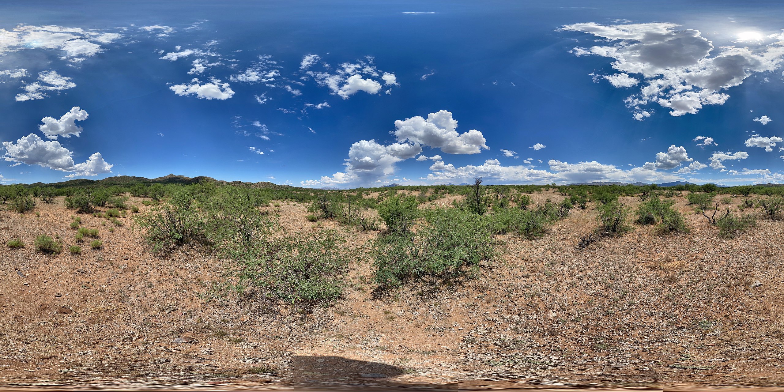
English: 360 spherical panoramic photo depicting mesquite and creosote brush in foreground, with mountains in the distance Archeological evidence points to human civilizations going back 4,000 years. These early agriculturalists farmed the floodplains and the lands at the base of nearby mountains. Later, the Spanish would introduce livestock like sheep and cattle. Grazing continue today as this land, owned by the City of Nogales, is leased to local ranchers. |
|||
| Depicted place |
English: Tumacacori National Historical Park, Santa Cruz County, Arizona |
|||
| Date | Taken on 10 May 2020 | |||
| Accession number | ||||
| Source |
English: NPGallery |
|||
| Permission (Reusing this file) |
|
|||
| NPS Unit Code | TUMA | |||
| Camera Model | Apple Apple, iPhone12,1 - 13.3.1 |
|---|
File history
Click on a date/time to view the file as it appeared at that time.
| Date/Time | Thumbnail | Dimensions | User | Comment | |
|---|---|---|---|---|---|
| current | 18:27, 14 January 2022 | | 4,608 × 2,304 (4.08 MB) | BMacZeroBot (talk | contribs) | Batch upload (Commons:Batch uploading/NPGallery) |
You cannot overwrite this file.
File usage on Commons
The following page uses this file:
.JPG)
.JPG&oldid=656410206)