File:Greater London rail frequency map.svg
Jump to navigation
Jump to search

Size of this PNG preview of this SVG file: 595 × 466 pixels. Other resolutions: 307 × 240 pixels | 613 × 480 pixels | 981 × 768 pixels | 1,280 × 1,002 pixels | 2,560 × 2,005 pixels.
Original file (SVG file, nominally 595 × 466 pixels, file size: 517 KB)
Captions
Captions
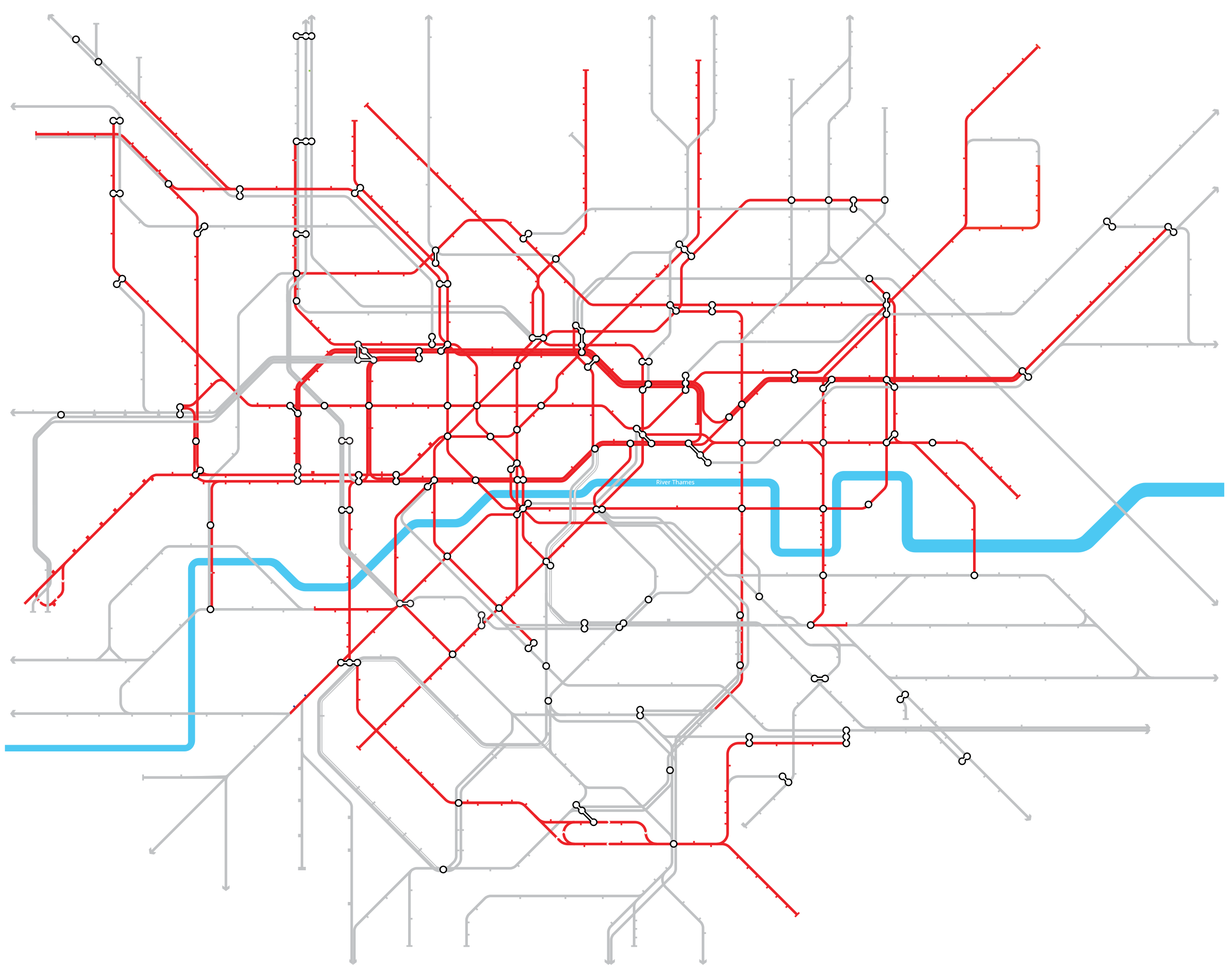
Map showing frequencies of rail service in Greater London.
Summary[edit]
| Description |
English: Map showing frequencies of rail service in Greater London.
Red: Lines with a consistent London terminus and stopping pattern, and stopping trains running at least every 10 minutes throughout the day Grey: Lines with an inconsistent or infrequent stopping pattern (less often than every 10 minutes) throughout the day |
| Date | |
| Source |
A new approach to rail passenger services in London and the South East p.10 |
| Author | Department for Transport, TfL |
Licensing[edit]
_(St_Edwards_Crown).svg)
|
This file is licensed under the United Kingdom Open Government Licence v3.0. |
See also: Meta for information on usage on Wikimedia wikis.
|
File history
Click on a date/time to view the file as it appeared at that time.
| Date/Time | Thumbnail | Dimensions | User | Comment | |
|---|---|---|---|---|---|
| current | 14:05, 17 March 2019 | | 595 × 466 (517 KB) | RaviC (talk | contribs) | User created page with UploadWizard |
You cannot overwrite this file.
File usage on Commons
The following 5 pages use this file:
File usage on other wikis
The following other wikis use this file:
- Usage on en.wikipedia.org