File:GreaterMiddleEast2.png
Jump to navigation
Jump to search
Size of this preview: 800 × 370 pixels. Other resolutions: 320 × 148 pixels | 640 × 296 pixels | 1,357 × 628 pixels.
Original file (1,357 × 628 pixels, file size: 53 KB, MIME type: image/png)
Captions
Captions
Add a one-line explanation of what this file represents
Summary[edit]
| Description |
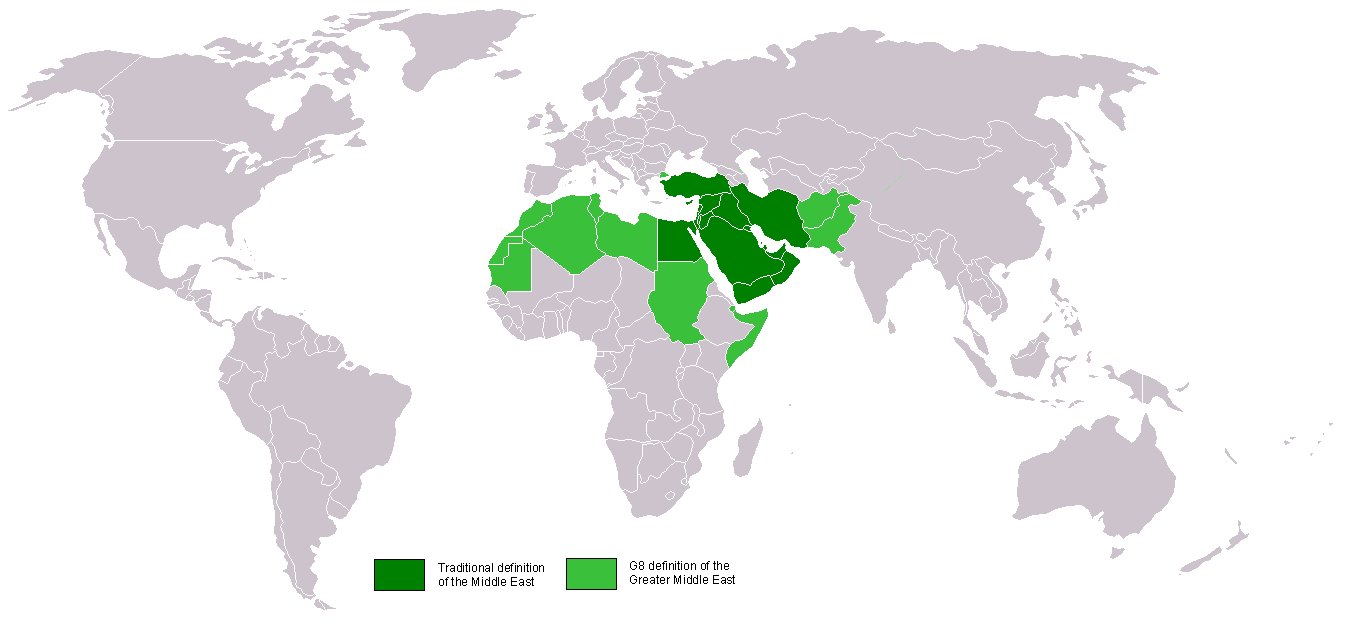
Traditional and G8 greater middle east. The Middle East is all these green + all of East Africa |
| Date | 10 October 2005 (original upload date) |
| Source | No machine-readable source provided. Own work assumed (based on copyright claims). |
| Author | No machine-readable author provided. Carlosar~commonswiki assumed (based on copyright claims). |
| Other versions |
|
Licensing[edit]
| I, the copyright holder of this work, release this work into the public domain. This applies worldwide. In some countries this may not be legally possible; if so: I grant anyone the right to use this work for any purpose, without any conditions, unless such conditions are required by law. |
derivative works[edit]
Derivative works of this file: Wikinews Bliski Wschód mapa.png
File history
Click on a date/time to view the file as it appeared at that time.
| Date/Time | Thumbnail | Dimensions | User | Comment | |
|---|---|---|---|---|---|
| current | 02:47, 11 April 2011 | | 1,357 × 628 (53 KB) | Hoshie (talk | contribs) | Added Cabinda (Angola) to the map along with Montenegro to the map. |
| 21:44, 16 December 2009 |  | 1,357 × 628 (41 KB) | Athens2004 (talk | contribs) | Reverted to version as of 12:06, 10 October 2005 | |
| 13:08, 18 November 2006 |  | 1,357 × 628 (48 KB) | Zaparojdik~commonswiki (talk | contribs) | Turkey explanation | |
| 12:06, 10 October 2005 |  | 1,357 × 628 (41 KB) | Carlosar~commonswiki (talk | contribs) | Category:Continents |
You cannot overwrite this file.
File usage on Commons
The following 4 pages use this file:
File usage on other wikis
The following other wikis use this file:
- Usage on bg.wikipedia.org
- Usage on bjn.wikipedia.org
- Usage on ca.wikipedia.org
- Usage on de.wikipedia.org
- Usage on en.wikipedia.org
- Usage on es.wikipedia.org
- Usage on fi.wikinews.org
- Usage on fo.wikipedia.org
- Usage on fr.wikipedia.org
- Usage on gl.wikipedia.org
- Usage on he.wiktionary.org
- Usage on hr.wikipedia.org
- Usage on incubator.wikimedia.org
- Usage on it.wikipedia.org
- Usage on ja.wikipedia.org
- Usage on jv.wikipedia.org
- Usage on koi.wikipedia.org
- Usage on lad.wikipedia.org
- Usage on lt.wikipedia.org
- Usage on min.wikipedia.org
- Usage on ml.wikipedia.org
- Usage on mwl.wikipedia.org
- Usage on nl.wikipedia.org
- Usage on no.wikipedia.org
- Usage on pam.wikipedia.org
- Usage on ps.wikipedia.org
- Usage on pt.wikipedia.org
- Usage on rue.wikipedia.org
- Usage on scn.wikipedia.org
- Usage on se.wikipedia.org
- Usage on sh.wikipedia.org
- Usage on sl.wikipedia.org
- Usage on su.wikipedia.org
- Usage on tl.wikipedia.org
- Usage on uk.wikipedia.org
- Usage on ur.wikipedia.org
- Usage on vi.wiktionary.org
View more global usage of this file.