File:Gravesend 1788.jpg
Jump to navigation
Jump to search
Size of this preview: 547 × 600 pixels. Other resolutions: 219 × 240 pixels | 438 × 480 pixels | 701 × 768 pixels | 934 × 1,024 pixels | 1,868 × 2,048 pixels | 3,245 × 3,557 pixels.
Original file (3,245 × 3,557 pixels, file size: 9.26 MB, MIME type: image/jpeg)
Captions
Captions
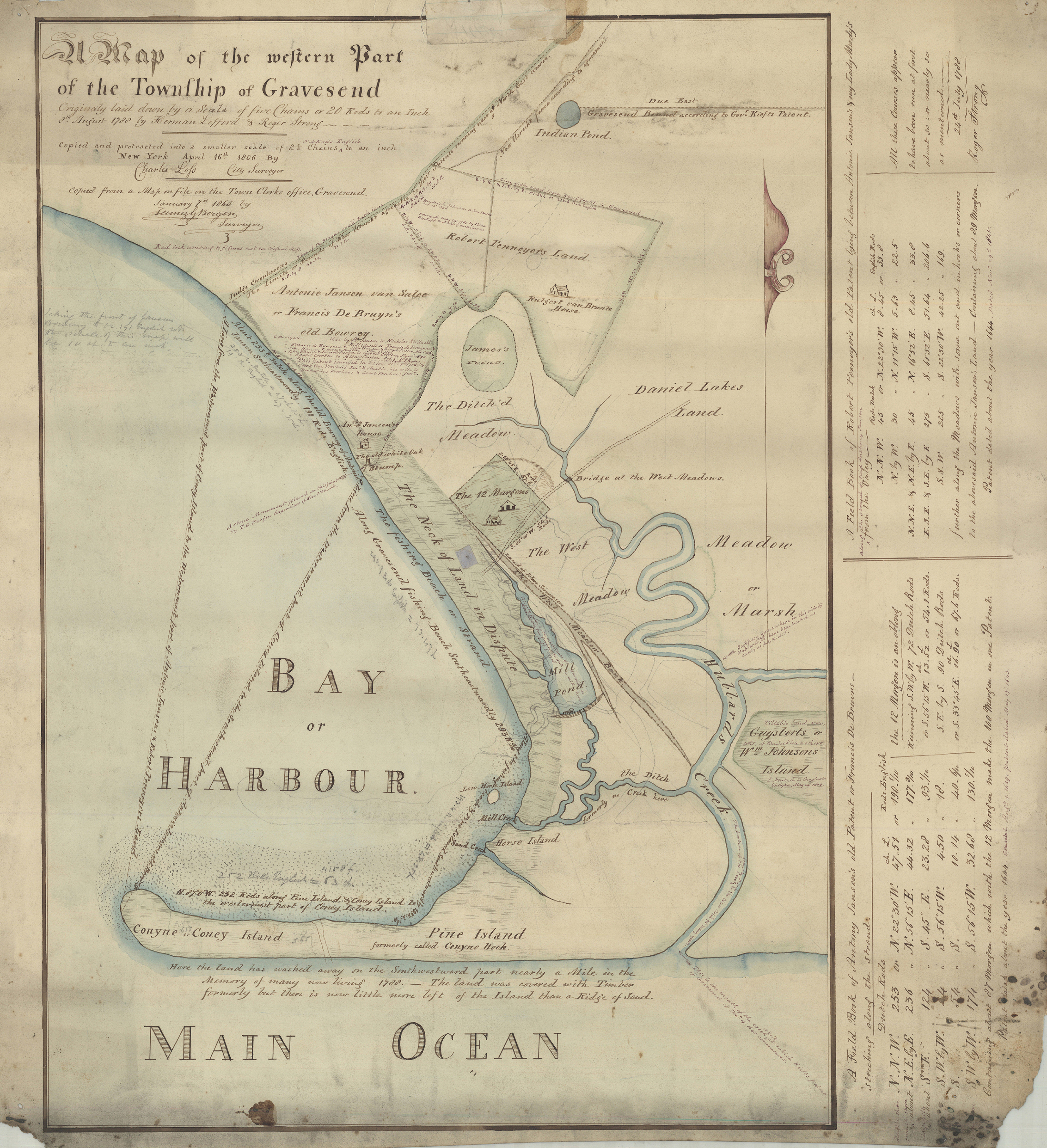
Gravesend, Brooklyn in 1788
Summary[edit]
| Description |
English: Map of the western part of the Township of Gravesend originally laid down by a scale of five chains or 20 rods to an inch, 8th August 1788 by Herman Lefford & Roger Strong: April 16th 1806; [18??], Map Collection, Bergen-[18--?]uu.Fl; Brooklyn Historical Society. |
|||||||||
| Date | ||||||||||
| Source | https://mapcollections.brooklynhistory.org/map/map-of-the-western-part-of-the-township-of-gravesend-originally-laid-down-by-a-scale-of-five-chains-or-20-rods-to-an-inch-8th-august-1788-by-herman-lefford-roger-strong-april-16th-1806/ | |||||||||
| Creator |
Herman Lefford & Roger Strong |
|||||||||
| Geotemporal data | ||||||||||
| Bounding box |
|
|||||||||
| Georeferencing | ||||||||||
Licensing[edit]
|
This work is in the public domain in its country of origin and other countries and areas where the copyright term is the author's life plus 70 years or fewer. This work is in the public domain in the United States because it was published (or registered with the U.S. Copyright Office) before January 1, 1929. | |
| This file has been identified as being free of known restrictions under copyright law, including all related and neighboring rights. | |
File history
Click on a date/time to view the file as it appeared at that time.
| Date/Time | Thumbnail | Dimensions | User | Comment | |
|---|---|---|---|---|---|
| current | 03:26, 19 February 2023 | | 3,245 × 3,557 (9.26 MB) | Pharos (talk | contribs) | Uploaded a work by Herman Lefford & Roger Strong from https://mapcollections.brooklynhistory.org/map/map-of-the-western-part-of-the-township-of-gravesend-originally-laid-down-by-a-scale-of-five-chains-or-20-rods-to-an-inch-8th-august-1788-by-herman-lefford-roger-strong-april-16th-1806/ with UploadWizard |
You cannot overwrite this file.
File usage on Commons
There are no pages that use this file.
File usage on other wikis
The following other wikis use this file:
- Usage on en.wikipedia.org