File:Grand Canyon Toroweap (5).jpg
Original file (3,170 × 2,324 pixels, file size: 4.09 MB, MIME type: image/jpeg)
Captions
Captions
Summary[edit]
.jpg&action=edit§ion=1)
| Description |
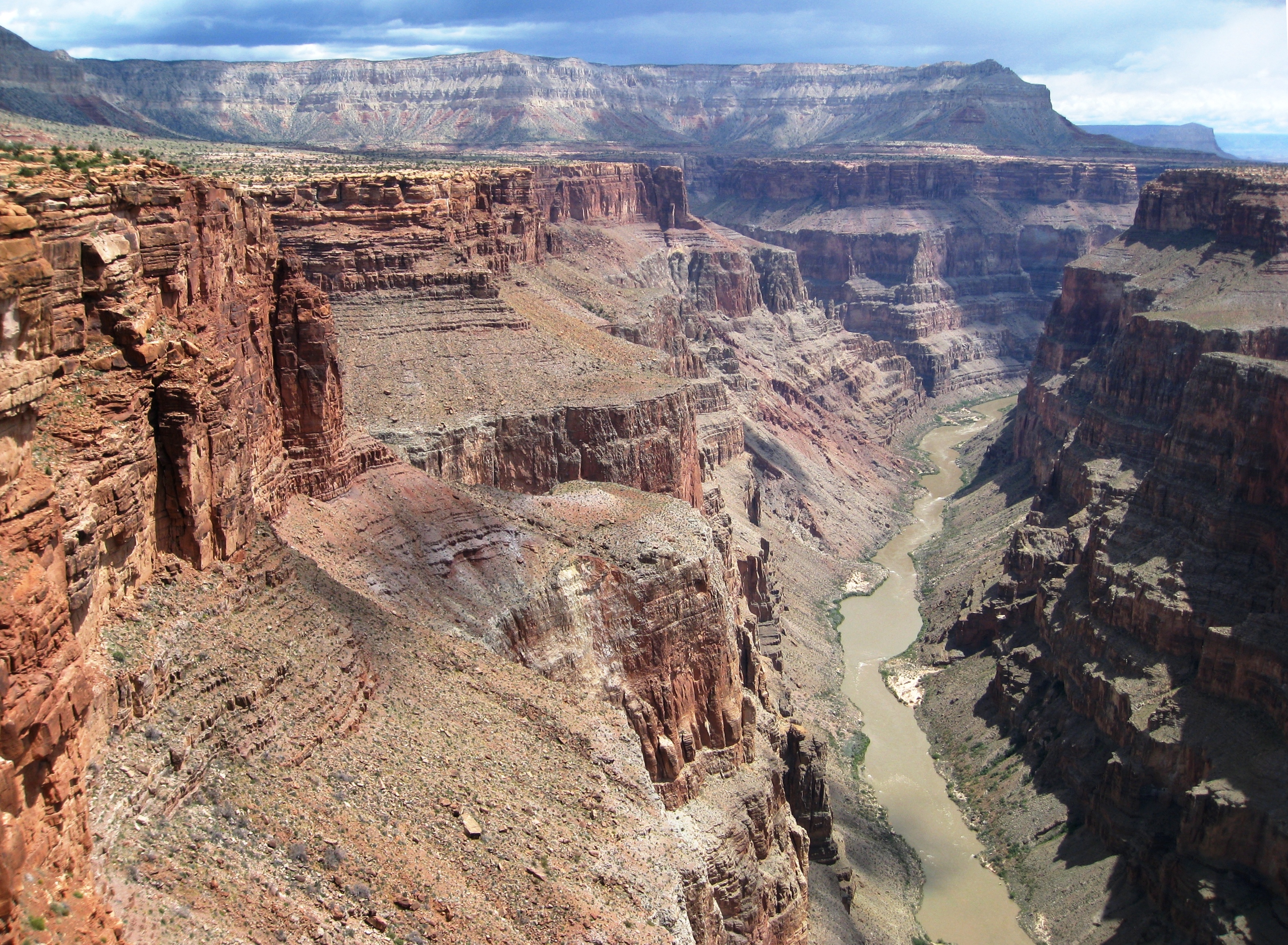
(view ~due east)-From the east side of the Toroweap area. There is about a 900 meter (3000 foot) drop to the Colorado river. |
| Date | |
| Source |
|
| Author | J Brew from near Seattle, USA |
| Camera location | | View this and other nearby images on: OpenStreetMap |
|---|
.jpg¶ms=036.217514_N_-113.055818_E_globe:Earth_type:camera_source:Flickr_&language=en)
Licensing[edit]
.jpg&action=edit§ion=2)
- You are free:
- to share – to copy, distribute and transmit the work
- to remix – to adapt the work
- Under the following conditions:
- attribution – You must give appropriate credit, provide a link to the license, and indicate if changes were made. You may do so in any reasonable manner, but not in any way that suggests the licensor endorses you or your use.
- share alike – If you remix, transform, or build upon the material, you must distribute your contributions under the same or compatible license as the original.
| This image, originally posted to Flickr, was reviewed on June 7, 2011 by the administrator or reviewer File Upload Bot (Magnus Manske), who confirmed that it was available on Flickr under the stated license on that date. |
File history
Click on a date/time to view the file as it appeared at that time.
| Date/Time | Thumbnail | Dimensions | User | Comment | |
|---|---|---|---|---|---|
| current | 11:54, 7 June 2011 | | 3,170 × 2,324 (4.09 MB) | File Upload Bot (Magnus Manske) (talk | contribs) | {{Information |Description=From the east side of the Toroweap area. There is about a 900 meter (3000 foot) drop to the Colorado river. sw2 527 |Source=[http://www.flickr.com/photos/brewbooks/5778461028/ Looking East into the Canyon] * Uploaded by [[User: |
You cannot overwrite this file.
File usage on Commons
The following 3 pages use this file:
File usage on other wikis
The following other wikis use this file:
- Usage on en.wikipedia.org
- Usage on www.wikidata.org
Metadata
.jpg&oldid=860980974)
- Views from Toroweap Overlook
- Tuckup Point
- Tuckup Trail
- Tuckup Point (west aspect)
- View east of Tuckup and SB Points
- Big Point (Tuckup Point)
- SB Point
- The Esplanade (Grand Canyon)
- Esplanade Sandstone
- Kaibab Limestone in Arizona
- Toroweap Formation
- Coconino Sandstone in Arizona
- Hermit Formation
- Supai Group
- Redwall Limestone
- Views of South Rim (east view)