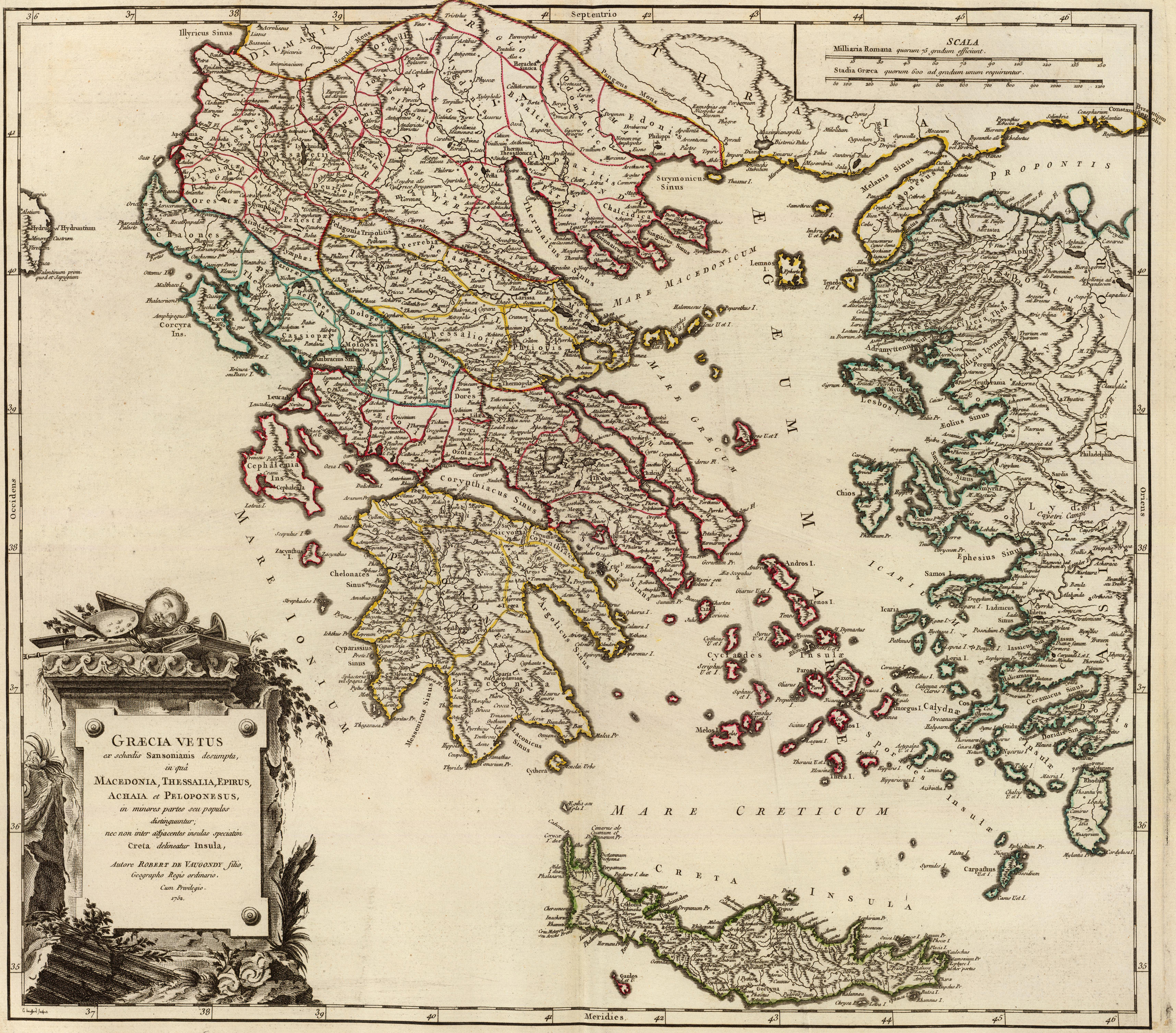
File:Graecia Vetus Map of Ancient Greece.jpg

From Wikimedia Commons, the free media repository
Jump to navigation Jump to search

Original file(3,425 × 3,009 pixels, file size: 9.28 MB, MIME type: image/jpeg)

Captions

Captions

Add a one-line explanation of what this file represents

Summary[edit]

Description

Map of Ancient Greece, Graecia Vetus (Macedonia, Thessaly, Epirus, Achaia, Peloponnesus)

  • Graecia Vetus ex schoedis Sansonianis desumpta, in qua Macedonia, Thessalia, Epirus, Achaia et Peloponesus, in minores partes seu populos distinguuntur; nec non inter adjacentes insulas speciatim Creta delineatur Insula, Autore Robert de Vaugondy filio, Geographo Regis ordinario. Cum Privilegio. 1752. E. Haussard sculpcit.
Date uploaded 27 August 2010, made 1752
Source Robert de Vaugondy, Didier, 1723-1786; Robert de Vaugondy, Gilles, 1688-1766; Sanson, Nicolas, 1600-1667
Author Robert de Vaugondy
Permission
(Reusing this file)
Public domain

This work is in the public domain in its country of origin and other countries and areas where the copyright term is the author's life plus 70 years or fewer.


You must also include a United States public domain tag to indicate why this work is in the public domain in the United States. Note that a few countries have copyright terms longer than 70 years: Mexico has 100 years, Jamaica has 95 years, Colombia has 80 years, and Guatemala and Samoa have 75 years. This image may not be in the public domain in these countries, which moreover do not implement the rule of the shorter term. Honduras has a general copyright term of 75 years, but it does implement the rule of the shorter term. Copyright may extend on works created by French who died for France in World War II (more information), Russians who served in the Eastern Front of World War II (known as the Great Patriotic War in Russia) and posthumously rehabilitated victims of Soviet repressions (more information).

Maps of Thessaly

File history

Click on a date/time to view the file as it appeared at that time.

Date/TimeThumbnailDimensionsUserComment
current12:31, 27 February 2010Thumbnail for version as of 12:31, 27 February 20103,425 × 3,009 (9.28 MB)Megistias (talk | contribs)== {{int:filedesc}} == {{Information |Description=Map of Ancient Greece, Graecia Vetus (Macedonia, Thessaly, Epirus, Achaia, Peloponnesus) *''Graecia Vetus'' ex schoedis Sansonianis desumpta, in qua Macedonia, Thessalia, Epirus, Achaia et Peloponesus, in

Metadata