File:Gore Creek, Colorado.png

From Wikimedia Commons, the free media repository
Jump to navigation Jump to search

Original file(3,266 × 2,572 pixels, file size: 58 KB, MIME type: image/png)

Captions

Captions

Add a one-line explanation of what this file represents
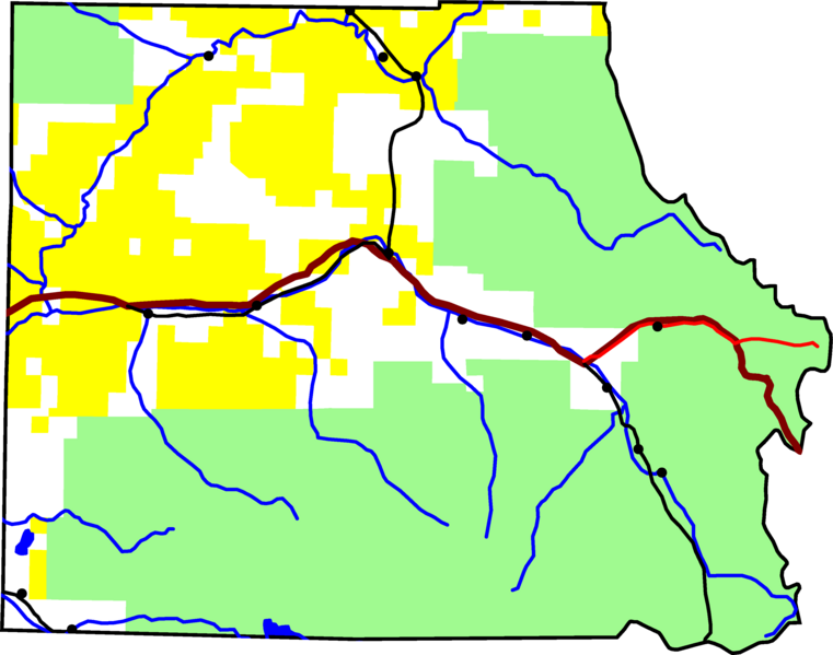
The plain map of Eagle County on which this locator map is based.

A map of Eagle County, Colorado, with Gore Creek highlighted in red.

David Benbennick made this map with data from nationalatlas.gov.

The map uses the azimuthal equidistant projection, centered on (-105.7167, 39.1333) (degrees latitude, longitude). The area outside the county is transparent, so it should look nice on non-white backgrounds.

Eventually, I will upload the 4 megabyte Metapost script I used to make this map. In the mean time, see Gore_Creek,_Colorado.mp.

Public domain I, the copyright holder of this work, release this work into the public domain. This applies worldwide.
In some countries this may not be legally possible; if so:
I grant anyone the right to use this work for any purpose, without any conditions, unless such conditions are required by law.

File history

Click on a date/time to view the file as it appeared at that time.

Date/TimeThumbnailDimensionsUserComment
current19:21, 10 August 2005Thumbnail for version as of 19:21, 10 August 20053,266 × 2,572 (58 KB)Dbenbenn (talk | contribs)by me, PD

There are no pages that use this file.