File:GoodenoughIslandTopography.png
Jump to navigation
Jump to search

Size of this preview: 657 × 600 pixels. Other resolutions: 263 × 240 pixels | 526 × 480 pixels | 841 × 768 pixels | 1,122 × 1,024 pixels | 1,398 × 1,276 pixels.
Original file (1,398 × 1,276 pixels, file size: 312 KB, MIME type: image/png)
Captions
Captions
Add a one-line explanation of what this file represents
Summary[edit]
| Description |
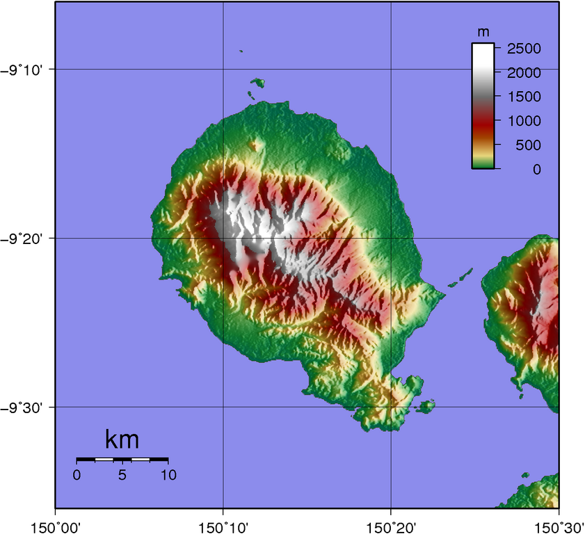
Topographic map of Goodenough Island SRTM data has lots missing data up in the mountains... |
| Date | |
| Source | Created with GMT from publicly available SRTM data |
| Author | Sadalmelik |
Licensing[edit]
| I, the copyright holder of this work, release this work into the public domain. This applies worldwide. In some countries this may not be legally possible; if so: I grant anyone the right to use this work for any purpose, without any conditions, unless such conditions are required by law. |
File history
Click on a date/time to view the file as it appeared at that time.
| Date/Time | Thumbnail | Dimensions | User | Comment | |
|---|---|---|---|---|---|
| current | 11:31, 2 June 2007 | | 1,398 × 1,276 (312 KB) | Sadalmelik (talk | contribs) | |
| 20:56, 1 June 2007 |  | 1,398 × 1,276 (304 KB) | Sadalmelik (talk | contribs) | {{Information |Description=Topographic map of Goodenough Island SRTM data has lots missing data up in the mountains... |Source=Created with GMT from publicly available SRTM data |Date=1st June 2007 |Author= User:Sadalmelik }} [[Category:Maps of Papu |
You cannot overwrite this file.
File usage on Commons
The following 4 pages use this file:
File usage on other wikis
The following other wikis use this file:
- Usage on als.wikipedia.org
- Usage on arz.wikipedia.org
- Usage on ceb.wikipedia.org
- Usage on de.wikipedia.org
- Usage on el.wikipedia.org
- Usage on en.wikipedia.org
- Usage on es.wikipedia.org
- Usage on fa.wikipedia.org
- Usage on fr.wikipedia.org
- Usage on gl.wikipedia.org
- Usage on he.wikipedia.org
- Usage on it.wikipedia.org
- Usage on ka.wikipedia.org
- Usage on nl.wikipedia.org
- Usage on pnb.wikipedia.org
- Usage on pt.wikipedia.org
- Usage on ru.wikipedia.org
- Usage on sw.wikipedia.org
- Usage on vi.wikipedia.org
- Usage on www.wikidata.org
- Usage on zh.wikipedia.org