File:Gold Coast locator map.svg
Jump to navigation
Jump to search

Size of this PNG preview of this SVG file: 800 × 476 pixels. Other resolutions: 320 × 191 pixels | 640 × 381 pixels | 1,024 × 610 pixels | 1,280 × 762 pixels | 2,560 × 1,525 pixels | 1,429 × 851 pixels.
Original file (SVG file, nominally 1,429 × 851 pixels, file size: 17.22 MB)
Captions
Captions
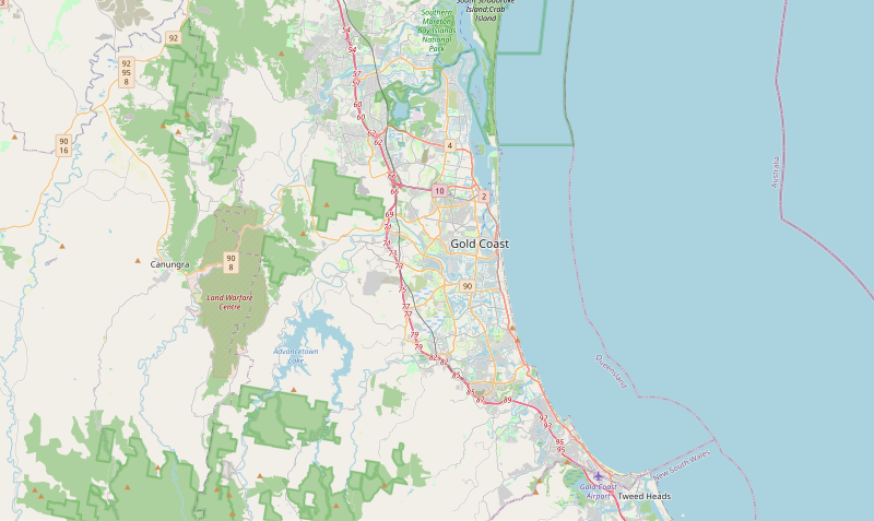
Locator map of the Gold Coast.
Summary[edit]
| Description |
English: Locator map of Queensland's Gold Coast. |
| Date | |
| Source | https://www.openstreetmap.org/#map=11/-28.0144/153.3801 |
| Author | OpenStreetMap contributors |
Licensing[edit]
| Description |
This map was created from OpenStreetMap project data, collected by the community. This map may be incomplete, and may contain errors. Don't rely solely on it for navigation. |
|||
| Date | (see file history) | |||
| Source | openstreetmap.org | |||
| Creator |
OpenStreetMap contributors |
|||
| Permission (Reusing this file) |
OpenStreetMap data is available under the Open Database License (details). Map tiles are licensed under the Creative Commons Attribution-ShareAlike 2.0 license (CC-BY-SA 2.0).
This file is licensed under the Creative Commons Attribution-Share Alike 2.0 Generic license.
|
|||
| Georeferencing | If inappropriate please set warp_status = skip to hide. |
File history
Click on a date/time to view the file as it appeared at that time.
| Date/Time | Thumbnail | Dimensions | User | Comment | |
|---|---|---|---|---|---|
| current | 04:25, 16 April 2023 | | 1,429 × 851 (17.22 MB) | Thiscouldbeauser (talk | contribs) | Uploaded a work by OpenStreetMap contributors from https://www.openstreetmap.org/#map=11/-28.0144/153.3801 with UploadWizard |
You cannot overwrite this file.
File usage on Commons
There are no pages that use this file.
File usage on other wikis
The following other wikis use this file:
- Usage on en.wikipedia.org
- Surfers Paradise, Queensland
- Gold Coast Airport
- Coolangatta
- Broadbeach, Queensland
- Burleigh Heads, Queensland
- Main Beach, Queensland
- Nerang, Queensland
- Palm Beach, Queensland
- Southport, Queensland
- Miami, Queensland
- Broadbeach Waters, Queensland
- Helensvale, Queensland
- Carrara, Queensland
- Queensland Australian Football League
- Merrimac, Queensland
- Ashmore, Queensland
- Benowa, Queensland
- Burleigh Waters, Queensland
- Biggera Waters, Queensland
- Bilinga, Queensland
- Bundall, Queensland
- Coombabah
- Hope Island, Queensland
- Labrador, Queensland
- Molendinar, Queensland
- Tugun, Queensland
- Varsity Lakes
- Oxenford, Queensland
- Mermaid Beach, Queensland
- Parkwood, Queensland
- Mermaid Waters, Queensland
- Sanctuary Cove, Queensland
- Upper Coomera, Queensland
- Elanora, Queensland
- Numinbah Valley
- Clear Island Waters, Queensland
- Runaway Bay, Queensland
- Reedy Creek, Queensland
- Andrews, Queensland
- Springbrook, Queensland
- Paradise Point, Queensland
- Sovereign Islands, Queensland
- Coomera, Queensland
- Gilston, Queensland
- Bonogin, Queensland
- Cedar Creek, Queensland (Logan & Gold Coast)
- Guanaba
- Maudsland, Queensland
- Highland Park, Queensland
- Hollywell, Queensland
View more global usage of this file.