File:Golan location map 3.PNG
Jump to navigation
Jump to search

Size of this preview: 751 × 600 pixels. Other resolutions: 301 × 240 pixels | 601 × 480 pixels | 925 × 739 pixels.
Original file (925 × 739 pixels, file size: 146 KB, MIME type: image/png)
Captions
Captions
Add a one-line explanation of what this file represents
Summary[edit]
| Description |
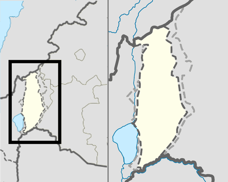
English: Location map of the Golan Heights. |
| Date | (UTC) |
| Source | |
| Author |
|
| This is a retouched picture, which means that it has been digitally altered from its original version. Modifications: change color of Syria. The original can be viewed here: Golan location map 2.PNG:
|
Licensing[edit]
I, the copyright holder of this work, hereby publish it under the following license:
This file is licensed under the Creative Commons Attribution 3.0 Unported license.
- You are free:
- to share – to copy, distribute and transmit the work
- to remix – to adapt the work
- Under the following conditions:
- attribution – You must give appropriate credit, provide a link to the license, and indicate if changes were made. You may do so in any reasonable manner, but not in any way that suggests the licensor endorses you or your use.
Original upload log[edit]
This image is a derivative work of the following images:
- File:Golan_location_map_2.PNG licensed with Cc-by-3.0
- 2011-11-10T18:51:00Z Nableezy 936x739 (143176 Bytes) restore
- 2011-11-10T18:07:48Z Chesdovi 925x739 (149277 Bytes) "a disputed territory may not be presented in a way that supports one of the sides to the conflict"
- 2011-11-10T17:00:35Z Nableezy 936x739 (143176 Bytes) restore
- 2011-11-10T10:36:25Z Biosketch 925x739 (149277 Bytes) The image is displayed throughout Wikipedia and should be used to force a POV..
- 2011-11-10T04:17:35Z Supreme Deliciousness 936x739 (143176 Bytes) Restore neutral map.
- 2011-11-10T03:33:32Z Jiujitsuguy 925x739 (149277 Bytes) Consistent with NPOV showing Heights controlled by neither side
- 2010-12-01T23:42:36Z Supreme Deliciousness 936x739 (143176 Bytes) Smaller fix.
- 2010-12-01T23:15:52Z Supreme Deliciousness 936x739 (143160 Bytes) Border fix.
- 2010-11-25T20:28:54Z Supreme Deliciousness 936x739 (143000 Bytes) smaller fixes
- 2010-11-25T20:21:05Z Supreme Deliciousness 936x739 (131973 Bytes) Smaller fixes.
- 2010-11-10T10:51:46Z Supreme Deliciousness 936x739 (116667 Bytes) Reverting vandalism
- 2010-11-10T07:19:34Z DrorK 925x739 (149277 Bytes) NPOVizing the map. A disputed territory may not be presented in a way that supports one of the sides to the conflict.
- 2010-10-19T18:32:25Z Supreme Deliciousness 936x739 (116667 Bytes) {{Information |Description={{en|1=Location map of the Golan Heights.}} |Source=*[[:File:Syria location map2.svg|Syria location map2.svg]] *[[:File:Israel location map.svg|Israel location map.svg]] |Author=*[[:File:Syria loca
Uploaded with derivativeFX
File history
Click on a date/time to view the file as it appeared at that time.
| Date/Time | Thumbnail | Dimensions | User | Comment | |
|---|---|---|---|---|---|
| current | 18:54, 10 November 2011 | | 925 × 739 (146 KB) | Nableezy (talk | contribs) | == {{int:filedesc}} == {{Information |Description={{en|1=Location map of the Golan Heights.}} |Source=*File:Golan_location_map_2.PNG |Date=2011-11-10 18:53 (UTC) |Author=*File:Golan_location_map_2.PNG: *[[:File:Syria location map2.svg|Syria lo |
You cannot overwrite this file.
File usage on Commons
There are no pages that use this file.
File usage on other wikis
The following other wikis use this file:
- Usage on ca.wikipedia.org
- Usage on en.wikipedia.org
- Usage on es.wikipedia.org