File:Germoe War Memorial, Tregonning Hill - geograph.org.uk - 233479.jpg
Jump to navigation
Jump to search
Size of this preview: 450 × 600 pixels. Other resolutions: 180 × 240 pixels | 480 × 640 pixels.
Original file (480 × 640 pixels, file size: 75 KB, MIME type: image/jpeg)
Captions
Captions
Add a one-line explanation of what this file represents
Summary[edit]
| Description |
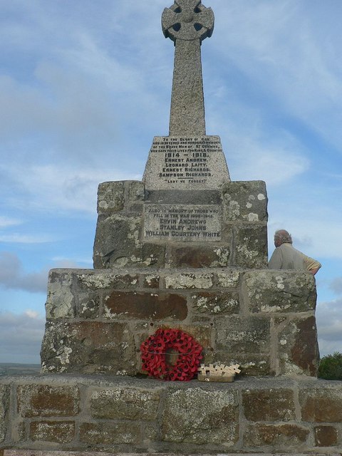
English: Germoe War Memorial, Tregonning Hill. The war memorial for the parish of Germoe marks the summit of Tregonning Hill, at 194 metres above sea level. That doesn't sound very high, but its higher than the rest of the land nearby, and the hill gives excellent views of the north and south coasts, Mounts Bay, The Lizard etc.
See also 233480
|
|
| Date | Taken on 1 August 2006 | |
| Source | From geograph.org.uk | |
| Author | RichTea |
| Object location | | View this and other nearby images on: OpenStreetMap |
|---|
_heading:90.00&language=en)
Licensing[edit]

|
This image was taken from the Geograph project collection. See this photograph's page on the Geograph website for the photographer's contact details. The copyright on this image is owned by RichTea and is licensed for reuse under the Creative Commons Attribution-ShareAlike 2.0 license.
|
This file is licensed under the Creative Commons Attribution-Share Alike 2.0 Generic license.
Attribution: RichTea
- You are free:
- to share – to copy, distribute and transmit the work
- to remix – to adapt the work
- Under the following conditions:
- attribution – You must give appropriate credit, provide a link to the license, and indicate if changes were made. You may do so in any reasonable manner, but not in any way that suggests the licensor endorses you or your use.
- share alike – If you remix, transform, or build upon the material, you must distribute your contributions under the same or compatible license as the original.
File history
Click on a date/time to view the file as it appeared at that time.
| Date/Time | Thumbnail | Dimensions | User | Comment | |
|---|---|---|---|---|---|
| current | 00:23, 1 February 2010 | | 480 × 640 (75 KB) | GeographBot (talk | contribs) | == {{int:filedesc}} == {{Information |description={{en|1=Germoe War Memorial, Tregonning Hill. The war memorial for the parish of Germoe marks the summit of Tregonning Hill, at 194 metres above sea level. That doesn't sound very high, but its higher than |
You cannot overwrite this file.
File usage on Commons
The following page uses this file:
File usage on other wikis
The following other wikis use this file:
- Usage on ceb.wikipedia.org
- Usage on www.wikidata.org