File:Geovisualization of places and river systems in India.png
Jump to navigation
Jump to search

Size of this preview: 552 × 599 pixels. Other resolutions: 221 × 240 pixels | 442 × 480 pixels | 707 × 768 pixels | 943 × 1,024 pixels | 2,000 × 2,172 pixels.
Original file (2,000 × 2,172 pixels, file size: 4.05 MB, MIME type: image/png)
Captions
Captions
Add a one-line explanation of what this file represents
Summary[edit]
| Description |
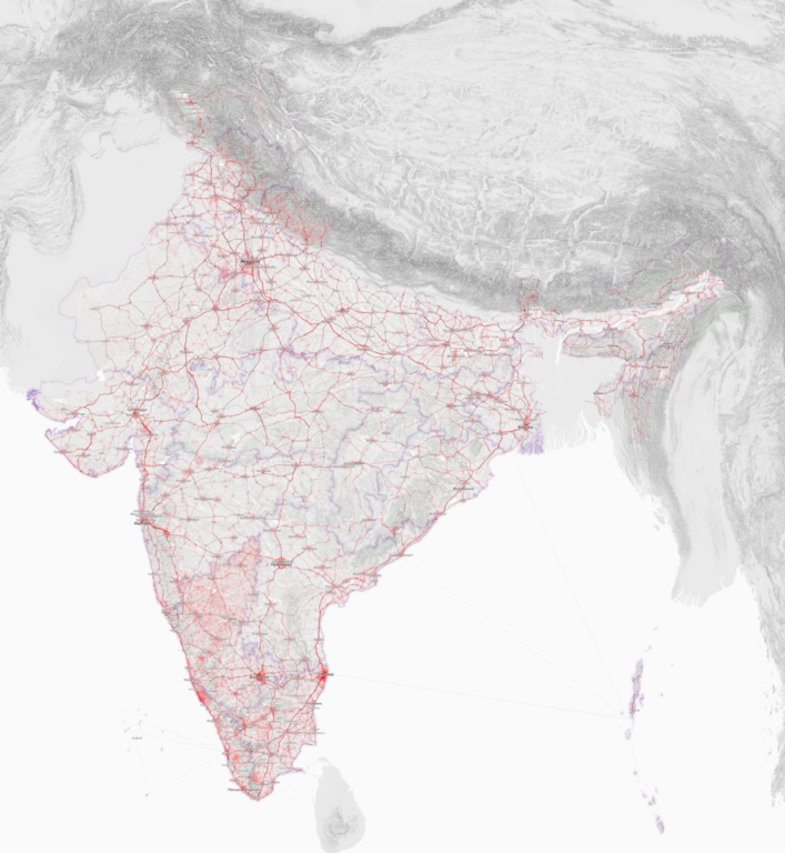
English: Map showing data density of places, highways, railways and river systems in the openstreetmap project. Sources:
|
| Date | |
| Source | Own work |
| Author | Planemad |
Licensing[edit]
I, the copyright holder of this work, hereby publish it under the following license:
This file is licensed under the Creative Commons Attribution-Share Alike 3.0 Unported license.
- You are free:
- to share – to copy, distribute and transmit the work
- to remix – to adapt the work
- Under the following conditions:
- attribution – You must give appropriate credit, provide a link to the license, and indicate if changes were made. You may do so in any reasonable manner, but not in any way that suggests the licensor endorses you or your use.
- share alike – If you remix, transform, or build upon the material, you must distribute your contributions under the same or compatible license as the original.
File history
Click on a date/time to view the file as it appeared at that time.
| Date/Time | Thumbnail | Dimensions | User | Comment | |
|---|---|---|---|---|---|
| current | 11:37, 8 February 2013 | | 2,000 × 2,172 (4.05 MB) | Planemad (talk | contribs) | Added state boundaries, ferry connections, style enhancements |
| 09:56, 8 February 2013 |  | 2,000 × 2,172 (3.71 MB) | Planemad (talk | contribs) | Reorder text layers for better readability, tone down heat mapping | |
| 17:38, 7 February 2013 |  | 2,000 × 2,172 (3.41 MB) | Planemad (talk | contribs) | Fix font sizes for capitals, darken forest areas | |
| 16:03, 7 February 2013 |  | 2,000 × 2,172 (3.37 MB) | Planemad (talk | contribs) | Neutral tones for background + terrain data | |
| 15:05, 25 January 2013 |  | 1,200 × 1,303 (671 KB) | Planemad (talk | contribs) | User created page with UploadWizard |
You cannot overwrite this file.
File usage on Commons
There are no pages that use this file.