File:Geografischer Mittelpunkt der Schweiz.JPG
Jump to navigation
Jump to search
Size of this preview: 800 × 533 pixels. Other resolutions: 320 × 213 pixels | 640 × 427 pixels | 1,024 × 683 pixels | 1,280 × 853 pixels | 2,560 × 1,707 pixels | 3,264 × 2,176 pixels.
Original file (3,264 × 2,176 pixels, file size: 1.44 MB, MIME type: image/jpeg)
Captions
Captions
Add a one-line explanation of what this file represents
Summary[edit]
| Description |
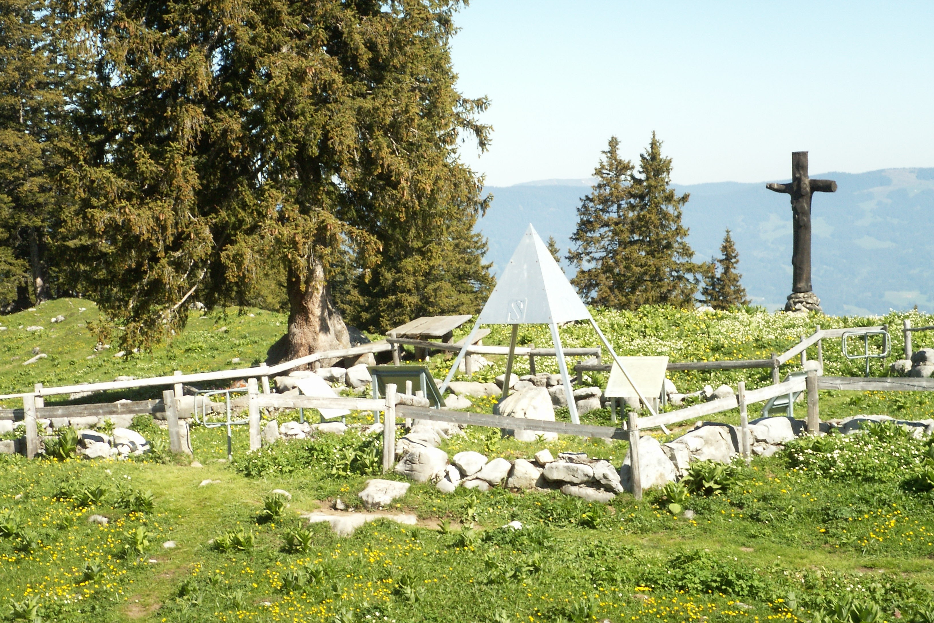
Deutsch: Eingezäuntes Areal um den geografischen Mittelpunkt der Schweiz
English: Marker near the geographical centre of Switzerland. |
| Date | Selbst fotografiert am 11.06.06 |
| Source | Own work |
| Author | Staycoolandbegood |
Licensing[edit]
| I, the copyright holder of this work, release this work into the public domain. This applies worldwide. In some countries this may not be legally possible; if so: I grant anyone the right to use this work for any purpose, without any conditions, unless such conditions are required by law. |
| Camera location | | View this and other nearby images on: OpenStreetMap |
|---|
File history
Click on a date/time to view the file as it appeared at that time.
| Date/Time | Thumbnail | Dimensions | User | Comment | |
|---|---|---|---|---|---|
| current | 08:50, 16 July 2006 | | 3,264 × 2,176 (1.44 MB) | Staycoolandbegood (talk | contribs) | {{Information |Description=Eingezäuntes Areal um den geografischen Mittelpunkt der Schweiz |Source=own work |Date=Selbst fotografiert am 11.06.06 |Author=Staycoolandbegood |Permission=OK }} |
You cannot overwrite this file.
File usage on Commons
The following page uses this file:
File usage on other wikis
The following other wikis use this file:
- Usage on als.wikipedia.org
- Usage on bs.wikipedia.org
- Usage on ceb.wikipedia.org
- Usage on de.wikipedia.org
- Usage on en.wikipedia.org
- Usage on es.wikipedia.org
- Usage on ka.wikipedia.org
- Usage on lmo.wikipedia.org
- Usage on nn.wikipedia.org
- Usage on tr.wikipedia.org
- Usage on www.wikidata.org