File:Geognostische Karte Württemberg Baden (1860).jpg
Jump to navigation
Jump to search

Size of this preview: 510 × 600 pixels. Other resolutions: 204 × 240 pixels | 408 × 480 pixels | 653 × 768 pixels | 870 × 1,024 pixels | 1,741 × 2,048 pixels | 6,771 × 7,965 pixels.
Original file (6,771 × 7,965 pixels, file size: 14.03 MB, MIME type: image/jpeg)
Captions
Captions
Add a one-line explanation of what this file represents
| Warning | The original file is very high-resolution. It might not load properly or could cause your browser to freeze when opened at full size. |
|---|
Summary[edit]
.jpg&action=edit§ion=1)
| Description |
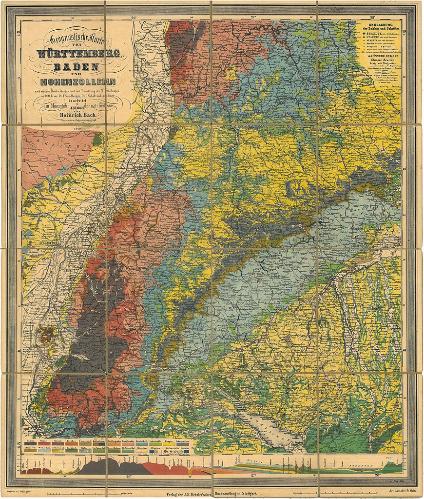
Deutsch: Geognostische Karte von Württemberg Baden und Hohenzollern nach eigenen Beobachtungen und mit Benützung der Mittheilungen von Dr. O. Fraas, Dr. F. Sandberger, Dr. J. Schill und Anderen bearbeitet im Maasstabe 1 /450000 der nat.: Grösse |
||||||||||||||||
| Date | |||||||||||||||||
| Source |
Deutsch: Scan der Karte aus Privatbesitz |
||||||||||||||||
| Author |
|
||||||||||||||||
|
This work is in the public domain in its country of origin and other countries and areas where the copyright term is the author's life plus 100 years or fewer. | |
| This file has been identified as being free of known restrictions under copyright law, including all related and neighboring rights. | |
File history
Click on a date/time to view the file as it appeared at that time.
| Date/Time | Thumbnail | Dimensions | User | Comment | |
|---|---|---|---|---|---|
| current | 18:42, 26 July 2013 | | 6,771 × 7,965 (14.03 MB) | Joergens.mi (talk | contribs) | == {{int:filedesc}} == {{Information |Description={{de|Geognostische Karte von Württemberg Baden und Hohenzollern nach eigenen Beobachtungen und mit Benützung der Mittheilungen von Dr. O. Fraas, Dr. F. Sandberger, Dr. J. Schill und Anderen bearbeite... |
You cannot overwrite this file.
File usage on Commons
There are no pages that use this file.
.jpg&oldid=719909257)