File:GbgAttack1719-01.jpg
Jump to navigation
Jump to search

Size of this preview: 688 × 600 pixels. Other resolutions: 275 × 240 pixels | 551 × 480 pixels | 881 × 768 pixels | 1,175 × 1,024 pixels | 2,350 × 2,048 pixels | 4,677 × 4,076 pixels.
Original file (4,677 × 4,076 pixels, file size: 2.66 MB, MIME type: image/jpeg)
Captions
Captions
Add a one-line explanation of what this file represents
Summary[edit]
| Description |
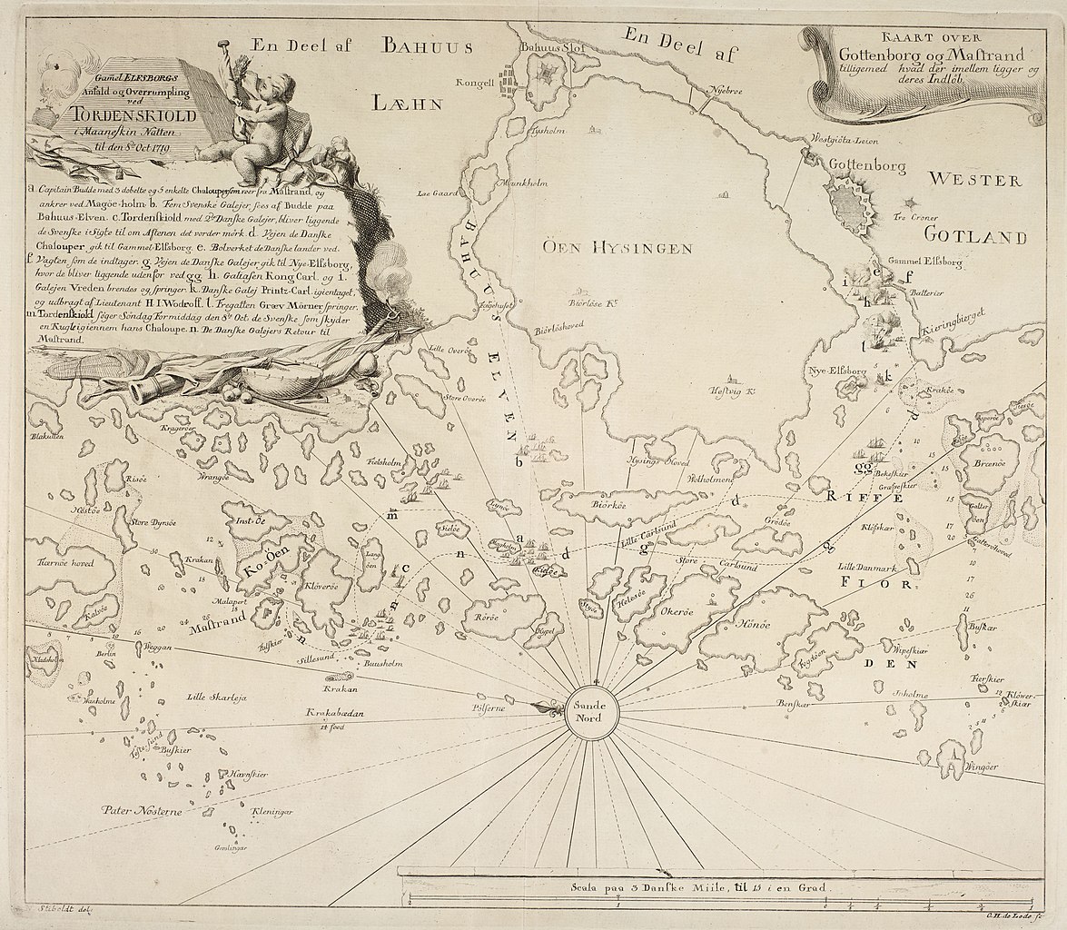
English: Map over the coast between Marstrand and Gothenburg, Sweden, showing the events during the danish attack at Nya Varvet naval shipyard, on 8th October 1719.
Svenska: Karta över kusten mellan Marstrand och Göteborg, som visar händelseförloppet under den danska attacken mot Nya Varvet den 8 oktober 1719 |
| Date | |
| Source | Royal Library, Copenhagen: KBK 1113,131,11-14-1719/1, 1951-452/67, DO518296 |
| Author | Stiboldt, N.; Lode, O. H. de; Rothe, C. P. |
Licensing[edit]
|
This work is in the public domain in its country of origin and other countries and areas where the copyright term is the author's life plus 100 years or fewer. | |
| This file has been identified as being free of known restrictions under copyright law, including all related and neighboring rights. | |
File history
Click on a date/time to view the file as it appeared at that time.
| Date/Time | Thumbnail | Dimensions | User | Comment | |
|---|---|---|---|---|---|
| current | 20:14, 5 March 2014 | | 4,677 × 4,076 (2.66 MB) | Dagjoh (talk | contribs) | {{Information |Description ={{en|1=Map over the coast between Marstrand and Gothenburg, Sweden, showing the events during the danish attack at Nya Varvet naval shipyard, on 8th October 1719.}} {{sv|1=Karta över kusten mellan Marstrand och Göteborg... |
You cannot overwrite this file.
File usage on Commons
The following page uses this file:
File usage on other wikis
The following other wikis use this file:
- Usage on sv.wikipedia.org