File:GapingGillSurface.jpg
Jump to navigation
Jump to search

Size of this preview: 800 × 600 pixels. Other resolutions: 320 × 240 pixels | 640 × 480 pixels | 1,024 × 768 pixels | 1,152 × 864 pixels.
Original file (1,152 × 864 pixels, file size: 229 KB, MIME type: image/jpeg)
Captions
Captions
Add a one-line explanation of what this file represents
| Description |
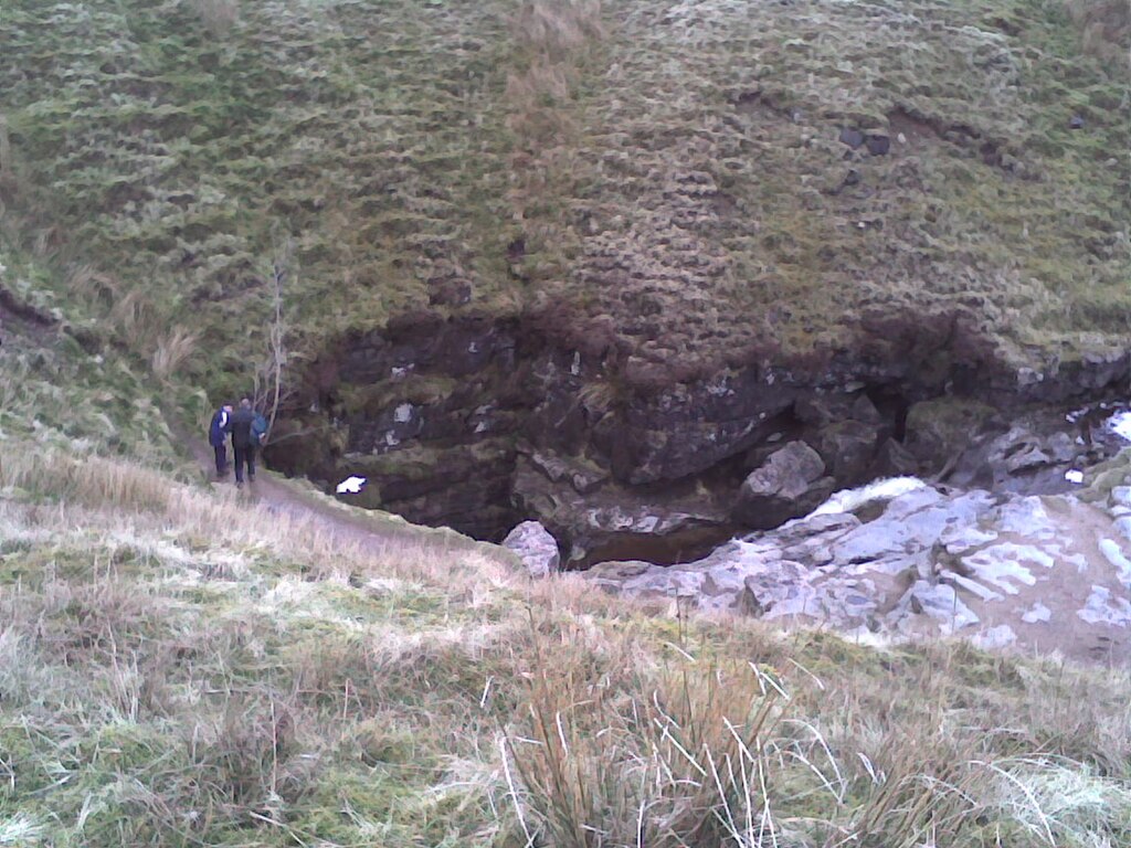
Deutsch: Gaping Gill, ein 105 m tiefe Doline, in welchem der Fell Beck Fluß verschwindet.
English: Gaping Gill, 105 m deep pothole (Ponor) where the stream Fell Beck flows into. North Yorkshire. |
| Date | 5 April 2008 (original upload date) |
| Source | Transferred from en.wikipedia to Commons by Zeimusu using CommonsHelper. |
| Author | Abcdef123456 at English Wikipedia |
Licensing[edit]
| This work has been released into the public domain by its author, Abcdef123456 at English Wikipedia. This applies worldwide. In some countries this may not be legally possible; if so: Abcdef123456 grants anyone the right to use this work for any purpose, without any conditions, unless such conditions are required by law. |
Original upload log[edit]
The original description page was here. All following user names refer to en.wikipedia.
- 2008-04-05 21:01 Abcdef123456 1152×864×??? (234766 bytes) An image of the mouth of Gaping Gill in North Yorkshire. == Licensing == {{PD-self}}
| Camera location | | View this and other nearby images on: OpenStreetMap |
|---|
File history
Click on a date/time to view the file as it appeared at that time.
| Date/Time | Thumbnail | Dimensions | User | Comment | |
|---|---|---|---|---|---|
| current | 23:30, 15 August 2008 | | 1,152 × 864 (229 KB) | File Upload Bot (Magnus Manske) (talk | contribs) | {{BotMoveToCommons|en.wikipedia}} {{Information |Description={{en|An image of the mouth of Gaping Gill in North Yorkshire.}} |Source=Transferred from [http://en.wikipedia.org en.wikipedia]; transferred to Commons by User:Zeimusu using [http://tools.w |
You cannot overwrite this file.
File usage on Commons
The following page uses this file:
File usage on other wikis
The following other wikis use this file:
- Usage on de.wikipedia.org
- Usage on en.wikipedia.org
- Usage on hu.wikipedia.org
- Usage on it.wikibooks.org
- Usage on it.wikiversity.org
- Usage on ro.wikipedia.org