File:Gönnheim Ludwigstraße 50 (an) 001 2020 01 04.jpg
Jump to navigation
Jump to search

Size of this preview: 600 × 600 pixels. Other resolutions: 240 × 240 pixels | 480 × 480 pixels | 768 × 768 pixels | 1,024 × 1,024 pixels | 2,236 × 2,236 pixels.
Original file (2,236 × 2,236 pixels, file size: 319 KB, MIME type: image/jpeg)
Captions
Captions
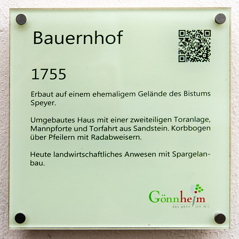
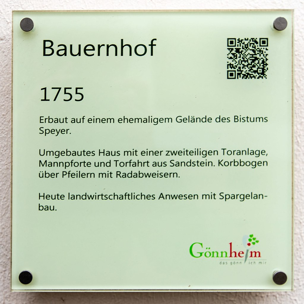
Information board
Summary[edit]
_001_2020_01_04.jpg&action=edit§ion=1)
| Description |
This is a photograph of a cultural monument.
It is on the list of cultural monuments of Gönnheim. Designation: Gate system
Place: Local municipality Gönnheim, Collective municipality Wachenheim, District Bad Dürkheim, Rhineland-Palatinate, Germany |
||
| Date | Taken on 04.01.2020 14:44:38 | ||
| Source | Self-photographed | ||
| Author | Friedrich Haag | ||
| Permission (Reusing this file) |
|
||
| Attribution (required by the license) | © Friedrich Haag / Wikimedia Commons / | ||
| Object location | | View this and other nearby images on: OpenStreetMap |
|---|
_001_2020_01_04.jpg¶ms=049.447992_N_0008.238931_E_globe:Earth_class:object_type:object_region:DE-RP_scale:2500_&language=en)
| Camera location | | View this and other nearby images on: OpenStreetMap |
|---|
_001_2020_01_04.jpg¶ms=049.448023_N_0008.238951_E_globe:Earth_type:camera_region:DE-RP_scale:2500_&language=en)
Licensing[edit]
_001_2020_01_04.jpg&action=edit§ion=2)
I, the copyright holder of this work, hereby publish it under the following license:
This file is licensed under the Creative Commons Attribution-Share Alike 4.0 International license.
Attribution: Friedrich Haag
- You are free:
- to share – to copy, distribute and transmit the work
- to remix – to adapt the work
- Under the following conditions:
- attribution – You must give appropriate credit, provide a link to the license, and indicate if changes were made. You may do so in any reasonable manner, but not in any way that suggests the licensor endorses you or your use.
- share alike – If you remix, transform, or build upon the material, you must distribute your contributions under the same or compatible license as the original.
File history
Click on a date/time to view the file as it appeared at that time.
| Date/Time | Thumbnail | Dimensions | User | Comment | |
|---|---|---|---|---|---|
| current | 10:16, 31 January 2020 | | 2,236 × 2,236 (319 KB) | F. Riedelio (talk | contribs) | Uploaded with LrMediaWiki 0.8.0, LR 9.1 Win |
You cannot overwrite this file.
File usage on Commons
The following 2 pages use this file:
_001_2020_01_04.jpg&oldid=839183371)