File:Fulda–Gerstungen–Erfurt Karte.png
Jump to navigation
Jump to search

Size of this preview: 664 × 599 pixels. Other resolutions: 266 × 240 pixels | 532 × 480 pixels | 851 × 768 pixels | 1,134 × 1,024 pixels | 1,852 × 1,672 pixels.
Original file (1,852 × 1,672 pixels, file size: 3.48 MB, MIME type: image/png)
Captions
Captions
Add a one-line explanation of what this file represents
Summary[edit]
| Description |
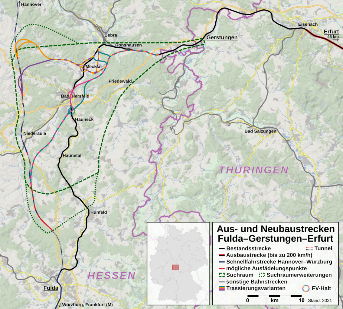
Deutsch: Aus- und Neubaustrecken Fulda–Gerstungen–Erfurt als Teil der Aus- und Neubaustrecke Hanau–Würzburg/Fulda–Erfurt. Stand 2019 ist der Abschnitt Eisenach–Erfurt ausgebaut, während der Trassenverlauf zwischen Gerstungen und Fulda noch nicht festgelegt ist. |
| Date | |
| Source | Own work, using OpenStreetMap data and File:Deutschland_Lage_von_Schleswig-Holstein.svg |
| Author | Hbf878, OpenStreetMap contributors and David Liuzzo |
Licensing[edit]
| Description |
This map was created from OpenStreetMap project data, collected by the community. This map may be incomplete, and may contain errors. Don't rely solely on it for navigation. |
|||
| Date | (see file history) | |||
| Source | openstreetmap.org | |||
| Creator |
OpenStreetMap contributors |
|||
| Permission (Reusing this file) |
OpenStreetMap data is available under the Open Database License (details). Map tiles are licensed under the Creative Commons Attribution-ShareAlike 2.0 license (CC-BY-SA 2.0).
This file is licensed under the Creative Commons Attribution-Share Alike 2.0 Generic license.
|
|||
| Georeferencing | If inappropriate please set warp_status = skip to hide. |
File history
Click on a date/time to view the file as it appeared at that time.
| Date/Time | Thumbnail | Dimensions | User | Comment | |
|---|---|---|---|---|---|
| current | 15:16, 9 October 2021 | | 1,852 × 1,672 (3.48 MB) | Hbf878 (talk | contribs) | Fernverkehrshalte |
| 21:56, 8 October 2021 |  | 1,852 × 1,672 (3.47 MB) | Hbf878 (talk | contribs) | Trassenvarianten | |
| 00:47, 5 October 2020 |  | 1,931 × 1,670 (3.63 MB) | Hbf878 (talk | contribs) | Ausschnitt | |
| 11:30, 28 July 2020 |  | 2,063 × 1,812 (4.22 MB) | Hbf878 (talk | contribs) | Suchraum Nord | |
| 21:27, 8 August 2019 |  | 2,063 × 1,812 (4.22 MB) | Hbf878 (talk | contribs) | Ausschnitt | |
| 17:26, 8 August 2019 |  | 2,235 × 1,812 (4.56 MB) | Hbf878 (talk | contribs) | minor | |
| 17:00, 8 August 2019 |  | 2,235 × 1,812 (4.56 MB) | Hbf878 (talk | contribs) | User created page with UploadWizard |
You cannot overwrite this file.
File usage on Commons
The following 10 pages use this file:
- User:Chumwa/OgreBot/Potential transport maps/2019 August 1-10
- User:Chumwa/OgreBot/Public transport information/2019 August 1-10
- User:Chumwa/OgreBot/Public transport information/2020 July 21-31
- User:Chumwa/OgreBot/Public transport information/2020 October 1-10
- User:Chumwa/OgreBot/Public transport information/2021 October 1-10
- User:Chumwa/OgreBot/Transport Maps/2019 August 1-10
- User:Chumwa/OgreBot/Transport Maps/2020 July 21-31
- User:Chumwa/OgreBot/Transport Maps/2020 October 1-10
- User:Chumwa/OgreBot/Transport Maps/2021 October 1-10
- User:Chumwa/OgreBot/Travel and communication maps/2019 August 1-10
File usage on other wikis
The following other wikis use this file:
- Usage on de.wikipedia.org
- Usage on en.wikipedia.org