File:Friesengebietstq.png
Jump to navigation
Jump to search

Size of this preview: 661 × 599 pixels. Other resolutions: 265 × 240 pixels | 530 × 480 pixels | 769 × 697 pixels.
Original file (769 × 697 pixels, file size: 110 KB, MIME type: image/png)
Captions
Captions
Add a one-line explanation of what this file represents
Summary[edit]
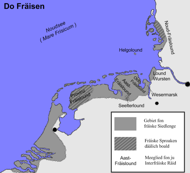
| Description | Gebiet fon fräiske Siedlenge, fräiske Lounde un Sproaken |
| Date | |
| Source | Own work |
| Author | Termo |
| Other versions |
|
Licensing[edit]
I, the copyright holder of this work, hereby publish it under the following licenses:

|
Permission is granted to copy, distribute and/or modify this document under the terms of the GNU Free Documentation License, Version 1.2 or any later version published by the Free Software Foundation; with no Invariant Sections, no Front-Cover Texts, and no Back-Cover Texts. A copy of the license is included in the section entitled GNU Free Documentation License. |
| This file is licensed under the Creative Commons Attribution-Share Alike 3.0 Unported license. | ||
| ||
| This licensing tag was added to this file as part of the GFDL licensing update. |
You may select the license of your choice.
File history
Click on a date/time to view the file as it appeared at that time.
| Date/Time | Thumbnail | Dimensions | User | Comment | |
|---|---|---|---|---|---|
| current | 21:27, 5 February 2008 | | 769 × 697 (110 KB) | Termo (talk | contribs) | {{Information |Description= Gebiet fon fräiske Siedlenge, fräiske Lounde un Sproaken |Source=eigene Arbeit |Date= February 2008 |Author= Termo |Permission= |other_versions=25px Blank Map }} |
You cannot overwrite this file.
File usage on Commons
There are no pages that use this file.
File usage on other wikis
The following other wikis use this file: