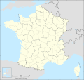
File:France map Lambert-93 with regions and departments polygons-blank.svg

Original file (SVG file, nominally 2,000 × 1,898 pixels, file size: 1.78 MB)
Captions
Captions
Summary[edit]
| Camera location | 46° 15′ 00″ N, 2° 06′ 00″ E | View this and other nearby images on: OpenStreetMap |
|---|
| DescriptionFrance map Lambert-93 with regions and departments polygons-blank.svg |
English: Blank map of metropolitan France in the official Lambert-93 projection, with regions and departments as independent polygons. Instructions of use:
Français : Carte vierge de la France métropolitaine suivant la projection officielle Lambert-93, avec régions et départements en tant que polygones indépendants. Instructions d'utilisation :
Lambert-93 projection ; RGF-93 datum |
||
| Date | |||
| Source |
Own work, derivate from France map Lambert-93 with regions and departments-blank.svg created by myself
|
||
| Author | Eric Gaba (Sting - fr:Sting) | ||
| Permission (Reusing this file) |
|
||
| Other versions |
Derivative works of this file:
[edit]
Same map but with topography and bathymetry:
|
||
| SVG development InfoField |
Licensing[edit]

|
Permission is granted to copy, distribute and/or modify this document under the terms of the GNU Free Documentation License, Version 1.2 or any later version published by the Free Software Foundation; with no Invariant Sections, no Front-Cover Texts, and no Back-Cover Texts. A copy of the license is included in the section entitled GNU Free Documentation License.http://www.gnu.org/copyleft/fdl.htmlGFDLGNU Free Documentation Licensetruetrue |
- You are free:
- to share – to copy, distribute and transmit the work
- to remix – to adapt the work
- Under the following conditions:
- attribution – You must give appropriate credit, provide a link to the license, and indicate if changes were made. You may do so in any reasonable manner, but not in any way that suggests the licensor endorses you or your use.
- share alike – If you remix, transform, or build upon the material, you must distribute your contributions under the same or compatible license as the original.
File history
Click on a date/time to view the file as it appeared at that time.
| Date/Time | Thumbnail | Dimensions | User | Comment | |
|---|---|---|---|---|---|
| current | 15:18, 19 October 2017 |  | 2,000 × 1,898 (1.78 MB) | Sting (talk | contribs) | No borders over the Lake of Constance |
| 18:58, 3 February 2009 |  | 2,000 × 1,898 (1.79 MB) | Sting (talk | contribs) | == Summary == {{Location|46|15|00|N|02|06|00|E|scale:5000000}} <br/> {{Information |Description={{en|Blank map of France in the official Lambert-93 projection, with regions and departments as independent polygons.<br/> '''''Instructions of |
You cannot overwrite this file.
File usage on Commons
The following 13 pages use this file:
- File:France - Grand Ouest - locator map.svg
- File:France map Lambert-93-Maximum altitude.svg
- File:France map Lambert-93-blank.svg
- File:France map Lambert-93 topographic-blank.svg
- File:France map Lambert-93 topographic with regions-blank.svg
- File:France map Lambert-93 topographic with regions and departements-blank.svg
- File:France map Lambert-93 with regions-blank.svg
- File:France map Lambert-93 with regions and departments-blank.svg
- File:France map Lambert-93 with regions and departments polygons-blank.svg
- File:France map Lambert-93 with rivers-blank.svg
- File:France map Lambert-93 with rivers and regions-blank.svg
- File:Map of March 2012 attacks in Toulouse and Montauban, and scarlet Vigipirate area, in France.svg
- Template:Other versions/France map Lambert-93
File usage on other wikis
The following other wikis use this file:
Metadata
This file contains additional information such as Exif metadata which may have been added by the digital camera, scanner, or software program used to create or digitize it. If the file has been modified from its original state, some details such as the timestamp may not fully reflect those of the original file. The timestamp is only as accurate as the clock in the camera, and it may be completely wrong.
| Width | 2000.0005 |
|---|---|
| Height | 1898 |


