File:Fortaleza e arredores.JPG
Jump to navigation
Jump to search

Size of this preview: 798 × 599 pixels. Other resolutions: 320 × 240 pixels | 639 × 480 pixels | 1,023 × 768 pixels | 1,280 × 961 pixels | 2,560 × 1,923 pixels | 3,004 × 2,256 pixels.
Original file (3,004 × 2,256 pixels, file size: 1.32 MB, MIME type: image/jpeg)
Captions
Captions
Add a one-line explanation of what this file represents
Summary[edit]
| Title |
Português: Fortaleza e arredores |
||||
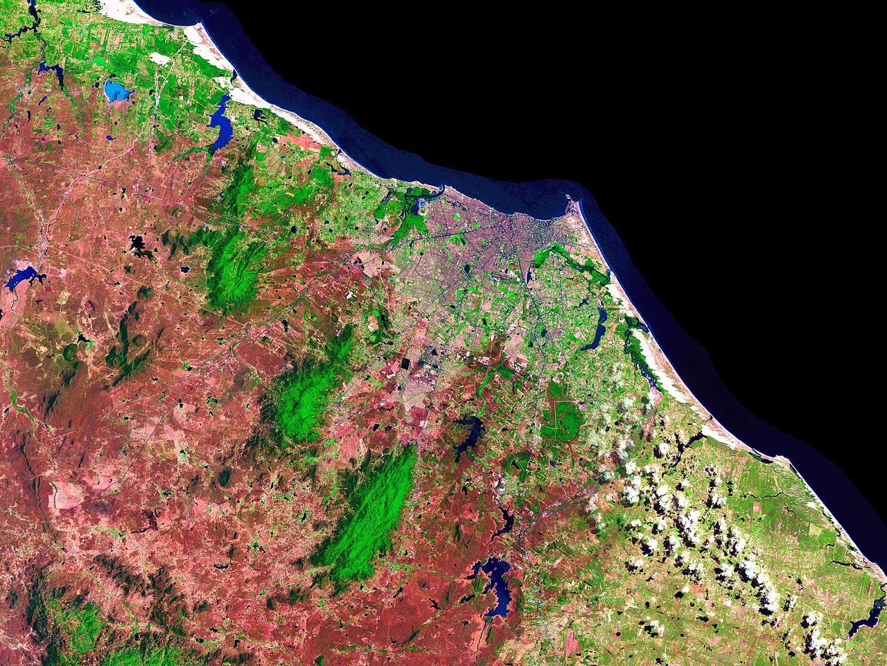
| Description |
Português: Os contrastes mostram as construções em roxo ou róseo claro, as vias em tons de azul escuro, quase preto, e as áreas verdes. Os tons de róseo/vermelho são áreas de clima seco (caatinga) - Articulação compatível com a escala 1:50.000 (IBGE). |
||||
| Source | http://www.cdbrasil.cnpm.embrapa.br/ | ||||
| Creator |
NASA; Embrapa |
||||
| Geotemporal data | |||||
| Date depicted | |||||
| Map location | Fortaleza | ||||
| Map type | topographic map | ||||
| Spatial reference system | equirectangular | ||||
| Scale | 1:50,000 | ||||
| Heading |
 |
||||
| Bounding box |
|
||||
| Georeferencing | If inappropriate please set warp_status = skip to hide. | ||||
| Bibliographic data | |||||
| Part of the series | MIRANDA, E. E. de; COUTINHO, A. C. (Coord.). Brasil Visto do Espaço. Campinas: Embrapa Monitoramento por Satélite, 2004. Disponível em: <http://www.cdbrasil.cnpm.embrapa.br>. Acesso em: 1 fev. 2016. | ||||
| Map sheet | SA-24-Z-C-IV-1; SA-24-Z-C-IV-2; SA-24-Z-C-V-1; SA-24-Z-C-IV-3; SA-24-Z-C-IV-4; SA-24-Z-C-V-3; SA-24-Z-C-V-4; SB-24-X-A-I-1; SB-24-X-A-I-2; SB-24-X-A-II-1; SB-24-X-A-II-2 | ||||
| Archival data | |||||
| Collection | Embrapa | ||||
| Notes | Foto do satélite Landsat 7 trabalhadas pela Embrapa, de uso livre. | ||||

- Error in {{Map}} template: unknown parameter "wikidata-location".
Licensing[edit]
| This image is in the public domain because it is a screenshot from NASA’s globe software World Wind using a public domain layer, such as Blue Marble, MODIS, Landsat, SRTM, USGS or GLOBE.
|
 |
File history
Click on a date/time to view the file as it appeared at that time.
| Date/Time | Thumbnail | Dimensions | User | Comment | |
|---|---|---|---|---|---|
| current | 18:29, 31 March 2006 | | 3,004 × 2,256 (1.32 MB) | Davidandrade (talk | contribs) | Foto do satélite landsat trabalhadas pela Embrapa de uso livre fornecidas no site http://www.cdbrasil.cnpm.embrapa.br/ |
You cannot overwrite this file.
File usage on Commons
The following page uses this file:
File usage on other wikis
The following other wikis use this file:
- Usage on hy.wikipedia.org
- Usage on ka.wikipedia.org
- Usage on myv.wikipedia.org
- Usage on no.wikipedia.org
- Usage on pt.wikipedia.org
- Usage on ru.wikipedia.org
- Usage on uk.wikipedia.org