File:Fort Supply, Utah Territory (Wyoming) map - vector image.svg
Jump to navigation
Jump to search

Size of this PNG preview of this SVG file: 280 × 160 pixels. Other resolutions: 320 × 183 pixels | 640 × 366 pixels | 1,024 × 585 pixels | 1,280 × 731 pixels | 2,560 × 1,463 pixels.
Original file (SVG file, nominally 280 × 160 pixels, file size: 681 KB)
Captions
Captions
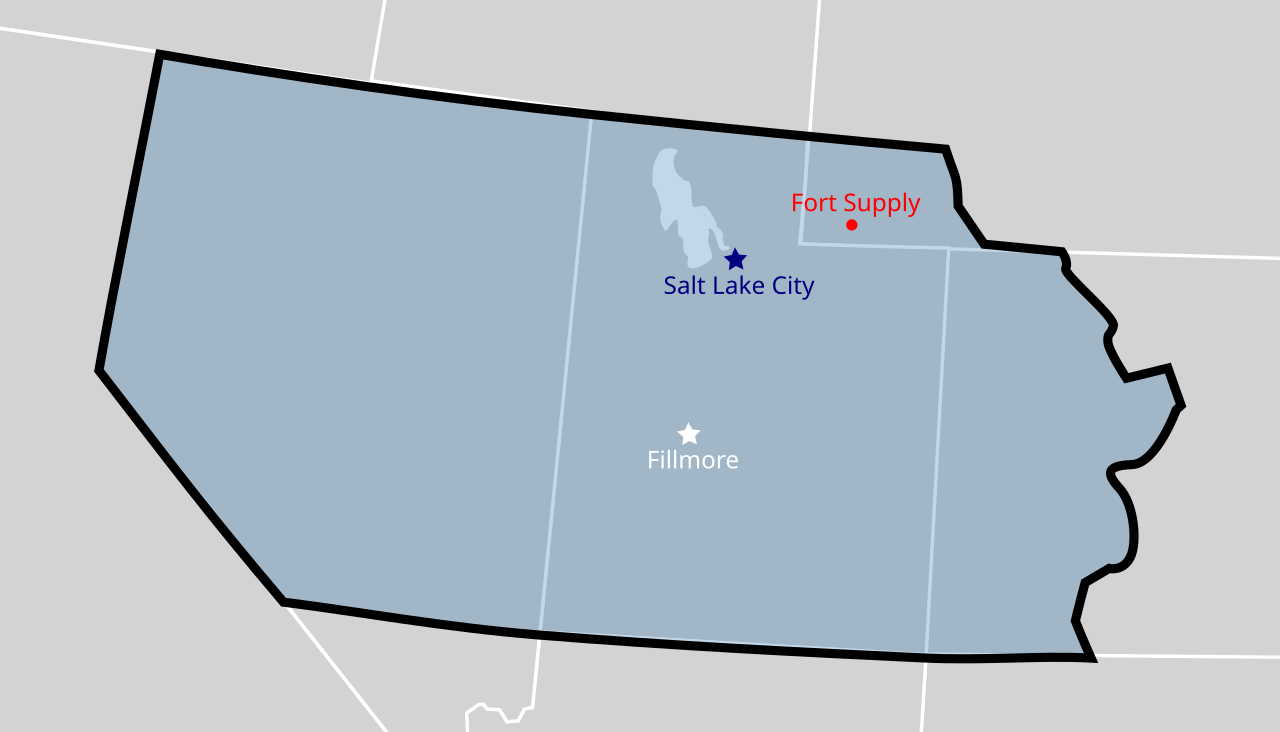
The approximate locations of Fort Supply, Salt Lake City, and Fillmore within the Utah Territory.
Summary[edit]
_map_-_vector_image.svg&action=edit§ion=1)
| Description | The approximate locations of Fort Supply, Salt Lake City, and Fillmore within the Utah Territory (as the territory was established by the United States Congress in 1850). The map is underlaid with a modern map of the United States showing the current state boundaries. The territory's boundaries and city locations may not be exact. |
| Date | (UTC) |
| Source |
This file was derived from: Utah Territory, vector image - 2011.svg: |
| Author |
Licensing[edit]
_map_-_vector_image.svg&action=edit§ion=2)
I, the copyright holder of this work, hereby publish it under the following licenses:
| This file is licensed under the Creative Commons Attribution-Share Alike 3.0 Unported license. | ||
| ||
| This licensing tag was added to this file as part of the GFDL licensing update. |

|
Permission is granted to copy, distribute and/or modify this document under the terms of the GNU Free Documentation License, Version 1.2 or any later version published by the Free Software Foundation; with no Invariant Sections, no Front-Cover Texts, and no Back-Cover Texts. A copy of the license is included in the section entitled GNU Free Documentation License. |
You may select the license of your choice.
Original upload log[edit]
_map_-_vector_image.svg&action=edit§ion=3)
This image is a derivative work of the following images:
- File:Utah Territory, vector image - 2011.svg licensed with Cc-by-sa-3.0-migrated, GFDL
- 2012-07-17T23:49:09Z Mangoman88 280x160 (15495 Bytes) Fix border along the 37th parallel north
- 2011-08-14T22:20:16Z Mangoman88 280x160 (14379 Bytes) {{Information |Description=The {{w|Utah Territory}} shown as established by the United States Congress in 1850. The map is underlaid with a modern map of the United States showing the current state boundaries. The territory's
Uploaded with derivativeFX
File history
Click on a date/time to view the file as it appeared at that time.
| Date/Time | Thumbnail | Dimensions | User | Comment | |
|---|---|---|---|---|---|
| current | 00:02, 19 June 2022 | | 280 × 160 (681 KB) | Beneathtimp (talk | contribs) | == {{int:filedesc}} == {{Information |Description=The approximate locations of Fort Supply, Salt Lake City, and Fillmore within the Utah Territory (as the territory was established by the United States Congress in 1850). The map is underlaid with a modern map of the United States showing the current state boundaries. The territory's boundaries and city locations may not be exact. |Source={{Derived from|Utah Territory, vector image - 2011.svg|display=50}} |Date=2022-06-18 23:54 (UTC) |Author=*... |
You cannot overwrite this file.
File usage on Commons
There are no pages that use this file.
File usage on other wikis
The following other wikis use this file:
- Usage on en.wikipedia.org
_map_-_vector_image.svg&oldid=667000932)