File:Foothills of the Uintas South of Evanston, Wyoming.jpg
Original file (4,000 × 3,000 pixels, file size: 7.07 MB, MIME type: image/jpeg)
Captions
Captions
Summary[edit]
| Description |
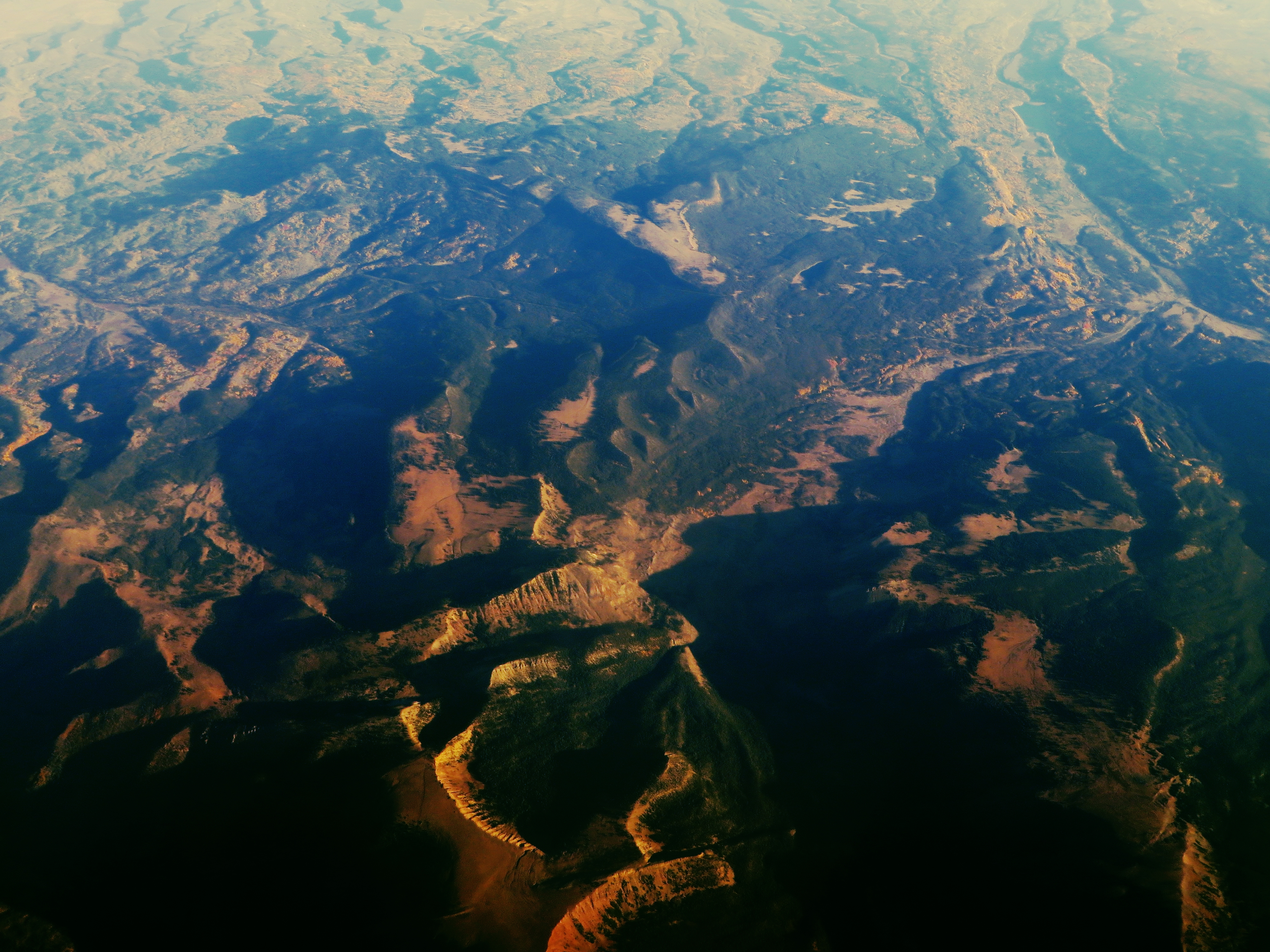
The Uinta Mountains are an east-west trending chain of mountains in northeastern Utah extending slightly into southern Wyoming in the United States. As a subrange of the Rocky Mountains, they are unusual for being the highest range in the contiguous United States running east to west, and lie approximately 100 miles (160 km) east of Salt Lake City. The range has peaks ranging from 11,000–13,528 feet (3,353–4,123 m), with the highest point being Kings Peak, also the highest point in Utah. The Mirror Lake Highway crosses the western half of the Uintas on its way to Wyoming. The south and east sides of the range are largely within the Colorado River watershed, including the Blacks Fork and the Duchesne River, which are tributaries of the Green River. The Green is the major tributary of the Colorado River and flows in a tight arc around the eastern side of the range. (Indeed John Wesley Powell said the Green was the "master stream" where it and the Colorado came together.) The Bear and Weber rivers, the two largest tributaries of Great Salt Lake, are born on the west slope of the range. The Provo River, the largest tributary to Utah Lake, begins on the southern side of the range and flows west to Utah Lake, which itself drains via the Jordan River into Great Salt Lake. The Uinta Mountains are part of the Wasatch and Uinta montane forests ecoregion. Nearly the entire range lies within Wasatch-Cache National Forest (on the north and west) and Ashley National Forest (on the south and east). The highest peaks of the range are protected as part of the High Uintas Wilderness. The forests contain many species of trees, including lodgepole pine, subalpine fir, Engelmann Spruce, Douglas-fir, and Quaking aspen. There are also many species of grasses, shrubs, and forbs growing in the Uinta Mountains. en.wikipedia.org/wiki/Uinta_Mountains en.wikipedia.org/wiki/Wikipedia:Text_of_Creative_Commons_... |
| Date | |
| Source | Foothills of the Uintas South of Evanston, Wyoming |
| Author | Ken Lund from Reno, Nevada, USA |
| Camera location | | View this and other nearby images on: OpenStreetMap |
|---|
Licensing[edit]
- You are free:
- to share – to copy, distribute and transmit the work
- to remix – to adapt the work
- Under the following conditions:
- attribution – You must give appropriate credit, provide a link to the license, and indicate if changes were made. You may do so in any reasonable manner, but not in any way that suggests the licensor endorses you or your use.
- share alike – If you remix, transform, or build upon the material, you must distribute your contributions under the same or compatible license as the original.
| This image was originally posted to Flickr by Ken Lund at https://flickr.com/photos/75683070@N00/21705167601. It was reviewed on 13 February 2016 by FlickreviewR and was confirmed to be licensed under the terms of the cc-by-sa-2.0. |
File history
Click on a date/time to view the file as it appeared at that time.
| Date/Time | Thumbnail | Dimensions | User | Comment | |
|---|---|---|---|---|---|
| current | 14:33, 13 February 2016 | | 4,000 × 3,000 (7.07 MB) | Tillman (talk | contribs) | Transferred from Flickr via Flickr2Commons |
You cannot overwrite this file.
File usage on Commons
The following page uses this file:
File usage on other wikis
The following other wikis use this file:
- Usage on en.wikipedia.org
- Usage on id.wikipedia.org
- Usage on zh.wikipedia.org