File:Fontaine Perigny - Hautes Fagnes - 02.jpg
Jump to navigation
Jump to search

Size of this preview: 800 × 600 pixels. Other resolutions: 320 × 240 pixels | 640 × 480 pixels | 1,024 × 768 pixels.
Original file (1,024 × 768 pixels, file size: 408 KB, MIME type: image/jpeg)
Captions
Captions
Add a one-line explanation of what this file represents
Summary[edit]
| Camera location | | View this and other nearby images on: OpenStreetMap |
|---|
| Description |
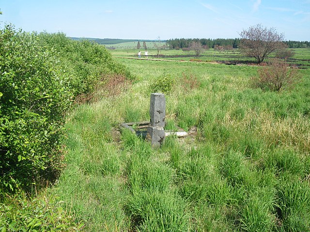
Français : Fontaine Périgny, l'une des sources de la Helle, sur l'ancienne frontière entre la Belgique et la Prusse / Allemagne (Hautes Fagnes, Sourbrodt), Belgique. En arrière plan, les caillebotis du chemin de la vallée de la Helle, la fagne Les Wez, et au loin la Fagne wallonne.
English: Old boundary stone at the "Fontaine Perigny" (origin of the Hill River) in High Fens, between Nederlands (1815-1830) then Belgium (1830-1918), and Prussia (1815-1870) then Germany (1870-1918) |
| Date | |
| Source | Own work |
| Author | Vberger |
Licensing[edit]
| I, the copyright holder of this work, release this work into the public domain. This applies worldwide. In some countries this may not be legally possible; if so: I grant anyone the right to use this work for any purpose, without any conditions, unless such conditions are required by law. |
File history
Click on a date/time to view the file as it appeared at that time.
| Date/Time | Thumbnail | Dimensions | User | Comment | |
|---|---|---|---|---|---|
| current | 20:29, 31 May 2011 | | 1,024 × 768 (408 KB) | Vberger~commonswiki (talk | contribs) | {{Information |Description ={{en|1=fgsdf}} |Source ={{own}} |Author =Vberger |Date = |Permission = |other_versions = }} fg |
You cannot overwrite this file.
File usage on Commons
The following page uses this file:
File usage on other wikis
The following other wikis use this file:
- Usage on fr.wikipedia.org