File:Folded Himalayan Rock Layers at Kali Gandaki in Nepal 2014.jpg
Jump to navigation
Jump to search
Size of this preview: 800 × 533 pixels. Other resolutions: 320 × 213 pixels | 640 × 427 pixels | 1,024 × 683 pixels | 1,280 × 853 pixels | 2,560 × 1,707 pixels | 5,472 × 3,648 pixels.
Original file (5,472 × 3,648 pixels, file size: 4.8 MB, MIME type: image/jpeg)
Captions
Captions
Add a one-line explanation of what this file represents
Summary[edit]
| Description |
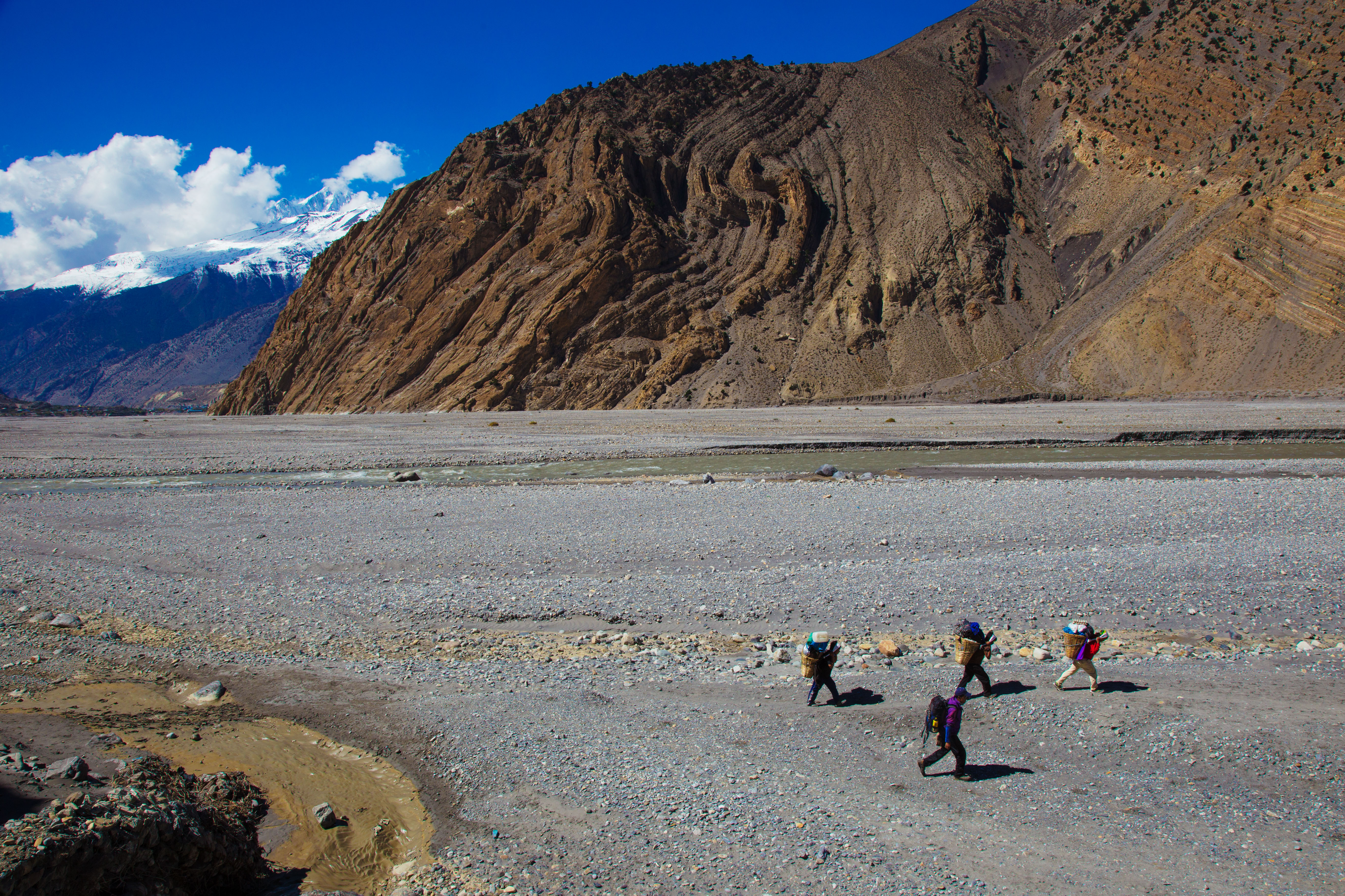
English: Folded layers of Himalayan rock, exposed in a cliff about 3 kilometres north-east of Jomsom, in the Kali Gandaki Gorge in Nepal. |
| Date | |
| Source | https://www.flickr.com/photos/jmhullot/15545178007/ |
| Author | Jean-Marie Hullot (jmhullot on Flickr) https://www.flickr.com/people/jmhullot/ |
| Camera location | | View this and other nearby images on: OpenStreetMap |
|---|
Licensing[edit]
| This image was originally posted to Flickr by jmhullot at https://www.flickr.com/photos/32856635@N00/15545178007. It was reviewed on 18 January 2015 by FlickreviewR and was confirmed to be licensed under the terms of the cc-by-2.0. |
This file is licensed under the Creative Commons Attribution 2.0 Generic license.
- You are free:
- to share – to copy, distribute and transmit the work
- to remix – to adapt the work
- Under the following conditions:
- attribution – You must give appropriate credit, provide a link to the license, and indicate if changes were made. You may do so in any reasonable manner, but not in any way that suggests the licensor endorses you or your use.
File history
Click on a date/time to view the file as it appeared at that time.
| Date/Time | Thumbnail | Dimensions | User | Comment | |
|---|---|---|---|---|---|
| current | 14:03, 18 January 2015 | | 5,472 × 3,648 (4.8 MB) | GeoWriter (talk | contribs) | User created page with UploadWizard |
You cannot overwrite this file.
File usage on Commons
There are no pages that use this file.
File usage on other wikis
The following other wikis use this file:
- Usage on en.wikibooks.org