File:Flag Map of Spanish Guinea (Second Spanish Republic).png
Jump to navigation
Jump to search

Size of this preview: 577 × 600 pixels. Other resolutions: 231 × 240 pixels | 462 × 480 pixels | 739 × 768 pixels | 985 × 1,024 pixels | 2,548 × 2,649 pixels.
Original file (2,548 × 2,649 pixels, file size: 355 KB, MIME type: image/png)
Captions
Captions
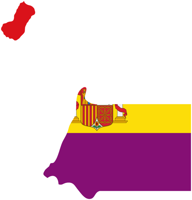
Flag Map of Spanish Guinea (Second Spanish Republic)
Summary[edit]
.png&action=edit§ion=1)
| Description |
English: Modern day Equatorial Guinea became a Spanish colony in 1778 and after the Spanish Republicans ousted the King The second Spanish republic ruled Equatorial Guinea from (1931_1939) until the Spanish civil war when fascist dictator Francisco’s Franco became dictator of Spain and he ruled Spanish Guinea until 1968 when Equatorial Guinea gained independence from Spain |
| Date | |
| Source | Own work |
| Author | Historical Empires |
Licensing[edit]
.png&action=edit§ion=2)
I, the copyright holder of this work, hereby publish it under the following license:
This file is licensed under the Creative Commons Attribution-Share Alike 4.0 International license.
- You are free:
- to share – to copy, distribute and transmit the work
- to remix – to adapt the work
- Under the following conditions:
- attribution – You must give appropriate credit, provide a link to the license, and indicate if changes were made. You may do so in any reasonable manner, but not in any way that suggests the licensor endorses you or your use.
- share alike – If you remix, transform, or build upon the material, you must distribute your contributions under the same or compatible license as the original.
File history
Click on a date/time to view the file as it appeared at that time.
| Date/Time | Thumbnail | Dimensions | User | Comment | |
|---|---|---|---|---|---|
| current | 19:21, 7 September 2023 | | 2,548 × 2,649 (355 KB) | Historical Empires (talk | contribs) | Uploaded own work with UploadWizard |
You cannot overwrite this file.
File usage on Commons
There are no pages that use this file.
.png&oldid=843985264)