File:First Landing Party of the Founders of Newark by Gutzon Borglum.jpg
Jump to navigation
Jump to search
Size of this preview: 400 × 600 pixels. Other resolutions: 160 × 240 pixels | 320 × 480 pixels | 512 × 768 pixels | 683 × 1,024 pixels | 1,647 × 2,470 pixels.
Original file (1,647 × 2,470 pixels, file size: 1.35 MB, MIME type: image/jpeg)
Captions
Captions
Add a one-line explanation of what this file represents
Summary
Object
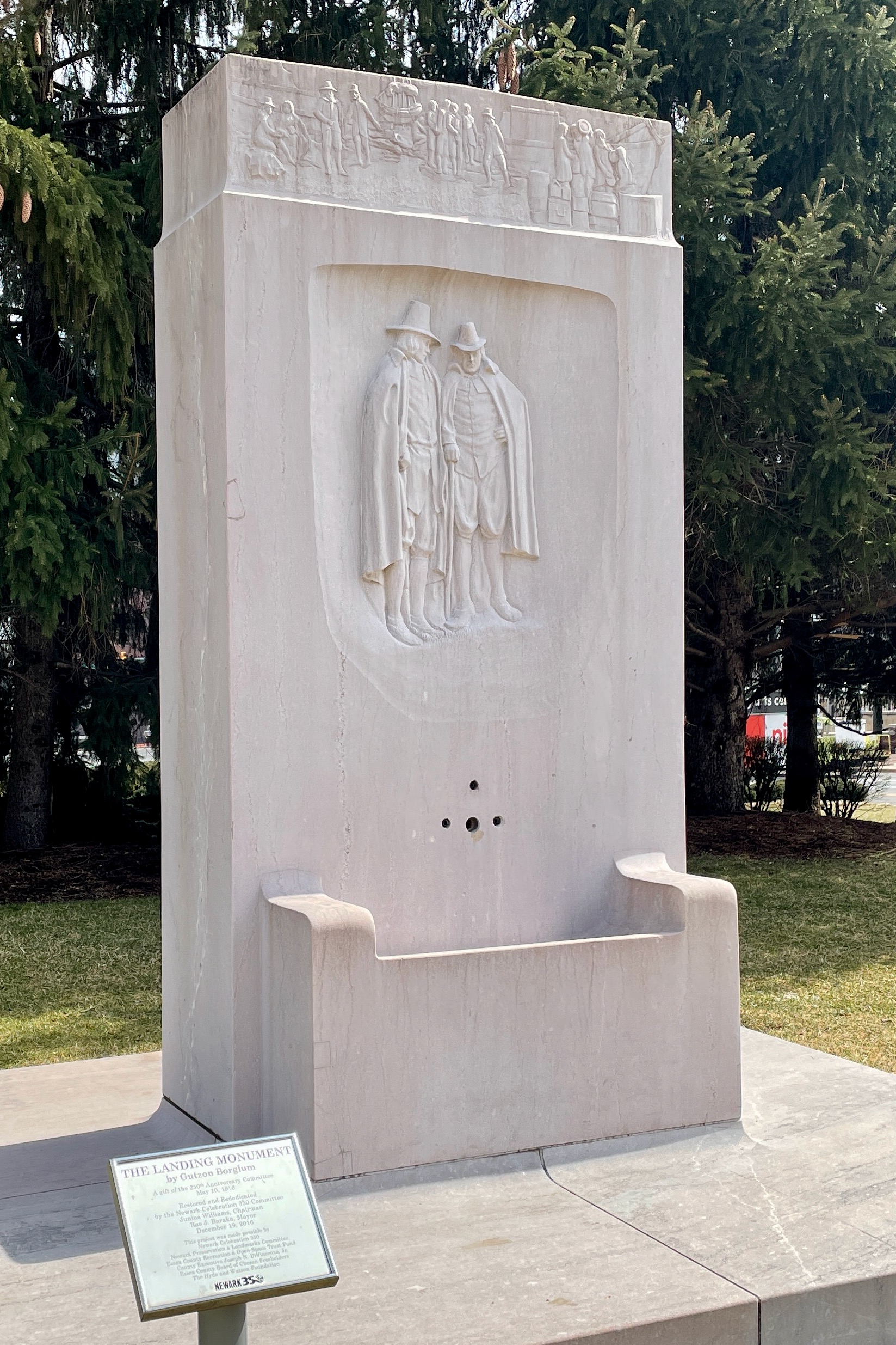
| Gutzon Borglum: First Landing Party of the Founders of Newark
|
||||||||||||||||||||||||||||||
|---|---|---|---|---|---|---|---|---|---|---|---|---|---|---|---|---|---|---|---|---|---|---|---|---|---|---|---|---|---|---|
| Artist |
|
 | ||||||||||||||||||||||||||||
| Title |
First Landing Party of the Founders of Newark |
|||||||||||||||||||||||||||||
| Part of |
Public Sculpture in Newark MPS |
|||||||||||||||||||||||||||||
| Object type |
marble sculpture / stele |
|||||||||||||||||||||||||||||
| Genre |
public art |
|||||||||||||||||||||||||||||
| Description | ||||||||||||||||||||||||||||||
| Date |
1916 |
|||||||||||||||||||||||||||||
| Medium |
marble |
|||||||||||||||||||||||||||||
| Dimensions |
height: 9.5 ft (289.5 cm) |
|||||||||||||||||||||||||||||
| Object location |
|
|||||||||||||||||||||||||||||
| References | ||||||||||||||||||||||||||||||
| Permission (Reusing this file) |
|
|||||||||||||||||||||||||||||

Photograph
| Date | |
| Source | Own work |
| Author | Zeete |
| Permission (Reusing this file) |
I, the copyright holder of this work, hereby publish it under the following license: This file is licensed under the Creative Commons Attribution-Share Alike 4.0 International license.
|
| Camera location | | View this and other nearby images on: OpenStreetMap |
|---|
Licensing
File history
Click on a date/time to view the file as it appeared at that time.
| Date/Time | Thumbnail | Dimensions | User | Comment | |
|---|---|---|---|---|---|
| current | 13:37, 17 March 2022 | | 1,647 × 2,470 (1.35 MB) | Zeete (talk | contribs) | Uploaded own work with UploadWizard |
You cannot overwrite this file.
File usage on Commons
The following 2 pages use this file:
File usage on other wikis
The following other wikis use this file:
- Usage on en.wikipedia.org
- Usage on es.wikipedia.org
- Usage on gl.wikipedia.org
- Usage on uk.wikipedia.org
- Usage on www.wikidata.org