File:Findhorn (40378942340).jpg
Jump to navigation
Jump to search

Size of this preview: 800 × 422 pixels. Other resolutions: 320 × 169 pixels | 640 × 337 pixels | 1,024 × 540 pixels | 1,280 × 675 pixels | 2,560 × 1,350 pixels | 5,916 × 3,119 pixels.
Original file (5,916 × 3,119 pixels, file size: 3.71 MB, MIME type: image/jpeg)
Captions
Captions
Add a one-line explanation of what this file represents
Summary[edit]
.jpg&action=edit§ion=1)
| Description |
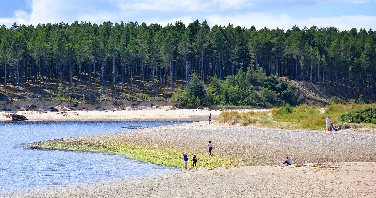
This location, in the North of Scotland has been popular with visitors for a long time. Here we see the River Findhorn where it reaches the Moray Firth. On the other side of the water is the Culbin Forest, which was planted to stop the extensive sand dunes from shifting in the wind. Before that it was the largest area of dunes in Britain. In 1694 an entire village was covered over by the sand and had to be abandoned. Today visitors come to this area for the extensive beach and a microclimate that belies it's northerly location. |
| Date | |
| Source | Findhorn |
| Author | Mike McBey |
Licensing[edit]
.jpg&action=edit§ion=2)
This file is licensed under the Creative Commons Attribution 2.0 Generic license.
- You are free:
- to share – to copy, distribute and transmit the work
- to remix – to adapt the work
- Under the following conditions:
- attribution – You must give appropriate credit, provide a link to the license, and indicate if changes were made. You may do so in any reasonable manner, but not in any way that suggests the licensor endorses you or your use.
| This image was originally posted to Flickr by M McBey at https://flickr.com/photos/158652122@N02/40378942340. It was reviewed on 15 February 2021 by FlickreviewR 2 and was confirmed to be licensed under the terms of the cc-by-2.0. |
File history
Click on a date/time to view the file as it appeared at that time.
| Date/Time | Thumbnail | Dimensions | User | Comment | |
|---|---|---|---|---|---|
| current | 18:05, 15 February 2021 | | 5,916 × 3,119 (3.71 MB) | Matlin (talk | contribs) | Transferred from Flickr via #flickr2commons |
You cannot overwrite this file.
File usage on Commons
There are no pages that use this file.
.jpg&oldid=816661468)