File:Figurative cartouche in a Syria map by Hagen.jpeg
Jump to navigation
Jump to search

Size of this preview: 800 × 551 pixels. Other resolutions: 320 × 221 pixels | 640 × 441 pixels | 1,024 × 706 pixels | 1,280 × 882 pixels | 1,496 × 1,031 pixels.
Original file (1,496 × 1,031 pixels, file size: 517 KB, MIME type: image/jpeg)
Captions
Captions
Add a one-line explanation of what this file represents
Summary[edit]
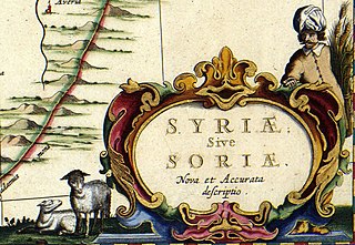
| SYRIAE Sive SORIAE Nova et Accurata descriptio
( |
||||||||||||||||||||||||||
|---|---|---|---|---|---|---|---|---|---|---|---|---|---|---|---|---|---|---|---|---|---|---|---|---|---|---|
| Author |
Publisher:
|
|||||||||||||||||||||||||
| Title |
SYRIAE Sive SORIAE Nova et Accurata descriptio |
|||||||||||||||||||||||||
| Object type | map | |||||||||||||||||||||||||
| Description |
Nederlands: Syrië vormde in de 17de eeuw onderdeel van het Turkse rijk. Door de voortdurende oorlogshandelingen en haar Europese buren, was de kennis omtrent het land erg beperkt. Ook in de kartografie wordt dat duidelijk. Voor deze kaart van Syrie beschikte Jan Janssonius (1588-1664) niet over recent bronnenmateriaal. Vermoedelijk greep hij terug op een 16de-eeuwse kaart van de Italiaanse kartograaf Giacomo Gastaldi (1500-1566).
English: Syria was in the 17th century part of the Turkish Empire. Because of continual war, the knowledge of the country was limited. This becomes clear in cartography. For this map of Syria Jan Janssonius (1588-1664) did not have recent sources. He probable relied on a 16th-century map by the Italian cartographer Giacomo Gastaldi (1500-1566). |
|||||||||||||||||||||||||
| Date | 1658 | |||||||||||||||||||||||||
| Medium |
Nederlands: kopergravure
English: copper engraving print |
|||||||||||||||||||||||||
| Dimensions | 43 x 52 cm | |||||||||||||||||||||||||
| Collection |
|
|||||||||||||||||||||||||
| Accession number |
Description of the Atlas Van der Hagen in the catalogue of the KB: http://opc4.kb.nl/DB=1/TTL=1/LNG=EN/PPN?PPN=353012750 |
|||||||||||||||||||||||||
| Notes | KW1049B13_006 - Volume 1 | |||||||||||||||||||||||||
| Related persons | Jan Janssonius - Gastaldi, Giacomo | |||||||||||||||||||||||||
| Depicted locations | Syria - Turkish Empire | |||||||||||||||||||||||||
| Source/Photographer |
Source page at the Geheugen van Nederland / Memory of the Netherlands website.
|
|||||||||||||||||||||||||
| Permission (Reusing this file) |
|
|||||||||||||||||||||||||
| Other versions | ||||||||||||||||||||||||||


File history
Click on a date/time to view the file as it appeared at that time.
| Date/Time | Thumbnail | Dimensions | User | Comment | |
|---|---|---|---|---|---|
| current | 23:17, 12 December 2022 | | 1,496 × 1,031 (517 KB) | Enyavar (talk | contribs) | File:Atlas Van der Hagen-KW1049B13 006-SYRIAE Sive SORIAE Nova et Accurata descriptio.jpeg cropped 73 % horizontally, 78 % vertically using CropTool with precise mode. |
You cannot overwrite this file.
File usage on Commons
The following 2 pages use this file: