File:Fig4148-Blokkering Stroomgat Reigersbergse polder.jpg
Jump to navigation
Jump to search
Size of this preview: 397 × 600 pixels. Other resolutions: 159 × 240 pixels | 318 × 480 pixels | 508 × 768 pixels | 678 × 1,024 pixels | 1,781 × 2,691 pixels.
Original file (1,781 × 2,691 pixels, file size: 946 KB, MIME type: image/jpeg)
Captions
Captions
Add a one-line explanation of what this file represents
Summary[edit]
| Description |
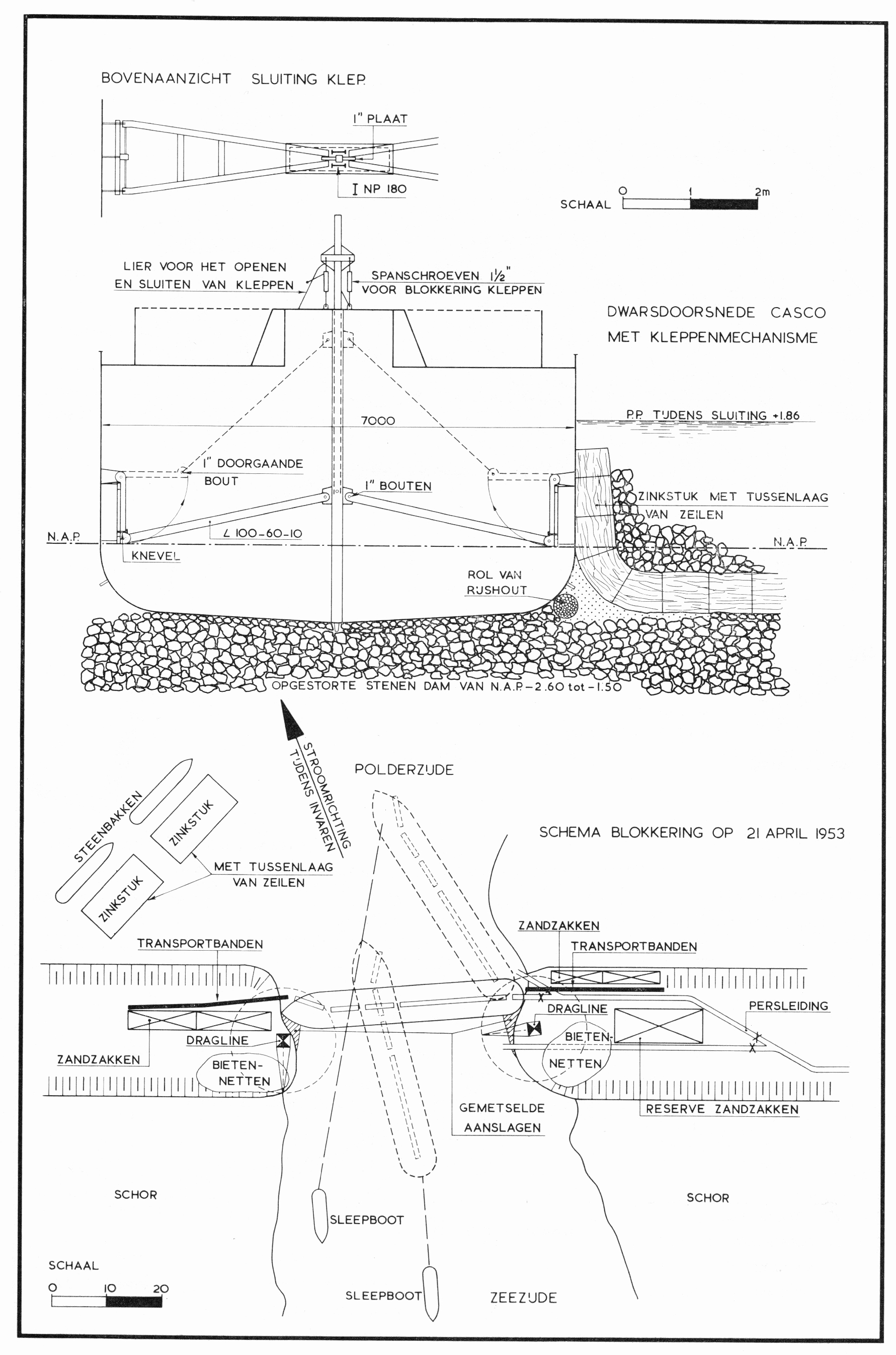
Nederlands: Op 21 april 1953 is de bres in de dijk van de Reigersbergse Polder bij Bath gesloten door het invaren en afzinken van een schip; Tekening uit "het "verslag van de stormvloed 1953". |
| Date | |
| Source | Verslag over de stormvloed 1953 |
| Author | Rijkswaterstaat |
| Camera location | | View this and other nearby images on: OpenStreetMap |
|---|
Government publication from 1953; copyright expired
Licensing[edit]
|
This work is in the public domain in its country of origin and other countries and areas where the copyright term is the author's life plus 70 years or fewer. This work is in the public domain in the United States because it was published (or registered with the U.S. Copyright Office) before January 1, 1929. | |
| This file has been identified as being free of known restrictions under copyright law, including all related and neighboring rights. | |
File history
Click on a date/time to view the file as it appeared at that time.
| Date/Time | Thumbnail | Dimensions | User | Comment | |
|---|---|---|---|---|---|
| current | 09:56, 17 July 2023 | | 1,781 × 2,691 (946 KB) | HJVerhagen (talk | contribs) | Uploaded a work by Rijkswaterstaat from Verslag over de stromvloed 1953 with UploadWizard |
You cannot overwrite this file.
File usage on Commons
The following page uses this file:
- File:Fig4148-Blokkering Stgroomgat Reigersbergse polder.jpg (file redirect)