File:Fading Rover Tracks Near Victoria Crater.jpg
Jump to navigation
Jump to search
Size of this preview: 800 × 600 pixels. Other resolutions: 320 × 240 pixels | 640 × 480 pixels | 1,024 × 768 pixels | 1,280 × 960 pixels | 2,560 × 1,920 pixels.
Original file (2,560 × 1,920 pixels, file size: 4.74 MB, MIME type: image/jpeg)
Captions
Captions
Add a one-line explanation of what this file represents
| Description |
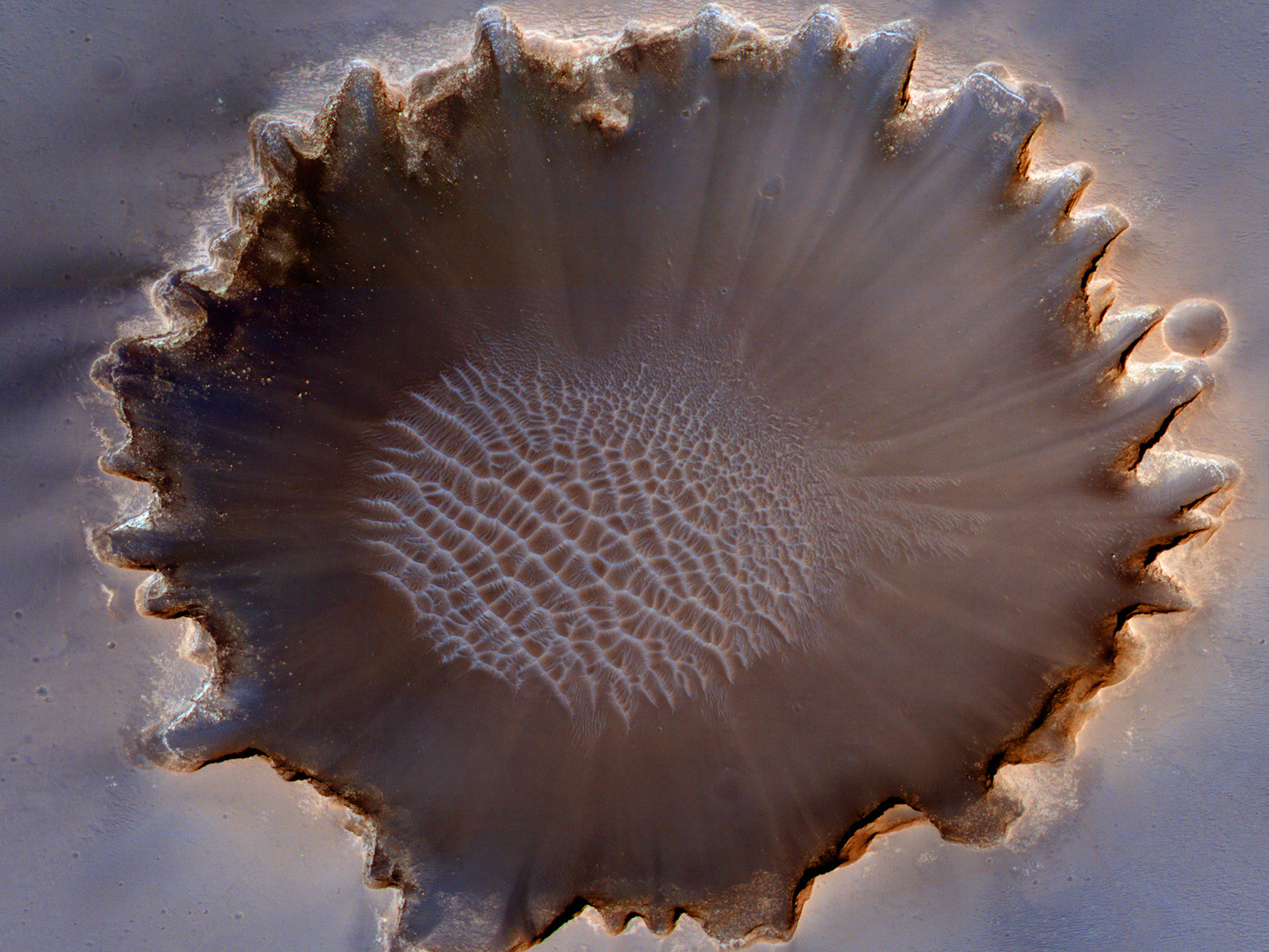
English: The tracks of the Opportunity Rover are just visible north (left) of the Victoria crater, having faded much since 2007 when the rover first drove around the crater. Image by HiRISE on the Mars Reconnaissance Orbiter.
Ελληνικά: Τα σημάδια από τις ρόδες του ρόβερ Opportunity, μόλις διακρίνονται στα βόρεια (αριστερά) του κρατήρα Victoria στον Άρη, έχοντας ξεθωριάσει σημαντικά λόγω του ανέμου από το 2007 που το ρόβερ έφτασε στον κρατήρα. Εικόνα από το πείραμα HiRISE, στη διαστημοσυσκευή Mars Reconnaissance Orbiter της NASA. |
|||||
| Date | ||||||
| Source | HiRISE webpage, description, file | |||||
| Author | NASA/JPL/University of Arizona | |||||
| Permission (Reusing this file) |
|
|||||
| Other versions |
 |

| Location on Mars | View this and other nearby images on: Google Maps |
|---|
File history
Click on a date/time to view the file as it appeared at that time.
| Date/Time | Thumbnail | Dimensions | User | Comment | |
|---|---|---|---|---|---|
| current | 21:22, 16 September 2011 | | 2,560 × 1,920 (4.74 MB) | Badseed (talk | contribs) | {{Information |Description={{en|The tracks of the Opportunity Rover are just visible north (top of image) of the Victoria crater, having faded much since 2007 when the rover first drove around the crater. Image by HiRISE on the Mars Reconnaissance Orbiter |
You cannot overwrite this file.
File usage on Commons
The following page uses this file:
File usage on other wikis
The following other wikis use this file:
- Usage on gl.wikipedia.org
- Usage on hy.wikipedia.org
- Usage on ro.wikipedia.org
- Usage on sr.wikipedia.org