File:FEMA-3320-EM, Mississippi Disaster Declaration.svg
Jump to navigation
Jump to search

Size of this PNG preview of this SVG file: 463 × 599 pixels. Other resolutions: 185 × 240 pixels | 371 × 480 pixels | 593 × 768 pixels | 791 × 1,024 pixels | 1,582 × 2,048 pixels | 765 × 990 pixels.
Original file (SVG file, nominally 765 × 990 pixels, file size: 1.4 MB)
Captions
Captions
Add a one-line explanation of what this file represents
Summary[edit]
| Description |
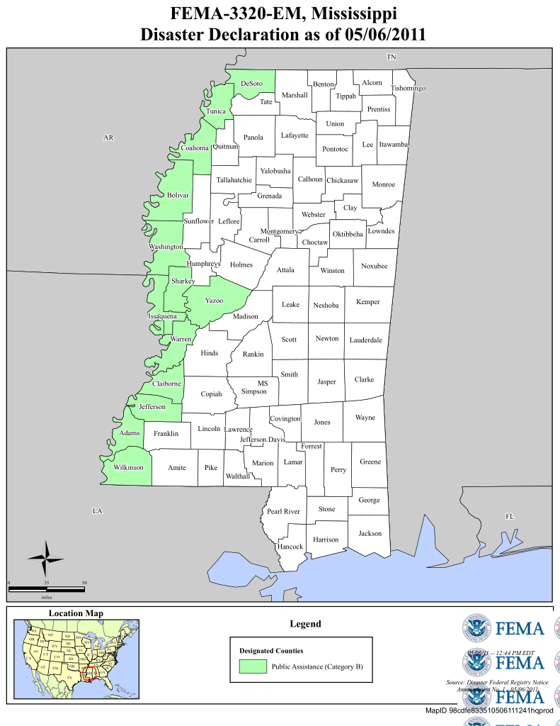
English: Mississippi Counties declared federal disaster areas in the Spring 2011 Mississippi River Floods |
| Date | |
| Source | http://gis.fema.gov/maps/em_3320.pdf |
| Author | United States federal government (FEMA) |
Licensing[edit]
This image is a work of a Federal Emergency Management Agency employee, taken or made as part of that person's official duties. As works of the U.S. federal government, all FEMA images are in the public domain in the United States. Additional media usage information may be found at https://www.fema.gov/photo-video-audio-use-guidelines
|
File history
Click on a date/time to view the file as it appeared at that time.
| Date/Time | Thumbnail | Dimensions | User | Comment | |
|---|---|---|---|---|---|
| current | 21:49, 8 May 2011 | | 765 × 990 (1.4 MB) | Kaldari (talk | contribs) | Reverting. Title text is unreadable at small sizes, crop is bad as well. |
| 22:23, 7 May 2011 |  | 744 × 1,015 (1.18 MB) | Pmsyyz (talk | contribs) | remove black rectangle | |
| 22:06, 7 May 2011 |  | 744 × 1,052 (1.21 MB) | Pmsyyz (talk | contribs) | smaller size | |
| 21:36, 7 May 2011 |  | 765 × 990 (1.4 MB) | Pmsyyz (talk | contribs) | {{Information |Description ={{en|1=Mississippi Counties declared federal disaster areas in the en:Spring 2011 Mississippi River Floods}} |Source =http://gis.fema.gov/maps/em_3320.pdf |Author =United States federal government (FEM |
You cannot overwrite this file.
File usage on Commons
There are no pages that use this file.
File usage on other wikis
The following other wikis use this file:
- Usage on de.wikipedia.org
- Usage on en.wikipedia.org