File:European Union Exclusive Economic Zones.PNG
Jump to navigation
Jump to search
Size of this preview: 767 × 600 pixels. Other resolutions: 307 × 240 pixels | 614 × 480 pixels | 982 × 768 pixels | 1,280 × 1,001 pixels | 2,560 × 2,002 pixels | 4,572 × 3,576 pixels.
Original file (4,572 × 3,576 pixels, file size: 1.65 MB, MIME type: image/png)
Captions
Captions
Add a one-line explanation of what this file represents
Summary[edit]
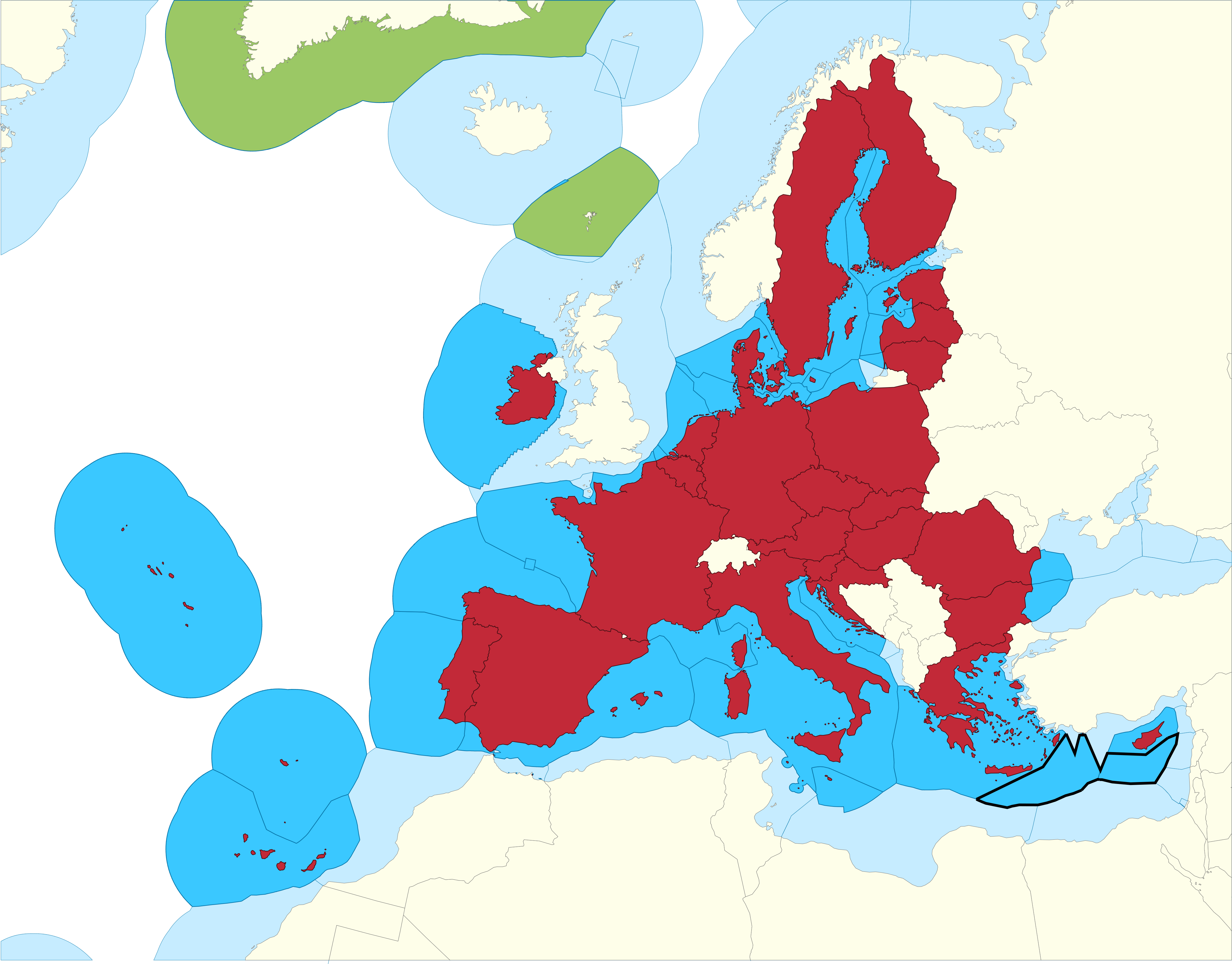
| Description |
English: European Union Member states Exclusive Economic Zones |
|||
| Date | ||||
| Source |
EU member states Exclusive Economic Zones
EU member states overseas territories Exclusive Economic Zones
EU member states
Disputed Exclusive Economic Zones |
|||
| Author | Sette-quattro, replacing the previous work done by Luis_wiki | |||
| Permission (Reusing this file) |
Own work | |||
| Other versions |
|


Licensing[edit]
| I, the copyright holder of this work, release this work into the public domain. This applies worldwide. In some countries this may not be legally possible; if so: I grant anyone the right to use this work for any purpose, without any conditions, unless such conditions are required by law. |
File history
Click on a date/time to view the file as it appeared at that time.
| Date/Time | Thumbnail | Dimensions | User | Comment | |
|---|---|---|---|---|---|
| current | 11:14, 17 February 2021 | | 4,572 × 3,576 (1.65 MB) | Ahmetlii (talk | contribs) | higher resolution |
| 11:09, 17 February 2021 |  | 1,280 × 997 (308 KB) | Ahmetlii (talk | contribs) | added the disputed EEZ border per en:Cyprus–Turkey maritime zones dispute | |
| 21:33, 8 September 2020 |  | 4,572 × 3,566 (1.22 MB) | Sette-quattro (talk | contribs) | updated without UK, clearer boundaries | |
| 08:54, 16 July 2011 |  | 485 × 294 (86 KB) | Epipelagic (talk | contribs) | Somewhat simplified the map | |
| 11:12, 23 December 2010 |  | 489 × 298 (19 KB) | Begg maps (talk | contribs) | {{Information |Description={{es|1=-}} |Source=- |Author=- |Date=- |Permission= |other_versions= }} | |
| 23:31, 27 August 2007 |  | 489 × 298 (19 KB) | Luis wiki (talk | contribs) | {{Information |Description= European Union Member states Exclusive Economic Zones |Source= Own work over screen capture of Map Interface of VLIZ Maritime Boundaries Geodatabase (http://w2.vliz.be/vmdcdata/marbound/geointerface.php) |Date= 28 August 2007 |
You cannot overwrite this file.
File usage on Commons
The following page uses this file:
File usage on other wikis
The following other wikis use this file:
- Usage on ar.wikipedia.org
- Usage on ast.wikipedia.org
- Usage on ca.wikipedia.org
- Usage on cs.wikipedia.org
- Usage on en.wikipedia.org
- Usage on es.wikipedia.org
- Usage on eu.wikipedia.org
- Usage on fi.wikipedia.org
- Usage on he.wikipedia.org
- Usage on id.wikipedia.org
- Usage on it.wikipedia.org
- Usage on ja.wikipedia.org
- Usage on ko.wikipedia.org
- Usage on no.wikipedia.org
- Usage on pt.wikipedia.org
- Usage on sv.wikipedia.org
- Usage on uk.wikipedia.org
- Usage on zh.wikipedia.org