File:Europe biogeography countries ua.svg
Jump to navigation
Jump to search

Size of this PNG preview of this SVG file: 800 × 531 pixels. Other resolutions: 320 × 212 pixels | 640 × 425 pixels | 1,024 × 679 pixels | 1,280 × 849 pixels | 2,560 × 1,698 pixels | 3,579 × 2,374 pixels.
Original file (SVG file, nominally 3,579 × 2,374 pixels, file size: 739 KB)
Captions
Captions
Add a one-line explanation of what this file represents
Summary[edit]
| Description |
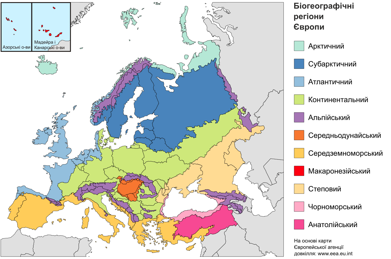
Українська: Карта біогеографічних регіонів Європи за картою Європейської агенції довкілля. Показує межі країн та біогеографічних регіонів. Легенда українською мовою. Формат SVG.
English: Map of the biogeographic regions of Europe, after EEA's map. Shows both country and biogeographical region boundaries. |
| Date | |
| Source | Made from Image:Biogeographical Regions Europe - Map (intl).png by the European Environmental Agency |
| Author | Dgho |
| Other versions |
Regions only: Image:Europe biogeography regions.svg; blank map: Image:Europe biogeography blank.svg  |
.png)
Licensing[edit]
I, the copyright holder of this work, hereby publish it under the following license:
This file is licensed under the Creative Commons Attribution-Share Alike 4.0 International license.
- You are free:
- to share – to copy, distribute and transmit the work
- to remix – to adapt the work
- Under the following conditions:
- attribution – You must give appropriate credit, provide a link to the license, and indicate if changes were made. You may do so in any reasonable manner, but not in any way that suggests the licensor endorses you or your use.
- share alike – If you remix, transform, or build upon the material, you must distribute your contributions under the same or compatible license as the original.
File history
Click on a date/time to view the file as it appeared at that time.
| Date/Time | Thumbnail | Dimensions | User | Comment | |
|---|---|---|---|---|---|
| current | 19:46, 24 April 2020 | | 3,579 × 2,374 (739 KB) | Dgho (talk | contribs) | Uploaded own work with UploadWizard |
You cannot overwrite this file.
File usage on Commons
The following page uses this file:
File usage on other wikis
The following other wikis use this file:
- Usage on uk.wikipedia.org
- Європа
- Біом
- Географічна карта
- Атлантична Європа
- Середньодунайський біогеографічний регіон
- Фауна Європи
- Арктичний біогеографічний регіон
- Макаронезійський біогеографічний регіон
- Альпійський біогеографічний регіон
- Степовий біогеографічний регіон
- Континентальний біогеографічний регіон
- Чорноморський біогеографічний регіон
- Середземноморський біогеографічний регіон
- Атлантичний біогеографічний регіон
- Анатолійський біогеографічний регіон
- Бореальний біогеографічний регіон