File:Europe-sees-the-world-as-colonies-in-1890.png
Jump to navigation
Jump to search

Size of this preview: 735 × 600 pixels. Other resolutions: 294 × 240 pixels | 588 × 480 pixels | 941 × 768 pixels | 1,255 × 1,024 pixels | 2,510 × 2,048 pixels | 4,660 × 3,803 pixels.
Original file (4,660 × 3,803 pixels, file size: 35.07 MB, MIME type: image/png)
Captions
Captions
Add a one-line explanation of what this file represents
| Description |
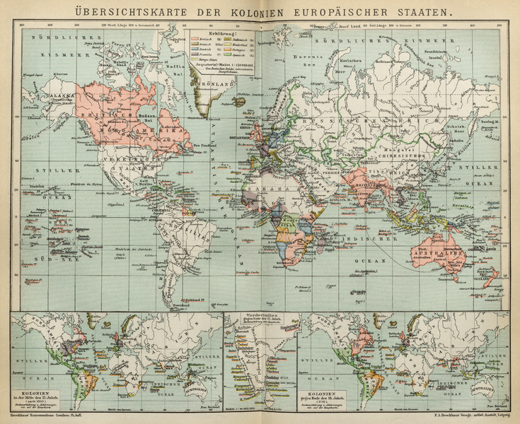
English: World map showing colonies of European countries in 1890, thus showing the world view of European's rulers.
Deutsch: Übersichtskarte der Kolonien europäischer Staaten. Aus Brockhaus Enzyklopädie, 14. Auflage von 1892
Die Karte zeigt die Weltsicht der europäischen Herrscher als einer Welt, die es als Kolonien zu erobern gilt. |
|||||
| Date | ||||||
| Source | en:Brockhaus Enzyklopädie 14th edition | |||||
| Author | F.A. Brockhaus Geogr.-artist. Anstalt, Leipzig | |||||
| Permission (Reusing this file) |
|
File history
Click on a date/time to view the file as it appeared at that time.
| Date/Time | Thumbnail | Dimensions | User | Comment | |
|---|---|---|---|---|---|
| current | 21:56, 24 May 2016 | | 4,660 × 3,803 (35.07 MB) | L.Willms (talk | contribs) | {{Information |Description ={{en|1=World map showing colonies of European countries in 1890, thus showing the world view of European's rulers. }} {{de|1=Übersichtskarte der Kolonien europäischer Staaten. Aus Brockhaus Enzyklopädie, 14. Auflage vo... |
You cannot overwrite this file.
File usage on Commons
There are no pages that use this file.