File:Entraunes 521.JPG
Jump to navigation
Jump to search

Size of this preview: 428 × 600 pixels. Other resolutions: 171 × 240 pixels | 343 × 480 pixels | 548 × 768 pixels | 731 × 1,024 pixels | 1,377 × 1,929 pixels.
Original file (1,377 × 1,929 pixels, file size: 958 KB, MIME type: image/jpeg)
Captions
Captions
Add a one-line explanation of what this file represents
Summary[edit]
| Description |
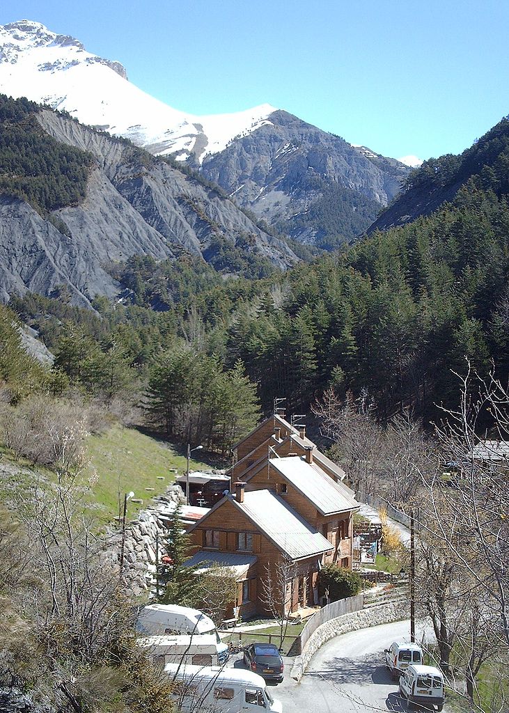
Français : Extension nord-est du village d'Entraunes en rive droite du Bourdoux. Au 1er plan la D 139 et les maisons en bois du lotissement du Ciastel . Au deuxième plan la vallée du Bourdoux affluent de rive gauche du Var. Et, à l'arrière plan en haut à gauche, le sommet enneigé de Roche-Grande (2 752 m) |
| Date | |
| Source | Own work |
| Author | PAYAN |
Licensing[edit]
I, the copyright holder of this work, hereby publish it under the following licenses:

|
Permission is granted to copy, distribute and/or modify this document under the terms of the GNU Free Documentation License, Version 1.2 or any later version published by the Free Software Foundation; with no Invariant Sections, no Front-Cover Texts, and no Back-Cover Texts. A copy of the license is included in the section entitled GNU Free Documentation License. |
This file is licensed under the Creative Commons Attribution-Share Alike 3.0 Unported, 2.5 Generic, 2.0 Generic and 1.0 Generic license.
- You are free:
- to share – to copy, distribute and transmit the work
- to remix – to adapt the work
- Under the following conditions:
- attribution – You must give appropriate credit, provide a link to the license, and indicate if changes were made. You may do so in any reasonable manner, but not in any way that suggests the licensor endorses you or your use.
- share alike – If you remix, transform, or build upon the material, you must distribute your contributions under the same or compatible license as the original.
You may select the license of your choice.
File history
Click on a date/time to view the file as it appeared at that time.
| Date/Time | Thumbnail | Dimensions | User | Comment | |
|---|---|---|---|---|---|
| current | 07:14, 1 May 2009 | | 1,377 × 1,929 (958 KB) | PAYAN (talk | contribs) | {{Information |Description={{fr|1=Extension nord-est du village d'Entraunes en rive droite du Bourdoux. Au 1er plan la D 139 et les maisons en bois du lotissement du Ciastel. A l'arrière plan le sommet enneigé de Roche-Grande (2 752 m)}} |Source=travail |
You cannot overwrite this file.
File usage on Commons
There are no pages that use this file.
File usage on other wikis
The following other wikis use this file:
- Usage on fr.wikipedia.org