File:End of Interstate 71.jpg
Jump to navigation
Jump to search

Size of this preview: 800 × 372 pixels. Other resolutions: 320 × 149 pixels | 640 × 298 pixels | 1,024 × 476 pixels | 1,280 × 596 pixels | 4,288 × 1,995 pixels.
Original file (4,288 × 1,995 pixels, file size: 3.85 MB, MIME type: image/jpeg)
Captions
Captions
Add a one-line explanation of what this file represents
Summary[edit]
| Description |
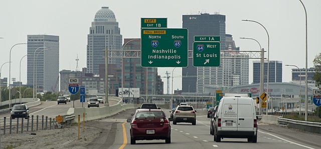
English: End of Interstate 71 in Louisville, Kentucky. Taken at the junction of Interstate 65 north and south, and Interstate 64 west. |
| Date | |
| Source | Own work |
| Author | Sixflashphoto |
| Permission (Reusing this file) |
I, the copyright holder of this work, hereby publish it under the following license: This file is licensed under the Creative Commons Attribution-Share Alike 4.0 International license.
|
| Camera location | | View this and other nearby images on: OpenStreetMap |
|---|
Licensing[edit]
I, the copyright holder of this work, hereby publish it under the following license:
This file is licensed under the Creative Commons Attribution-Share Alike 4.0 International license.
- You are free:
- to share – to copy, distribute and transmit the work
- to remix – to adapt the work
- Under the following conditions:
- attribution – You must give appropriate credit, provide a link to the license, and indicate if changes were made. You may do so in any reasonable manner, but not in any way that suggests the licensor endorses you or your use.
- share alike – If you remix, transform, or build upon the material, you must distribute your contributions under the same or compatible license as the original.

|
This image has been assessed under the valued image criteria and is considered the most valued image on Commons within the scope: End of Interstate 71. You can see its nomination here. |
File history
Click on a date/time to view the file as it appeared at that time.
| Date/Time | Thumbnail | Dimensions | User | Comment | |
|---|---|---|---|---|---|
| current | 06:52, 2 September 2017 | | 4,288 × 1,995 (3.85 MB) | Sixflashphoto (talk | contribs) | User created page with UploadWizard |
You cannot overwrite this file.
File usage on Commons
The following 2 pages use this file:
File usage on other wikis
The following other wikis use this file:
- Usage on en.wikipedia.org
Metadata
Categories:
- August 2017 in Kentucky
- End of Interstate Route signs
- Exits numbered 1 in Kentucky
- Interstate 71 in Kentucky
- Interstate 65 in Kentucky
- Interstate Highway shields in Kentucky
- Interstate 64 shields
- Interstate 65 shields
- Interstate 71 shields
- Road sign gantries in Kentucky
- 2017 in road transport in the United States
- August 2017 in transport in the United States
- Road signs in the United States photographed in 2017
- Pull-Through signs in the United States
- Street lights in Kentucky