File:Egypt location map.svg
Jump to navigation
Jump to search

Size of this PNG preview of this SVG file: 650 × 599 pixels. Other resolutions: 260 × 240 pixels | 520 × 480 pixels | 833 × 768 pixels | 1,110 × 1,024 pixels | 2,221 × 2,048 pixels | 1,055 × 973 pixels.
Original file (SVG file, nominally 1,055 × 973 pixels, file size: 324 KB)
Captions
Captions
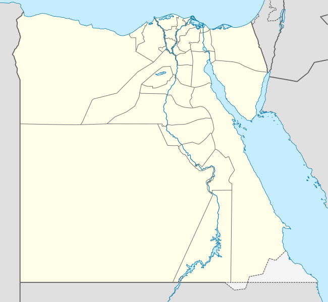
Location map of Egypt

|
The boundaries on this map show the de facto situation. This is just one of several different views on the subject (see COM:NPOV). |
Summary[edit]
| Description |
Deutsch: Positionskarte von Ägypten
Quadratische Plattkarte, N-S-Streckung 111,8685 %. Geographische Begrenzung der Karte:
English: Location map of Egypt
Equirectangular projection, N/S stretching 111.8685 %. Geographic limits of the map:
|
| Date | 10-08-2008 |
| Source |
own work, using
|
| Author | NordNordWest |
| Other versions |
Derivative works of this file:
|


|
This map has been made or improved in the German Kartenwerkstatt (Map Lab). You can propose maps to improve as well.
|
Licensing[edit]
I, the copyright holder of this work, hereby publish it under the following licenses:

|
Permission is granted to copy, distribute and/or modify this document under the terms of the GNU Free Documentation License, Version 1.2 or any later version published by the Free Software Foundation; with no Invariant Sections, no Front-Cover Texts, and no Back-Cover Texts. A copy of the license is included in the section entitled GNU Free Documentation License. |
This file is licensed under the Creative Commons Attribution-Share Alike 3.0 Unported license.
- You are free:
- to share – to copy, distribute and transmit the work
- to remix – to adapt the work
- Under the following conditions:
- attribution – You must give appropriate credit, provide a link to the license, and indicate if changes were made. You may do so in any reasonable manner, but not in any way that suggests the licensor endorses you or your use.
- share alike – If you remix, transform, or build upon the material, you must distribute your contributions under the same or compatible license as the original.
You may select the license of your choice.
File history
Click on a date/time to view the file as it appeared at that time.
| Date/Time | Thumbnail | Dimensions | User | Comment | |
|---|---|---|---|---|---|
| current | 21:35, 12 February 2013 | | 1,055 × 973 (324 KB) | NordNordWest (talk | contribs) | upd |
| 16:03, 17 April 2011 |  | 1,055 × 973 (351 KB) | NordNordWest (talk | contribs) | upd | |
| 17:03, 7 March 2010 |  | 1,055 × 973 (553 KB) | NordNordWest (talk | contribs) | resize | |
| 10:48, 3 September 2009 |  | 1,055 × 956 (552 KB) | NordNordWest (talk | contribs) | ||
| 19:10, 23 May 2009 |  | 1,056 × 959 (557 KB) | NordNordWest (talk | contribs) | corr | |
| 11:12, 10 August 2008 |  | 1,056 × 957 (491 KB) | NordNordWest (talk | contribs) | {{Information |Description= {{de|Positionskarte von Ägypten}} Quadratische Plattkarte, N-S-Streckung 110 %. Geographische Begrenzung der Karte: * N: 32.1° N * S: 21.3° N * W: 24.2° O * O: 37.3° O {{en|Location map of [[:en:Egypt|Egyp |
You cannot overwrite this file.
File usage on Commons
More than 100 pages use this file. The following list shows the first 100 pages that use this file only. A full list is available.
- User:NordNordWest/Gallery/Location maps
- File:Algeria in Africa.svg
- File:Algeria in Africa (-mini map -rivers).svg
- File:Angola in Africa.svg
- File:Angola in Africa (-mini map -rivers).svg
- File:BLANK in Africa.svg
- File:BLANK in Africa (-mini map -rivers).svg
- File:Benin in Africa.svg
- File:Benin in Africa (-mini map -rivers).svg
- File:Botswana in Africa.svg
- File:Botswana in Africa (-mini map -rivers).svg
- File:Burkina Faso in Africa.svg
- File:Burkina Faso in Africa (-mini map -rivers).svg
- File:Burundi in Africa.svg
- File:Burundi in Africa (-mini map -rivers).svg
- File:Cameroon in Africa.svg
- File:Cameroon in Africa (-mini map -rivers).svg
- File:Canary Islands in Africa.svg
- File:Canary Islands in Africa (-mini map -rivers).svg
- File:Canary Islands in Africa (special marker).svg
- File:Cape Verde in Africa.svg
- File:Central African Republic in Africa.svg
- File:Ceuta in Africa.svg
- File:Chad in Africa.svg
- File:Comoros in Africa.svg
- File:Comoros in Africa (special marker).svg
- File:Cote d Ivoire in Africa.svg
- File:Democratic Republic of the Congo in Africa.svg
- File:Djibouti in Africa.svg
- File:Djibouti in Africa (special marker).svg
- File:Egypt in Africa (claimed).svg
- File:Egypt in Africa (controlled hatched).svg
- File:Egypt in Africa (de-facto).svg
- File:Egypt in Africa (undisputed only).svg
- File:Egypt relief location map.jpg
- File:Equatorial Guinea in Africa.svg
- File:Eritrea in Africa.svg
- File:Eswatini in Africa.svg
- File:Ethiopia in Africa.svg
- File:French Southern and Antarctic Lands in Africa (Scattered islands in the Indian Ocean only).svg
- File:Gabon in Africa.svg
- File:Gambia in Africa.svg
- File:Ghana in Africa.svg
- File:Guinea-Bissau in Africa.svg
- File:Guinea in Africa.svg
- File:Hurghada map.png
- File:Kenya in Africa (de-facto).svg
- File:Kenya in Africa (disputed hatched).svg
- File:Kenya in Africa (undisputed only).svg
- File:Lesotho in Africa.svg
- File:Lesotho in Africa (special marker).svg
- File:Liberia in Africa.svg
- File:Libya in Africa.svg
- File:Madagascar in Africa.svg
- File:Madeira in Africa.svg
- File:Malawi in Africa.svg
- File:Mali in Africa.svg
- File:Mauritania in Africa.svg
- File:Mauritius in Africa (+dependencies).svg
- File:Mauritius in Africa (Island of Mauritius only).svg
- File:Mauritius in Africa (most western islands only).svg
- File:Mayotte in Africa.svg
- File:Melilla in Africa.svg
- File:Morocco in Africa (claimed).svg
- File:Morocco in Africa (claims hatched).svg
- File:Morocco in Africa (de-facto).svg
- File:Morocco in Africa (only undisputed).svg
- File:Mozambique in Africa.svg
- File:Namibia in Africa.svg
- File:Niger in Africa.svg
- File:Nigeria in Africa.svg
- File:Pelusium Egypt.PNG
- File:Plazas de soberania in Africa.svg
- File:Republic of the Congo in Africa.svg
- File:Reunion in Africa.svg
- File:Rwanda in Africa.svg
- File:Rwanda in Africa (special marker).svg
- File:Sahrawi Arab Democratic Republic in Africa (claimed).svg
- File:Sahrawi Arab Democratic Republic in Africa (claimed hatched).svg
- File:Sahrawi Arab Democratic Republic in Africa (de-facto).svg
- File:Saint Helena, Ascension, Tristan da Cunha in Africa.svg
- File:Saint Helena, Ascension in Africa (wo Tristan da Cunha).svg
- File:Sao Tome and Principe in Africa.svg
- File:Senegal in Africa.svg
- File:Seychelles in Africa.svg
- File:Sierra Leone in Africa.svg
- File:Somalia in Africa.svg
- File:Somalia in Africa (de-facto).svg
- File:Somaliland in Africa.svg
- File:South Africa in Africa.svg
- File:South Sudan in Africa (claimed).svg
- File:South Sudan in Africa (claimed hatched).svg
- File:South Sudan in Africa (de-facto).svg
- File:Sudan in Africa (claimed).svg
- File:Sudan in Africa (claimed hatched).svg
- File:Sudan in Africa (undisputed).svg
- File:Tanzania in Africa.svg
- File:Togo in Africa.svg
- File:Tunisia in Africa.svg
- File:Uganda in Africa.svg
.svg)
.svg)
.svg)
.svg)
.svg)
.svg)
.svg)
.svg)
.svg)
.svg)
.svg)
.svg)
.svg)
.svg)
.svg)
.svg)
.svg)
.svg)
.svg)
.svg)
.svg)
.svg)
.svg)
.svg)
.svg)
.svg)
.svg)
.svg)
.svg)
.svg)
.svg)
.svg)
.svg)
.svg)
.svg)
.svg)
.svg)
.svg)
.svg)
.svg)
View more links to this file.
File usage on other wikis
The following other wikis use this file:
- Usage on af.wikipedia.org
- Usage on als.wikipedia.org
- Usage on am.wikipedia.org
- Usage on ar.wikipedia.org
- كأس الأمم الإفريقية 2006
- كأس الأمم الإفريقية 1986
- حمام مصري
- قالب:خريطة مواقع مصر
- كأس العالم تحت 20 سنة لكرة القدم 2009
- سد الكفرة
- كأس الأمم الإفريقية 2019
- الدوري المصري الممتاز 2015–16
- الدوري المصري الممتاز 2016–17
- البطولة العربية لكرة القدم النسائية 2006
- هجوم بئر العبد (أكتوبر 2016)
- كأس العالم تحت 19 سنة لكرة السلة 2017
- البطولة العربية للأندية 2016–17
- الدوري المصري الممتاز 2017–18
- قائمة ملاعب كرة القدم في مصر
- الدوري المصري الممتاز 2018–19
- الدوري المصري الممتاز 2019–20
- تصنيف:مسلسلات تلفزيونية مصرية تقع أحداثها في الصعيد
- مطار البردويل الدولي
- قاعدة الإسماعيلية الجوية
- قاعدة العامرية الجوية
- قاعدة الضبعة الجوية
- قاعدة كبريت الجوية
- جبل سيناء (مكان مقدس)
- الدوري المصري الممتاز 2020–21
- مرسى ثلمت
- كأس العرب لكرة الصالات 2021
- رأس مسلة
- الدوري المصري الممتاز 2021–22
- راس عسران
- راس بكر
- مرسى أم موريكا
- شرم المية
- رأس نصراني
- جزر القلعان
- أرض الهبوط 174
- مطار سيدي حنيش
View more global usage of this file.