File:EffigyMounds L7 25sep01.jpg
Jump to navigation
Jump to search

Size of this preview: 600 × 600 pixels. Other resolutions: 240 × 240 pixels | 480 × 480 pixels | 768 × 768 pixels | 1,024 × 1,024 pixels | 2,048 × 2,048 pixels | 4,000 × 4,000 pixels.
Original file (4,000 × 4,000 pixels, file size: 4.19 MB, MIME type: image/jpeg)
Captions
Captions
Add a one-line explanation of what this file represents
Summary[edit]
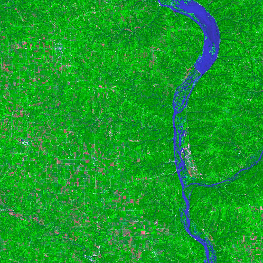
| Description | False-color satellite image of w:Effigy Mounds National Monument, Iowa, USA. The numerous rivers and streams trace blue lines across the green vegetation in this image, while dark green (often forests) vegetation mingles with lighter green (often farmland). The pinkish areas are bare ground, for example, fallow or newly cleared fields. Roads appear as light blue-gray lines. |
| Date | |
| Source | http://earthobservatory.nasa.gov/Newsroom/NewImages/images.php3?img_id=17030 |
| Author | Enhanced Thematic Mapper Plus (ETM+) instrument on the Landsat 7 satellite. Landsat 7 is a joint program between the United States Geological Survery (USGS) and NASA. |
| Permission (Reusing this file) |
Public domain. |
Licensing[edit]
| This file is in the public domain in the United States because it was solely created by NASA. NASA copyright policy states that "NASA material is not protected by copyright unless noted". (See Template:PD-USGov, NASA copyright policy page or JPL Image Use Policy.) | ||
 |
Warnings:
|
| Annotations | This image is annotated: View the annotations at Commons |
File history
Click on a date/time to view the file as it appeared at that time.
| Date/Time | Thumbnail | Dimensions | User | Comment | |
|---|---|---|---|---|---|
| current | 18:13, 9 September 2010 | | 4,000 × 4,000 (4.19 MB) | Holly Cheng (talk | contribs) | original file |
| 21:55, 5 May 2006 |  | 540 × 540 (200 KB) | Holly Cheng (talk | contribs) | {{Information | Description=False-color satellite image of w:Effigy Mounds National Monument, Iowa, USA. The numerous rivers and streams trace blue lines across the green vegetation in this image, while dark green (often forests) vegetation mingles wi |
You cannot overwrite this file.
File usage on Commons
There are no pages that use this file.