File:Effects of Hurricane Laura on the Louisiana coast - image n 2.jpg

Original file (3,535 × 2,567 pixels, file size: 2.65 MB, MIME type: image/jpeg)
Captions
Captions
Summary[edit]
| Description |
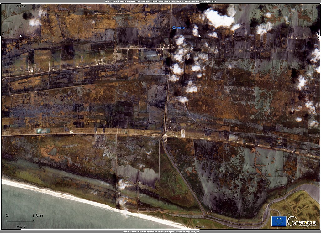
English: Laura was the first major hurricane of the 2020 Atlantic season to make landfall on the US coast. Until 24 August, it was classified as Category 1, but between 25 and 26 August the wind speeds increased from 120 to 225 km/hour in a short timespan, as Laura intensified to become a Category 4 hurricane. It eventually became southwest Louisiana's first Category 4 landfalling hurricane on record, according to NOAA's historical database. At 03:00 UTC of 27 August, Laura hit the Louisiana coastline causing storm surges reaching 5 meters, severe damages and at least 16 deaths. This image, acquired by one of the Copernicus Sentinel-2 satellites on 31 August 2020, shows a detail of the area around Cameron Parish in Louisiana where Hurricane Laura made landfall. High-resolution open data from Copernicus Sentinel-2 satellites allow accurate delineation of flood extent and damage assessment. |
| Date | 2 September 2020 (upload date) |
| Source | Effects of Hurricane Laura on the Louisiana coast - image n.2 |
| Author | European Union , Copernicus Sentinel-2 imagery |
Licensing[edit]

|
This image contains data from a satellite in the Copernicus Programme, such as Sentinel-1, Sentinel-2 or Sentinel-3. Attribution is required when using this image.
Attribution: Contains modified Copernicus Sentinel data 2020
The use of Copernicus Sentinel Data is regulated under EU law (Commission Delegated Regulation (EU) No 1159/2013 and Regulation (EU) No 377/2014). Relevant excerpts:
Free access shall be given to GMES dedicated data [...] made available through GMES dissemination platforms [...].
Access to GMES dedicated data [...] shall be given for the purpose of the following use in so far as it is lawful:
GMES dedicated data [...] may be used worldwide without limitations in time.
GMES dedicated data and GMES service information are provided to users without any express or implied warranty, including as regards quality and suitability for any purpose. |
File history
Click on a date/time to view the file as it appeared at that time.
| Date/Time | Thumbnail | Dimensions | User | Comment | |
|---|---|---|---|---|---|
| current | 09:56, 31 July 2023 | | 3,535 × 2,567 (2.65 MB) | OptimusPrimeBot (talk | contribs) | #Spacemedia - Upload of https://www.copernicus.eu/system/files/2020-09/image_day/02_Layout_5_nodata_credit_row.jpg via Commons:Spacemedia |
You cannot overwrite this file.
File usage on Commons
There are no pages that use this file.