File:EdwardSimonLewisHouse1.jpg
Jump to navigation
Jump to search

Size of this preview: 430 × 600 pixels. Other resolutions: 172 × 240 pixels | 344 × 480 pixels | 734 × 1,024 pixels.
Original file (734 × 1,024 pixels, file size: 95 KB, MIME type: image/jpeg)
Captions
Captions
Add a one-line explanation of what this file represents
Summary[edit]
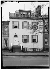
| English: 1. Historic American Buildings Survey John O. Brostrup, Photographer April 6, 1936 11:30 A. M. VIEW FROM NORTHEAST (front) - Edward Simon Lewis House, 456 N Street Southwest, Washington, District of Columbia, DC
( |
|||||||||||||||||||||||
|---|---|---|---|---|---|---|---|---|---|---|---|---|---|---|---|---|---|---|---|---|---|---|---|
| Author |
|
||||||||||||||||||||||
| Title |
English: 1. Historic American Buildings Survey John O. Brostrup, Photographer April 6, 1936 11:30 A. M. VIEW FROM NORTHEAST (front) - Edward Simon Lewis House, 456 N Street Southwest, Washington, District of Columbia, DC |
||||||||||||||||||||||
| Description |
English: VIEW FROM NORTHEAST (front)
|
||||||||||||||||||||||
| Date | 6 April 1936, 11:30 | ||||||||||||||||||||||
| Accession number |
HABS DC,WASH,129--1 |
||||||||||||||||||||||
| Source |
|
||||||||||||||||||||||
| Other versions |
|
||||||||||||||||||||||


| Object location | | View this and other nearby images on: OpenStreetMap |
|---|
Licensing[edit]

|
This file comes from the Historic American Buildings Survey (HABS), Historic American Engineering Record (HAER) or Historic American Landscapes Survey (HALS). These are programs of the National Park Service established for the purpose of documenting historic places. Records consist of measured drawings, archival photographs, and written reports.
|
| This image or media file contains material based on a work of a National Park Service employee, created as part of that person's official duties. As a work of the U.S. federal government, such work is in the public domain in the United States. See the NPS website and NPS copyright policy for more information. |
File history
Click on a date/time to view the file as it appeared at that time.
| Date/Time | Thumbnail | Dimensions | User | Comment | |
|---|---|---|---|---|---|
| current | 20:53, 29 August 2012 | | 734 × 1,024 (95 KB) | Slowking4 (talk | contribs) | User created page with UploadWizard |
You cannot overwrite this file.
File usage on Commons
The following 2 pages use this file:
File usage on other wikis
The following other wikis use this file:
- Usage on en.wikipedia.org
- Usage on www.wikidata.org
Metadata
Categories:
- Edward Simon Lewis House
- Photographs by John O. Brostrup
- Windows in Washington, D.C.
- Dormer windows in Washington, D.C.
- 1936 in Washington, D.C.
- Historic American Buildings Survey of Washington, D.C.
- Black and white photographs of Washington, D.C.
- Arched dormers in the United States
- April 1936 United States photographs