File:Eastern side of Merom cemetery.jpg
Jump to navigation
Jump to search
Size of this preview: 800 × 600 pixels. Other resolutions: 320 × 240 pixels | 640 × 480 pixels | 1,024 × 768 pixels | 1,280 × 960 pixels | 2,560 × 1,920 pixels | 2,816 × 2,112 pixels.
Original file (2,816 × 2,112 pixels, file size: 4.01 MB, MIME type: image/jpeg)
Captions
Captions
Add a one-line explanation of what this file represents
|
This is an image of a place or building that is listed on the National Register of Historic Places in the United States of America. Its reference number is 75000052. |
| Camera location | | View this and other nearby images on: OpenStreetMap |
|---|
| Description |
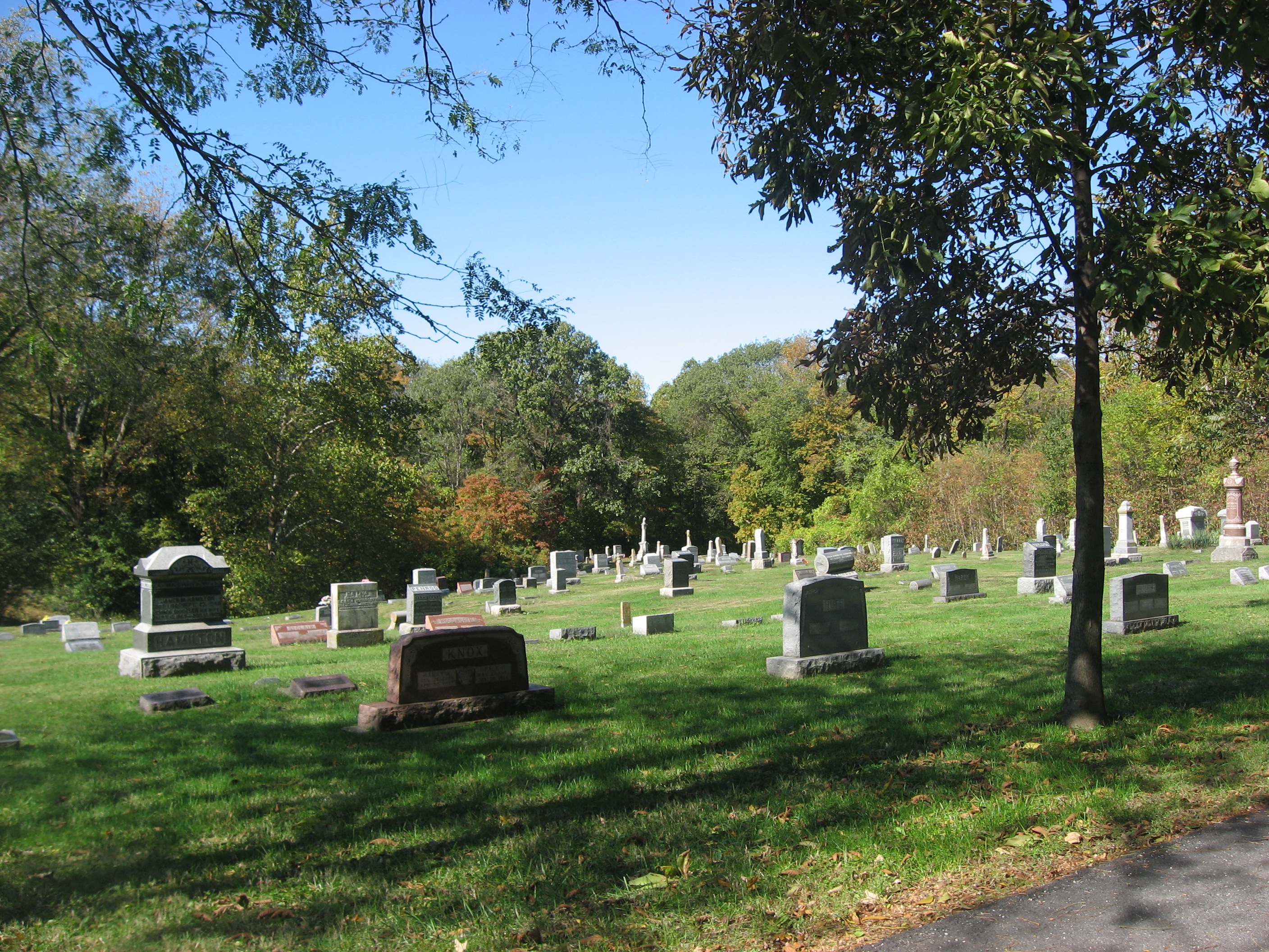
English: Eastern part of the town cemetery of Merom, Indiana, United States. Located off Third Street on the northwestern edge of town, the cemetery is an archaeological site known as the Merom Site; together with the adjacent Fort Azatlan (in the woods in the background), it is listed on the National Register of Historic Places. |
||
| Date | Taken on 21 October 2011 | ||
| Source | Own work | ||
| Author | Nyttend | ||
| Permission (Reusing this file) |
|
File history
Click on a date/time to view the file as it appeared at that time.
| Date/Time | Thumbnail | Dimensions | User | Comment | |
|---|---|---|---|---|---|
| current | 00:33, 23 October 2011 | | 2,816 × 2,112 (4.01 MB) | Nyttend (talk | contribs) | {{NRHP|75000052}} {{Location|39|3|43|N|87|34|6|W}} {{Information |Description={{en|Eastern part of the town cemetery of {{w|Merom, Indiana|Merom}}, {{w|Indiana}}, {{w|United States}}. Located off Third Street on the northwestern edge of town, the cemeter |
You cannot overwrite this file.
File usage on Commons
There are no pages that use this file.