File:E Lanc Downingtown a.JPG
Jump to navigation
Jump to search

Size of this preview: 800 × 600 pixels. Other resolutions: 320 × 240 pixels | 640 × 480 pixels | 1,024 × 768 pixels | 1,280 × 960 pixels | 2,560 × 1,920 pixels | 4,320 × 3,240 pixels.
Original file (4,320 × 3,240 pixels, file size: 4.71 MB, MIME type: image/jpeg)
Captions
Captions
Add a one-line explanation of what this file represents
|
This is an image of a place or building that is listed on the National Register of Historic Places in the United States of America. Its reference number is 79002196. |
Summary[edit]
| Description |
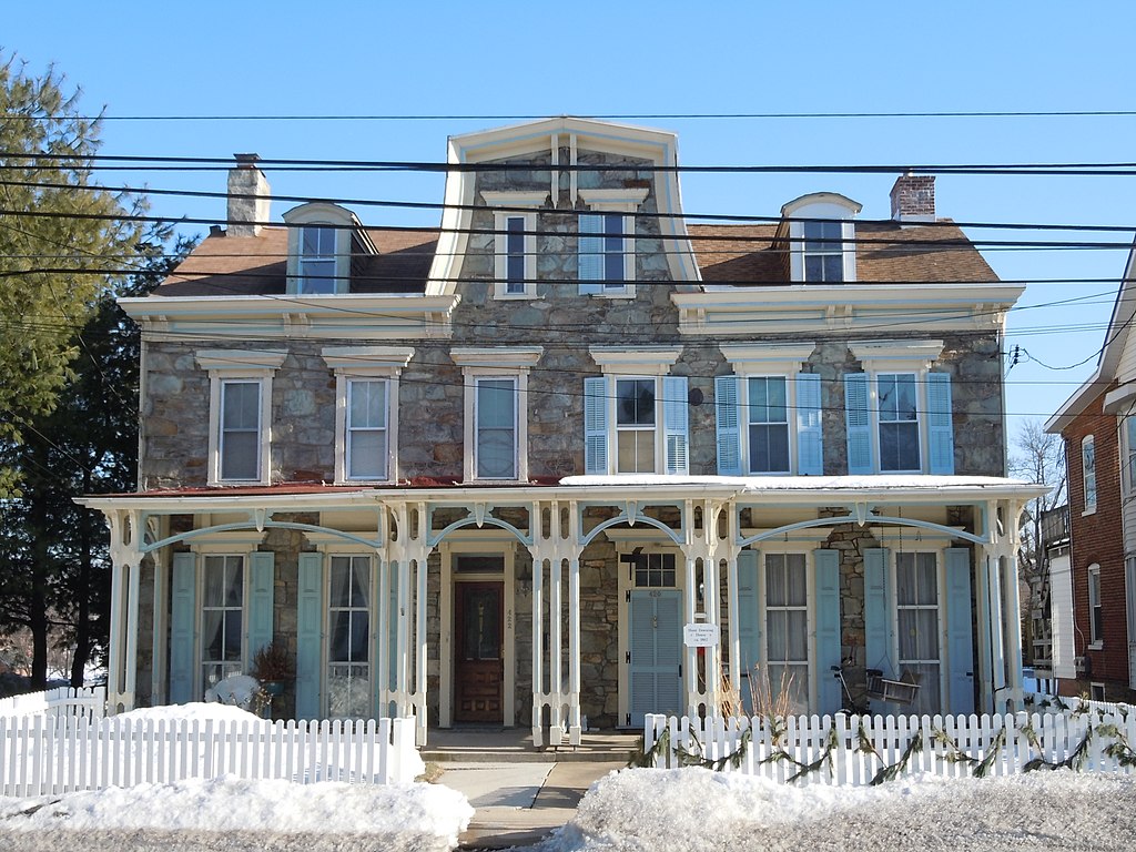
English: Hunt-Downing House, c. 1802, 420-422 East Lancaster Street (US 30) in Downingtown, Chester County, Pennsylvania. In the East Lancaster Avenue Historic District, on the NRHP since December 11, 1979. The HD is in irregular pattern along East Lancaster Avenue, Downingtown, PA. This Hunt Downing House should not be confused with the one a few miles east in West Whiteland Township, also on the NRHP. |
| Date | |
| Source | Own work |
| Author | Smallbones |
| Camera location | | View this and other nearby images on: OpenStreetMap |
|---|
Licensing[edit]
| I, the copyright holder of this work, release this work into the public domain. This applies worldwide. In some countries this may not be legally possible; if so: I grant anyone the right to use this work for any purpose, without any conditions, unless such conditions are required by law. |
File history
Click on a date/time to view the file as it appeared at that time.
| Date/Time | Thumbnail | Dimensions | User | Comment | |
|---|---|---|---|---|---|
| current | 02:40, 12 February 2011 | | 4,320 × 3,240 (4.71 MB) | Smallbones (talk | contribs) | {{Information |Description ={{en|1=Hunt-Downing House, c. 1802, 420-422 East Lancaster Street (US 30) in Downingtown, Chester County, Pennsylvania. In the East Lancaster Avenue Historic District, on the NRHP since December 11, 1979. The HD is in irreg |
You cannot overwrite this file.
File usage on Commons
There are no pages that use this file.
File usage on other wikis
The following other wikis use this file:
- Usage on en.wikipedia.org
- Usage on www.wikidata.org
Metadata
Categories:
- Houses on the National Register of Historic Places in Chester County, Pennsylvania
- Historic districts in Chester County, Pennsylvania
- Stone houses in Pennsylvania
- Downingtown, Pennsylvania
- Snow in Pennsylvania
- Window shutters in the United States
- Twin houses in the United States
- Porches in Pennsylvania
- Semi-detached houses