File:EWR airport map.PNG
Jump to navigation
Jump to search
Size of this preview: 417 × 599 pixels. Other resolutions: 167 × 240 pixels | 334 × 480 pixels | 791 × 1,136 pixels.
Original file (791 × 1,136 pixels, file size: 145 KB, MIME type: image/png)
Captions
Captions
Add a one-line explanation of what this file represents

|
File:EWR Airport Diagram.svg is a vector version of this file. It should be used in place of this PNG file when not inferior.
File:EWR airport map.PNG → File:EWR Airport Diagram.svg
For more information, see Help:SVG. |
 |
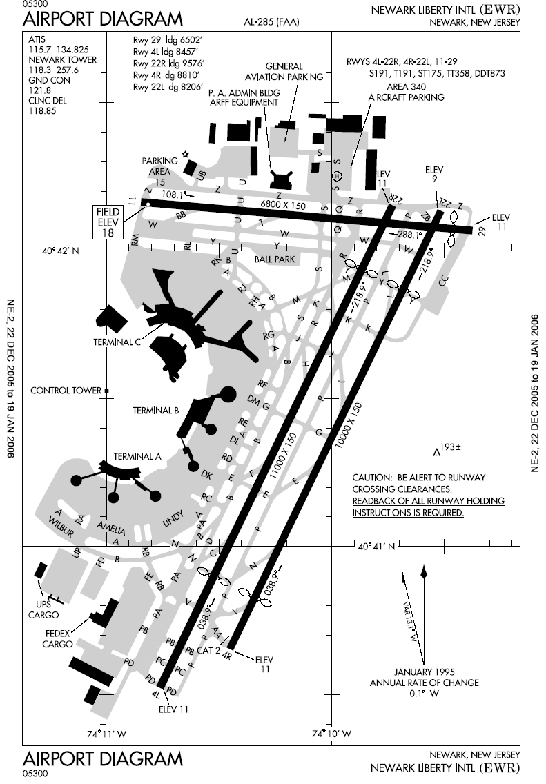
Airport diagram of Newark Liberty International Airport
This image or file is a work of a Federal Aviation Administration employee, taken or made as part of that person's official duties. As a work of the U.S. federal government, the image is in the public domain in the United States.
|
 |
File history
Click on a date/time to view the file as it appeared at that time.
| Date/Time | Thumbnail | Dimensions | User | Comment | |
|---|---|---|---|---|---|
| current | 22:52, 6 January 2006 | | 791 × 1,136 (145 KB) | Cmprince (talk | contribs) | Aiport diagram of Newark Liberty International Airport {{PD-USGov-FAA}} |
You cannot overwrite this file.
File usage on Commons
The following page uses this file: