File:Dust storms across the western Sahara (MODIS 2015-02-23).jpg
Jump to navigation
Jump to search

Size of this preview: 774 × 600 pixels. Other resolutions: 310 × 240 pixels | 619 × 480 pixels | 991 × 768 pixels | 1,280 × 992 pixels | 2,560 × 1,984 pixels | 8,000 × 6,200 pixels.
Original file (8,000 × 6,200 pixels, file size: 6.59 MB, MIME type: image/jpeg)
Captions
Captions
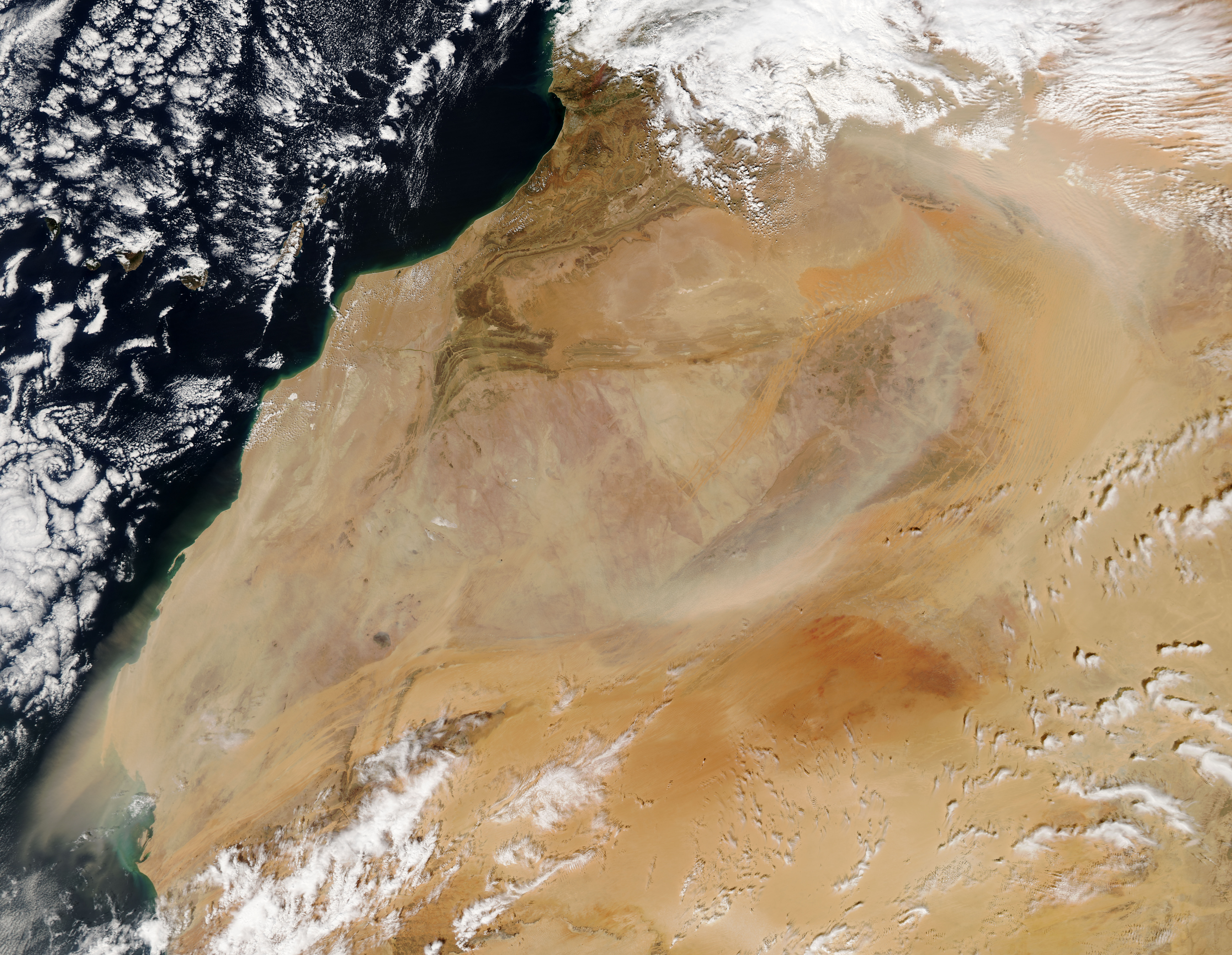
February continued to be dusty late into the month, as evidenced by this true-color image captured by the Moderate Resolution Imaging Spectroradiometer (MODIS) aboard NASA�s Aqua satellite on February 18.
Summary[edit]
.jpg&action=edit§ion=1)
| Description |
English: The Sahara Desert is an arid, broad expanse featuring primarily sand and barren, hard, rocky plateaus. It stretches over most of northern Africa, covering about 3.6 million square mi (9.4 million square km) and covers parts of Tunisia, Niger, Morocco, Mauritania, Western Sahara, Mali, Egypt, Libya, Chad, Sudan and Algeria.
Dust storms are the major natural hazard occurring in the Sahara region, and they occur with regularity, especially in the spring. The month of February, 2015 has been especially active, with several storms occurring throughout the month. One such storm, deemed an �Epic Sandstorm� by ABC News, followed cyclonic winds which crossed the Atlas Mountains. The storm lasted for over three days, and by February 1, it caused a massive sea of dust to pour from Africa to Turkey. February continued to be dusty late into the month, as evidenced by this true-color image captured by the Moderate Resolution Imaging Spectroradiometer (MODIS) aboard NASA�s Aqua satellite on February 18. Heavy clouds over the Atlas Mountains suggest a storm system has kicked up winds. The northwesterly winds lofts heavy bands of dust and sand aloft, drive them to the south and east initially, then the dust and sand curves southwestward and out over the Atlantic Ocean. |
||
| Date | Taken on 18 February 2015 | ||
| Source |
Dust storms across the western Sahara (direct link)
|
||
| Author | Jeff Schmaltz, MODIS Land Rapid Response Team, NASA GSFC |
| This media is a product of the Aqua mission Credit and attribution belongs to the mission team, if not already specified in the "author" row |
Licensing[edit]
.jpg&action=edit§ion=2)
| This file is in the public domain in the United States because it was solely created by NASA. NASA copyright policy states that "NASA material is not protected by copyright unless noted". (See Template:PD-USGov, NASA copyright policy page or JPL Image Use Policy.) | ||
 |
Warnings:
|
File history
Click on a date/time to view the file as it appeared at that time.
| Date/Time | Thumbnail | Dimensions | User | Comment | |
|---|---|---|---|---|---|
| current | 22:10, 11 February 2024 | | 8,000 × 6,200 (6.59 MB) | OptimusPrimeBot (talk | contribs) | #Spacemedia - Upload of http://modis.gsfc.nasa.gov/gallery/images/image02232015_250m.jpg via Commons:Spacemedia |
You cannot overwrite this file.
File usage on Commons
There are no pages that use this file.
.jpg&oldid=850837199)