File:Dust Storm over Bolivia.jpg
Jump to navigation
Jump to search

Size of this preview: 510 × 600 pixels. Other resolutions: 204 × 240 pixels | 408 × 480 pixels | 653 × 768 pixels | 870 × 1,024 pixels | 1,741 × 2,048 pixels | 3,400 × 4,000 pixels.
Original file (3,400 × 4,000 pixels, file size: 1.98 MB, MIME type: image/jpeg)
Captions
Captions
Add a one-line explanation of what this file represents
Summary[edit]
| Description |
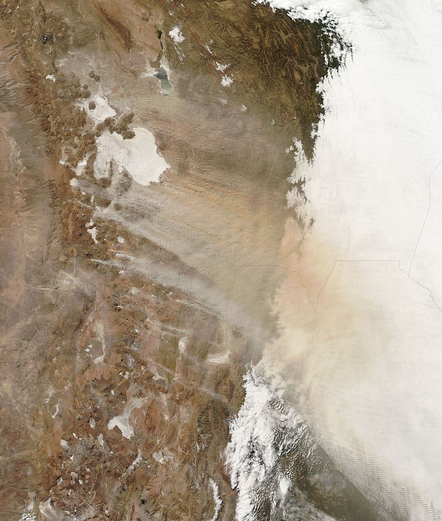
English: Strong winds whip thick clouds of dust across the Bolivian highlands in this photo-like image. Much of the pale dust along the southern edge of the storm is coming from small white spots, salt pans (dry lake beds), south and south-west of Salar de Uyuni, but little or no dust appears to be blowing off the large salt pans, Salar de Uyuni and Salar de Coipasa. Instead, the dust is multi-colored, pointing to a variety of different soil types. Though the region is typically dry, El Niño brought even drier conditions in late 2009 and 2010. By July, much of Bolivia was in the grip of severe drought, particularly in the south-east. The lack of rainfall may have contributed to the dusty conditions seen in the image.
|
| Date | |
| Source | NASA Earth Observatory |
| Author | Jeff Schmaltz |
Image captured by the Moderate Resolution Imaging Spectroradiometer (MODIS) on NASA’s Aqua satellite.
Licensing[edit]
| This file is in the public domain in the United States because it was solely created by NASA. NASA copyright policy states that "NASA material is not protected by copyright unless noted". (See Template:PD-USGov, NASA copyright policy page or JPL Image Use Policy.) | ||
 |
Warnings:
|
| Annotations | This image is annotated: View the annotations at Commons |
File history
Click on a date/time to view the file as it appeared at that time.
| Date/Time | Thumbnail | Dimensions | User | Comment | |
|---|---|---|---|---|---|
| current | 13:09, 20 July 2010 | | 3,400 × 4,000 (1.98 MB) | Originalwana (talk | contribs) | {{Information |Description={{en|1=Strong winds whip thick clouds of dust across the Bolivian highlands in this photo-like image. Much of the pale dust along the southern edge of the storm is coming from small white spots, salt p |
You cannot overwrite this file.
File usage on Commons
There are no pages that use this file.
File usage on other wikis
The following other wikis use this file:
- Usage on fa.wikipedia.org
- Usage on ml.wikipedia.org