File:Duisburg Ruhrort — Rheinbrücke. rº-vº.jpg
Jump to navigation
Jump to search

Size of this preview: 460 × 599 pixels. Other resolutions: 184 × 240 pixels | 368 × 480 pixels | 590 × 768 pixels | 786 × 1,024 pixels | 1,572 × 2,048 pixels | 3,365 × 4,383 pixels.
Original file (3,365 × 4,383 pixels, file size: 9.23 MB, MIME type: image/jpeg)
Captions
Captions
Add a one-line explanation of what this file represents
Summary[edit]
| Description |
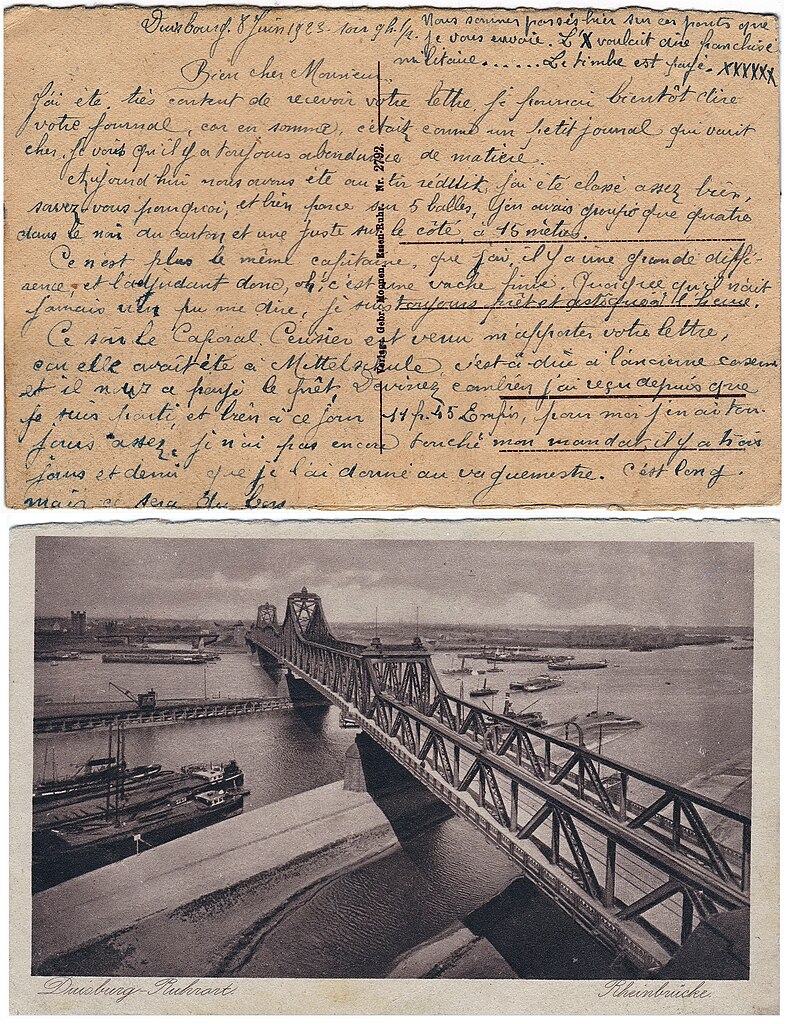
Français : Duisbourg (Allemagne - Rhénanie-du-Nord-Westphalie) 1920 — Pont sur le Rhin Ruhrort-Homberg.
Carte envoyée par un militaire français en 1923 (occupation de la Rhénanie après la Première Guerre mondiale) Deutsch: (Deutschland - Nordrhein-Westfalen) — Rheinbrücke Ruhrort-Homberg. https://structurae.net/de/bauwerke/rheinbruecke-ruhrort-homberg. Karte, die 1923 von einem französischen Soldaten verschickt wurde (Alliierte Rheinlandbesetzung) |
| Date | |
| Source | Collection personnelle |
| Author | Verlag : Gebr. Moonen, Essen - Ruhr - Nr. 2792. |

| Camera location | | View this and other nearby images on: OpenStreetMap |
|---|
Licensing[edit]
|
This work is in the public domain in its country of origin and other countries and areas where the copyright term is the author's life plus 70 years or fewer. This work is in the public domain in the United States because it was published (or registered with the U.S. Copyright Office) before January 1, 1929. | |
| This file has been identified as being free of known restrictions under copyright law, including all related and neighboring rights. | |
{{Fichierprincipal|[[File:Duisburg Ruhrort — Rheinbrücke. 1920.jpg|thumb|Duisburg Ruhrort — Rheinbrücke. 1920}}
File history
Click on a date/time to view the file as it appeared at that time.
| Date/Time | Thumbnail | Dimensions | User | Comment | |
|---|---|---|---|---|---|
| current | 20:04, 8 April 2023 | | 3,365 × 4,383 (9.23 MB) | Jpcuvelier (talk | contribs) | Uploaded a work by Verlag : Gebr. Moonen, Essen - Ruhr - Nr. 2792. from Collection personnelle with UploadWizard |
You cannot overwrite this file.
File usage on Commons
The following page uses this file: