File:Drinking Fountain. - geograph.org.uk - 164118.jpg
From Wikimedia Commons, the free media repository
Jump to navigation
Jump to search
Drinking_Fountain._-_geograph.org.uk_-_164118.jpg (640 × 479 pixels, file size: 154 KB, MIME type: image/jpeg)
File information
Structured data
Captions
DescriptionDrinking Fountain. - geograph.org.uk - 164118.jpg |
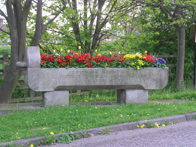
English: Drinking Fountain.
|
||
Date | |||
Source | From geograph.org.uk | ||
Author | Hugh Mortimer | ||
Permission (Reusing this file) |
This file is licensed under the Creative Commons Attribution-Share Alike 2.0 Generic license. Attribution: Hugh Mortimer
|
||
Attribution (required by the license) InfoField | Hugh Mortimer / Drinking Fountain. / | ||
InfoField | Hugh Mortimer / Drinking Fountain. |
Camera location | 54° 30′ 28.1″ N, 1° 34′ 15″ W | View this and other nearby images on: OpenStreetMap | 54.507810; -1.570700 |
---|
Object location | 54° 30′ 28.2″ N, 1° 34′ 15″ W | View this and other nearby images on: OpenStreetMap | 54.507820; -1.570900 |
---|
File history
Click on a date/time to view the file as it appeared at that time.
Date/Time | Thumbnail | Dimensions | User | Comment | |
---|---|---|---|---|---|
current | 08:38, 31 January 2010 | 640 × 479 (154 KB) | GeographBot (talk | contribs) | == {{int:filedesc}} == {{Information |description={{en|1=Drinking Fountain. A trough at Blands Corner roundabout. Inscribed 'Drinking Fountain and Cattle Trough Association, 70 Victoria Street, SW' it was moved to a less vulnerable position on the grass v |
You cannot overwrite this file.
File usage on Commons
There are no pages that use this file.
Metadata
This file contains additional information such as Exif metadata which may have been added by the digital camera, scanner, or software program used to create or digitize it. If the file has been modified from its original state, some details such as the timestamp may not fully reflect those of the original file. The timestamp is only as accurate as the clock in the camera, and it may be completely wrong.
Image title | OLYMPUS DIGITAL CAMERA |
---|---|
Camera manufacturer | OLYMPUS OPTICAL CO.,LTD |
Camera model | C750UZ |
Exposure time | 1/100 sec (0.01) |
F-number | f/3.2 |
ISO speed rating | 113 |
Date and time of data generation | 17:46, 4 May 2006 |
Lens focal length | 14.8 mm |
Orientation | Normal |
Horizontal resolution | 72 dpi |
Vertical resolution | 72 dpi |
Software used | v753u-81 |
File change date and time | 17:46, 4 May 2006 |
Y and C positioning | Co-sited |
Exposure Program | Creative program (biased toward depth of field) |
Exif version | 2.2 |
Date and time of digitizing | 17:46, 4 May 2006 |
Image compression mode | 2 |
APEX exposure bias | 0 |
Maximum land aperture | 3.4 APEX (f/3.25) |
Metering mode | Pattern |
Light source | Unknown |
Flash | Flash did not fire, compulsory flash suppression |
Color space | sRGB |
Custom image processing | Normal process |
Exposure mode | Auto exposure |
White balance | Auto white balance |
Digital zoom ratio | 0 |
Scene capture type | Standard |
Contrast | Normal |
Saturation | Normal |
Sharpness | Normal |
Structured data
Items portrayed in this file
depicts
some value
4 May 2006
54°30'28.12"N, 1°34'14.52"W
54°30'28.15"N, 1°34'15.24"W
Hidden categories:
- CC-BY-SA-2.0
- Images from Geograph Britain and Ireland
- Images from Geograph Britain and Ireland missing SDC MIME type
- Information field template with formatting
- Files with coordinates missing SDC location of creation (54° N, 2° W)
- Images by Hugh Mortimer
- United Kingdom photographs taken on 2006-05-04
- Pages with maps