File:Dozois 77.07W 47.46N.jpg
Jump to navigation
Jump to search

Size of this preview: 740 × 599 pixels. Other resolutions: 296 × 240 pixels | 593 × 480 pixels | 1,016 × 823 pixels.
Original file (1,016 × 823 pixels, file size: 265 KB, MIME type: image/jpeg)
Captions
Captions
Add a one-line explanation of what this file represents
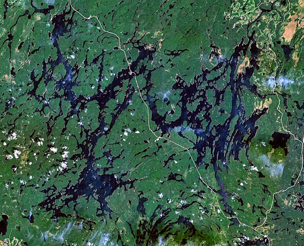
| Description | Reservoir Dozois, Quebec, Canada. Quebec Route 117 is also visible running from north to south in the centre of the image. |
| Source | NASA WorldWind |
| Author | NASA |
| This image is in the public domain because it is a screenshot from NASA’s globe software World Wind using a public domain layer, such as Blue Marble, MODIS, Landsat, SRTM, USGS or GLOBE.
|
 |
File history
Click on a date/time to view the file as it appeared at that time.
| Date/Time | Thumbnail | Dimensions | User | Comment | |
|---|---|---|---|---|---|
| current | 13:52, 7 October 2008 | | 1,016 × 823 (265 KB) | P199 (talk | contribs) | {{Information |Description=Reservoir Dozois, Quebec, Canada |Source=NASA WorldWind |Date= |Author=NASA |Permission= |other_versions= }} {{PD-WorldWind}} Category:Reservoirs of Quebec |
You cannot overwrite this file.
File usage on Commons
There are no pages that use this file.
File usage on other wikis
The following other wikis use this file:
- Usage on bg.wikipedia.org
- Usage on ceb.wikipedia.org
- Usage on de.wikipedia.org
- Usage on en.wikipedia.org
- Usage on es.wikipedia.org
- Usage on fr.wikipedia.org
- Usage on www.wikidata.org
- Usage on zh.wikipedia.org