File:División política de México acta.svg
Jump to navigation
Jump to search

Size of this PNG preview of this SVG file: 652 × 600 pixels. Other resolutions: 261 × 240 pixels | 522 × 480 pixels | 835 × 768 pixels | 1,114 × 1,024 pixels | 2,227 × 2,048 pixels | 1,242 × 1,142 pixels.
Original file (SVG file, nominally 1,242 × 1,142 pixels, file size: 246 KB)
Captions
Captions
Add a one-line explanation of what this file represents
Summary[edit]
| Description |
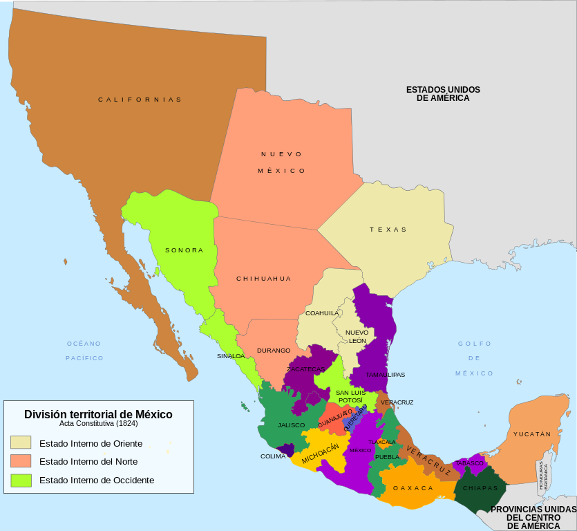
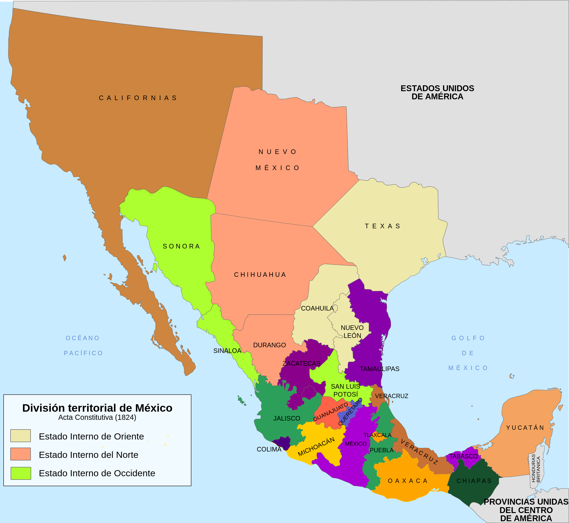
English: Map of Mexico at the time of the signing of the Constitutive Act of the Mexican federation, based on the work of Hpav7 call map 1823.PNG Mexico.
Español: Mapa del territorio mexicano al momento de la firma del Acta Constitutiva de la federación Mexicana, basado en el trabajo de Hpav7 llamado Mapa Mexico 1823.PNG. |
| Date | |
| Source | Own work |
| Author | Sarumo74 |
Licensing[edit]
| I, the copyright holder of this work, release this work into the public domain. This applies worldwide. In some countries this may not be legally possible; if so: I grant anyone the right to use this work for any purpose, without any conditions, unless such conditions are required by law. |
File history
Click on a date/time to view the file as it appeared at that time.
| Date/Time | Thumbnail | Dimensions | User | Comment | |
|---|---|---|---|---|---|
| current | 23:47, 17 June 2010 | | 1,242 × 1,142 (246 KB) | Sarumo74 (talk | contribs) | {{Information |Description={{en|1=Map of Mexico at the time of the signing of the Constitutive Act of the Mexican federation, based on the work of Hpav7 call map 1823.PNG Mexico.}} {{es|1=Mapa del territorio mexicano al momento de la firma del Acta Co |
You cannot overwrite this file.
File usage on Commons
There are no pages that use this file.
File usage on other wikis
The following other wikis use this file:
- Usage on es.wikipedia.org